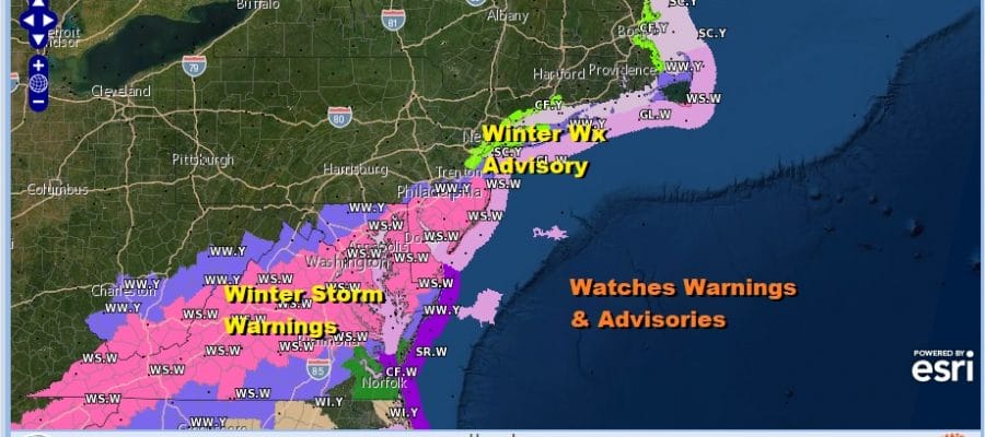
Winter Storm Warning Coastal New Jersey South
Winter Weather Advisories NYC Long Island

Weather in 5/Joe & Joe Weather Show Latest Podcast
Winter Storm Warning Coastal New Jersey South
Winter Weather Advisories NYC Long Island
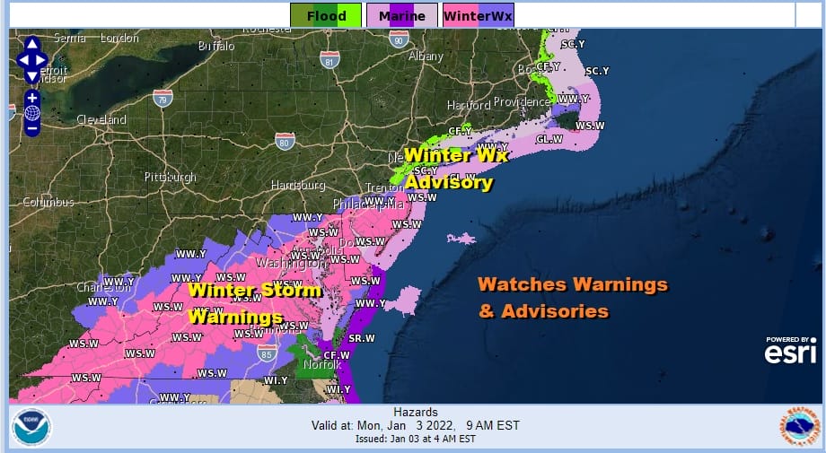
A developing storm continues to move across the Southeastern States this morning and it sending precipitation northward on what is a very loaded radar this morning in the Mid Atlantic states and points south and southwest. Winter Storm Warnings continue this morning over a large area from the southern half of New Jersey south to Delaware and Maryland and southwest across Virginia to the mountains of North Georgia. Winter Weather Advisories border either side of the warning area and they include NYC, Long Island and Philadelophia.

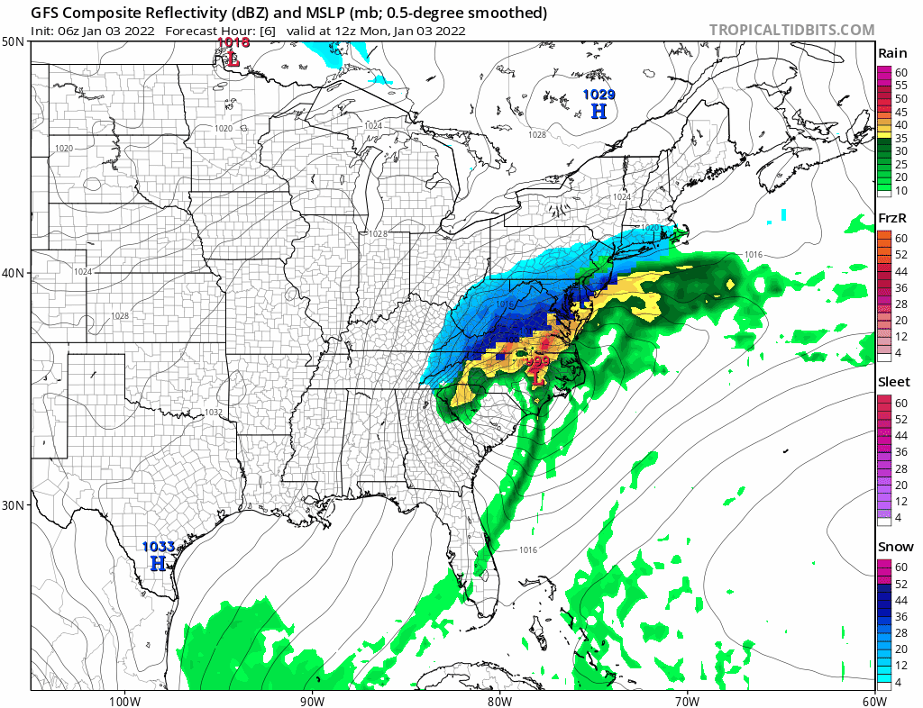
Snow amounts may have nudged up a little on the northern fringe. Most of that is precautionary due to the uncertainty of where the northern cut off is so we will watch the radar and the observations. The jackpot zone looks to be Southern New Jersey down into the Delmarva Peninsula. here is going to be a very sharp cut off from snow to nothing on the northern fringe of this storm and where that lines up today is anyone’s guess really. 20 or 30 miles could mean an additional 2 to 3 inches or the difference between an inch or two to barely a coating or flurries.
SATELLITE

WEATHER RADAR

Look for precipitation to spread northward this morning. The radar is loaded to the south but once that norther edge is reached we will start to see the radar echoes sweep eastward rather than northward. Any accumulating snows fall this morning into early afternoon before slowly tapering off from west to east. The northerly wind will take temperatures down below freezing and especially where snow is falling, temperatures will be in the 20s.
Once everything ends skies will clear out with lows in the 20s by morning. Sunshine returns Tuesday with highs in the 30s. A strong low develops in the Great Lakes Wednesday and a cold front swings east. Look for some clouds with temperatures into the 40s and the chance for a shower or two. Then it turns colder again Thursday.
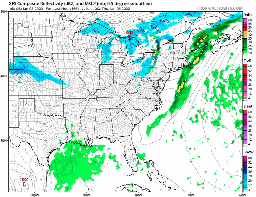
Late last week we talked about a potential for snow at the end of this week. The GFS model has a habit of showing storms in the long range, losing them, and then slowly bringing them back This is where we seem to be now as the models has been slowly bringing back the idea of a storm forming in the Central Appalachians and heading northeast to just south of Long Island Thursday night and Friday morning. We will discuss this more once this current storm is done.
BE SURE TO DOWNLOAD THE FREE METEOROLOGIST JOE CIOFFI WEATHER APP &
ANGRY BEN’S FREE WEATHER APP “THE ANGRY WEATHERMAN!

MANY THANKS TO TROPICAL TIDBITS & F5 WEATHER FOR THE USE OF MAPS
Please note that with regards to any severe weather, tropical storms, or hurricanes, should a storm be threatening, please consult your local National Weather Service office or your local government officials about what action you should be taking to protect life and property.


