
Winter Storm Pulling Away From Coast Weather Conditions Improve
Some last minute bands of snow came southward last night from Upstate NY and New England and brought a few inches of snow in some places and a couple of additional inches in others that got 2 to 5 inches of snow during the day yesterday (mainly in North Jersey. Now our storm is now southeast of Cape Cod and the snow is gone other than the stray flurry or two. Weather conditions are set to improve today with leftover clouds giving way to some sun along with a gusty wind. Highs in most places will be in the 30s to near 40. That should at least melt some of the snow away.
SATELLITE

REGIONAL RADAR

Radars this morning show the end of the back edge snows and we can also see heavy snow backing into Southeastern New England this morning. This will eventually come to an end as the storm heads up for the Canadian Maritime Provinces.
LOCAL RADAR NEW YORK CITY

LOCAL RADAR PHILADELPHIA


Chilly air will be with us tonight. Skies should at least partially clear out with a gusty breeze tapering off. Lows will mostly in the 20s everywhere with the odd 30 or so in warmer urban settings. Wednesday brings the next weather system which is a weak cold front moving southeast from the Great Lakes.
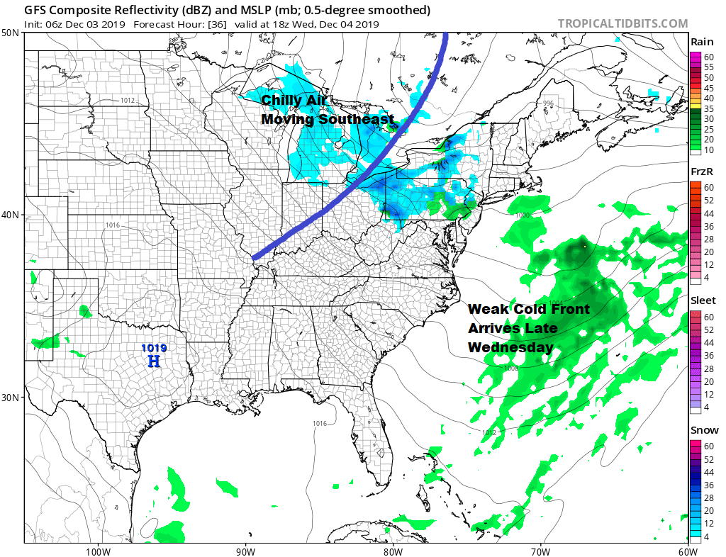
There isn’t going to be much too this other than a rain or snow shower as it approaches and moves through Wednesday evening. Most highs will reach into the 40s ahead of it on Wednesday. Behind it for Thursday it will be a little colder again with some sunshine. Highs will be in the upper 30s to lower 40s.
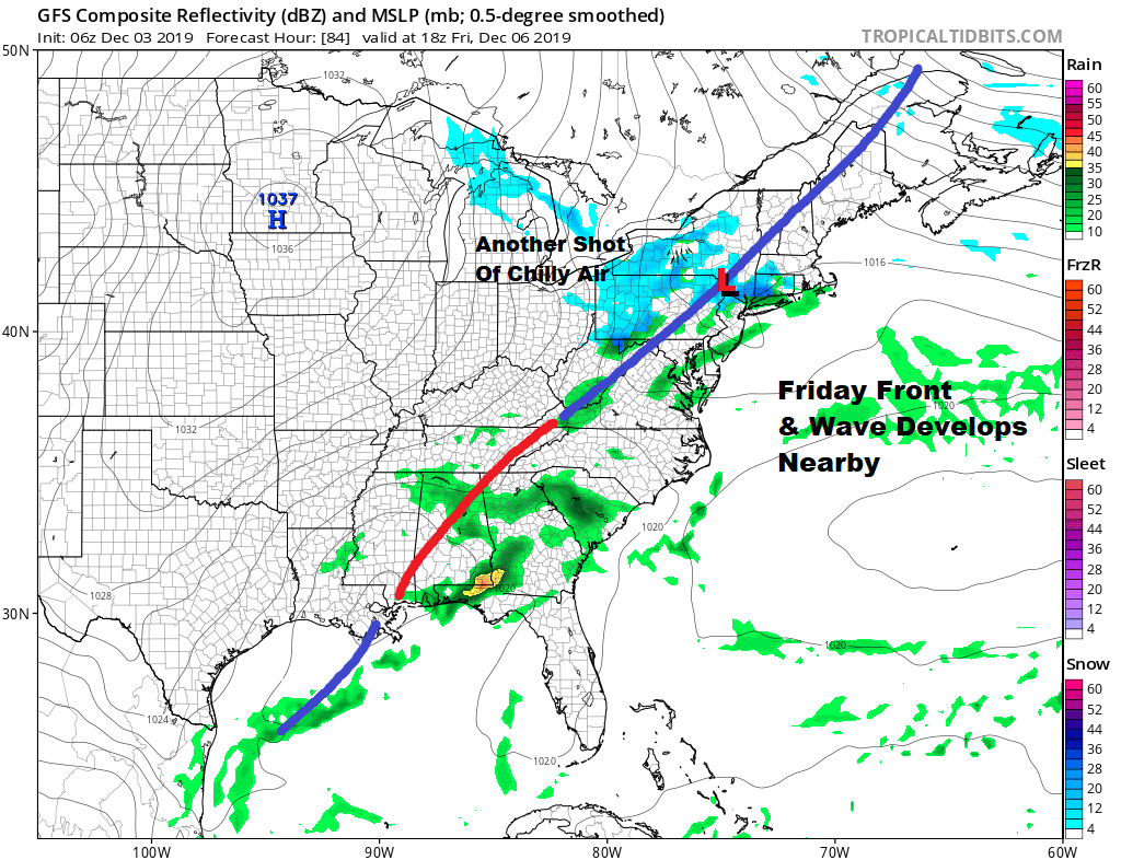
Friday we have another weather system approaching in the northwest flow we have overhead. This will be another cold front but it will have a bit of a wave on it as it moves through. It would seem that this low might develop into something after it moves offshore and it simply re-enforces the chilly dry pattern for us this weekend. Clouds and maybe a passing rain or snow shower is possible Friday. Highs will reach into the 40s. Barring any complications the weekend should nice and dry.
BE SURE TO DOWNLOAD THE FREE METEOROLOGIST JOE CIOFFI WEATHER APP &
ANGRY BEN’S FREE WEATHER APP “THE ANGRY WEATHERMAN!
MANY THANKS TO TROPICAL TIDBITS FOR THE USE OF MAPS
Please note that with regards to any severe weather, tropical storms, or hurricanes, should a storm be threatening, please consult your local National Weather Service office or your local government officials about what action you should be taking to protect life and property.


