DOWNLOAD MY NEW FREE JOESTRADAMUS WEATHER APP FOR ANDROID
WINDY COLD CONDITIONS THROUGH THURSDAY
WEAK SYSTEM FRIDAY RAIN OR SNOW SHOWERS
MORE RAIN LATE SATURDAY INTO SUNDAY & EARLY NEXT WEEK
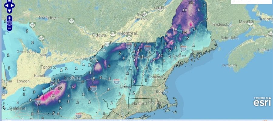
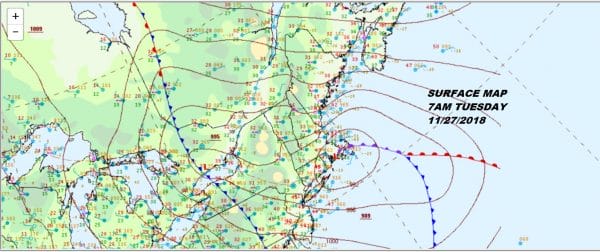
Last night’s storm system continues to spin away with the low center this morning in Southeaster Massachusetts. The old Midwest blizzard primary low is all but gone over Lake Ontario and we are seeing colder air being drawn southward through Interior New England and Upstate NY as rain has changed to snow there. This will be a one foot or more snow producer to the north in elevated areas. This is also a long duration event with most areas here seeing on and off snow for the next 2 days or so.
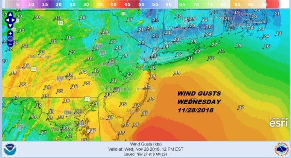
We being downwind of all this means we will be dealing with..well wind! The spinning low to the northeast strengthens and the pressure gradient tightens up so look for windy conditions into Thursday around here. Winds today will be 10 to 20 mph with gusts at time into the mid 20s. Wednesday will be the windiest day of the next 3 with winds of 15 to 25 mph sustained and gusts well into the 30s.
This morning we are seeing lots of clouds on the satellite loop but we should see enough drying for some breaks of sunshine developing with temperatures in the 40s. Colder air will gradually move in overnight and for Wednesday into Friday with highs just in the upper 30s and lower 40s and nighttime lows in the 20s inland and lower 30s in the warmer urban areas.
EASTERN SATELLITE
REGIONAL RADAR
Looking at the regional radar this morning we can see snow to the north with the southern edge of the precipitation shield showing some backside light rain showers that are moving southeastward. A passing shower can’t be ruled out today though they should be mostly inland and no big deal if they happen.
LOCAL RADAR NEW YORK CITY
LOCAL RADAR PHILADELPHIA

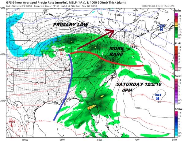
The next weather system sets up for Friday. This system appears to be weak and we will see clouds. There might be a passing rain or snow shower or two with this but the main energy waits for Saturday as another storm comes out of the Plains and heads for the lower Great Lakes. This is going to be another primary low to the west of the Appalachians and a secondary that develops over us with no real cold air around anywhere so it is mostly rain for everyone.
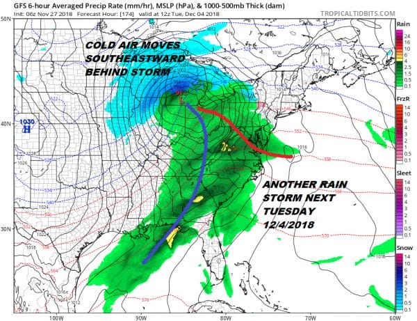
The rain comes in later Saturday afternoon or evening from southwest to northeast and then it moves out Sunday morning but this could be another 1 to 2 inch rain producer and then that is followed by still another low going to the Great Lakes for Tuesday of next week which will be another primary/secondary type system with another round of rain on the order of an inch or 2.
This storm could be the last one in this sequence as the pattern breaks down a bit and rearranges itself as we head into Mid December though what it rearranges to at this point is anyone’s guess.
SUBSCRIBE TO PATREON FOR A WEATHER EXPERIENCE FREE OF ADS, EXCLUSIVE VIDEOS FOR MEMBERS ONLY AND MUCH MORE…STARTS AT $2 A MONTH..MESSAGE ME AT ANY TIME
MANY THANKS TO TROPICAL TIDBITS FOR THE USE OF MAPS
Please note that with regards to any tropical storms or hurricanes, should a storm be threatening, please consult your local National Weather Service office or your local government officials about what action you should be taking to protect life and property.

