Wind Advisory Wednesday Warm Wednesday Chilly Thursday Friday
Hurricane Delta Rains Possible Late Weekend
WEATHER IN 5 TUESDAY OCTOBER 6, 2020
We finished off a nice day and head into a mild night of clear skies mixed with some patchy clouds. High pressure is offshore and a cold front lies to the west. This front will produce showers and some thunderstorms in Upstate NY and Central & Northern New England Wednesday. We on the other hand will just see some clouds in the mix on Wednesday along with some sun. Highs will reach the low and middle 70s. The cold front might have a passing shower ahead of it but it is a rather solid bet that most of you won’t see anything from it.
SATELLITE
REGIONAL RADAR
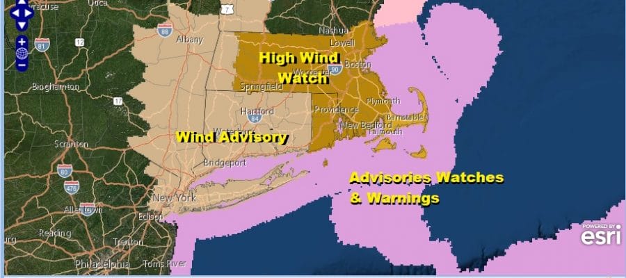
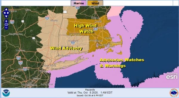
A storm will strengthen to the northeast Wednesday night and Thursday and that will rev up the wind starting Wednesday afternoon and continuing into early Thursday morning from Northern New Jersey northeastward into New England . A wind advisory has been posted for Wednesday afternoon into early Thursday morning for gusts of 50 mph possible.
During the day Thursday the wind will diminish but it will be breezy, and we will see some sunshine. Temperatures will be just in the low to mid 60s. Then it will be a chilly night into Friday morning with the lowest temperatures of the Autumn season so far. Low to mid 40s will do it along the coast and warmer urban settings while inland areas will be mostly in the 30s.
Friday will be a sunny but chilly day with highs in the low 60s on average. Some spots will have a tough time getting above 60 north and west of the coast while further south low to mid 60s will be the highs from Southern New Jersey and Southern Pennsylvania southward.
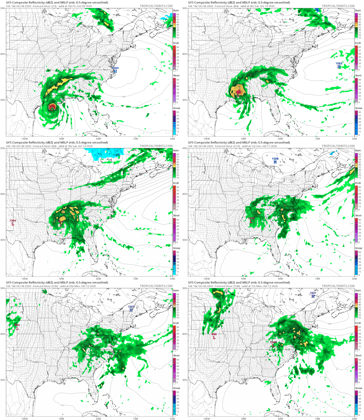
Run after run of weather models are showing that the chances for rain here for part of the Columbus Day weekend are increasing. The latest GFS shows major Hurricane Delta moving inland into Southern Louisiana and then moving northeastward and accelerating. Saturday looks warm with some sunshine but another cold front arrives Saturday night. Highs will be in the low to mid 70s. Then the next high builds into New England. An onshore flow sets up with the high to the northeast and up comes the rains from Delta. Sunday look for increasing clouds but it appears the rain will wait until Sunday night and Monday. There is still some uncertainty here regarding the extent of the rain and how much we will get but if the upper air feature with this remains viable, we could see a solid soaking rain from this. First though we have to resolve the track of Delta and that will take another day or so to figure out.
BE SURE TO DOWNLOAD THE FREE METEOROLOGIST JOE CIOFFI WEATHER APP &
ANGRY BEN’S FREE WEATHER APP “THE ANGRY WEATHERMAN!
MANY THANKS TO TROPICAL TIDBITS FOR THE USE OF MAPS
Please note that with regards to any severe weather, tropical storms, or hurricanes, should a storm be threatening, please consult your local National Weather Service office or your local government officials about what action you should be taking to protect life and property.


