Nice Day of Sunshine Colder Thursday Friday Questions With Hurricane Delta Holiday Weekend
WEATHER IN 5 TUESDAY OCTOBER 6, 2020
We have a nice day of weather today with sunshine. High pressure is moving out to the east. An upper trough is moving east across New England with some clouds there. It will be a partly to mostly sunny day and temperatures will be headed higher today. Over Long Island and Connecticut today because of that upper trough in New England it will be partly sunny and one or two sprinkles or a shower can’t be ruled out. For everyone else in Eastern Pennsylvania to Southern New England, there are no issues today. Highs will reach the upper 60s and lower 70s this afternoon.
SATELLITE
REGIONAL RADAR
Tonight we should see a mix of clear skies and some clouds with most lows in the 50s with 40s in cool spots. Wednesday look for a mix of sun and clouds with warmer temperatures. highs will reach the low to mid 70s. We do have a cold front that will be moving through late in the day.
This front will produce some showers and even a thunderstorm or two across New England but further south the front is weak and doesn’t have much to work with. A shower late in the day when the front goes by can’t be ruled out. Behind it we have a chilly air mass building in for Thursday and Friday. Thursday will see a mix of sun and clouds with a gusty wind. Highs will be just in the low to mid 60s.
Friday morning will be a cold one with most lows in coastal areas and warmer urban centers in the low to mid 40s while many inland areas will be in the 30s. If winds drop off frost is a possibility. Friday will be nice and sunny but cool with highs just into the 60s.
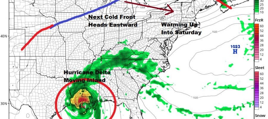
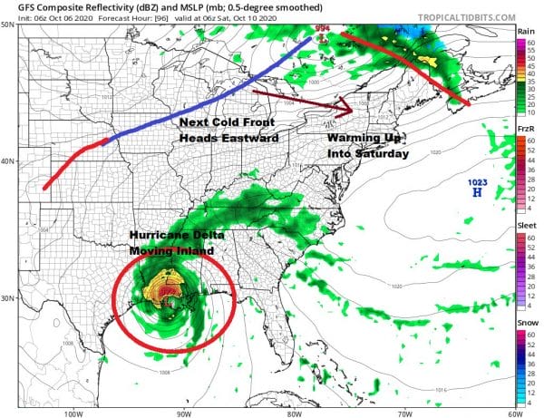
The holiday weekend remains a puzzle. There are no issues for Saturday as we will have a west southwest wind and the next cold front to the northwest won’t arrive until Saturday night and it will pass with no important weather with it. Highs Saturday will be back into the 70s. Hurricane Delta will be moving inland somewhere along the Louisiana coast Friday night or early Saturday and then it will turn northeastward. The front coming through here Saturday night stalls just to our south and high pressure builds to the north for Sunday into Monday. This will create an onshore flow here.
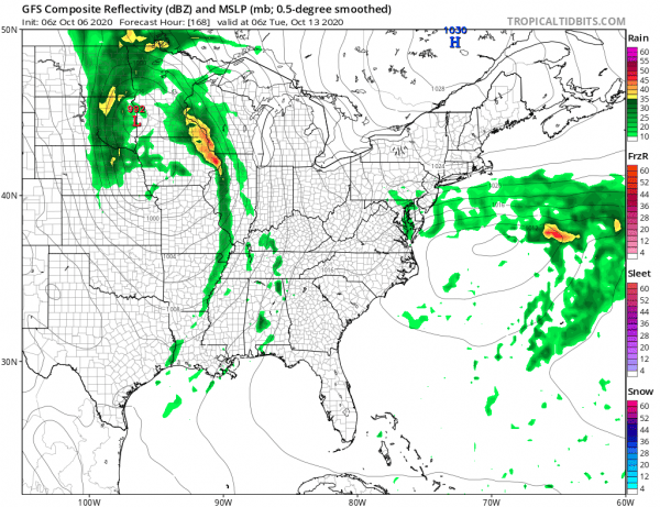
At the very least it will be cooler Sunday with an ocean wind and highs in the 60s. The big question is whether the high to the north will suppress the remnant rains of Delta to the south and take the bulk of that rain across the Mid Atlantic states leaving the Northeast dry, or that the high leaves us just enough room to allow the rain to move northward. It seems the slower motion would delay any rain until Sunday night or Monday which means Sunday could be dry. The GFS cuts off the northern fringe of the rain to just north of NYC. We have many days yet to figure this out. For now we move along. Hurricane Delta is going to become a major hurricane today as it continues to strengthen rapidly.
Maximum winds on the 8am advisory were 110 mph and the storm continues to strengthen rapidly. We will likely see hurricane watches go up soon for parts of the Central Gulf coast. Conditions favor further strengthening and Delta could at least reach the same strength that Hurricane Laura did at some point.
BE SURE TO DOWNLOAD THE FREE METEOROLOGIST JOE CIOFFI WEATHER APP &
ANGRY BEN’S FREE WEATHER APP “THE ANGRY WEATHERMAN!
MANY THANKS TO TROPICAL TIDBITS FOR THE USE OF MAPS
Please note that with regards to any severe weather, tropical storms, or hurricanes, should a storm be threatening, please consult your local National Weather Service office or your local government officials about what action you should be taking to protect life and property.


