Wind Advisory Tonight Into Friday Major Storm Heavy Rains Sunday Night Into Monday
The cold front has passed and the severe weather has come to an end. The satellite picture this evening shows that skies have cleared out for the most part but winds are still howling from the northwest at 20 to 30 mph with gusts over 40 mph. Wind advisories continue this evening but we should see winds ease below advisory criteria overnight. Colder air is coming in and this will take us into the start of the weekend with below average temperatures. Most lows tonight will be in the 30s to near 40 degrees.
SATELLITE

REGIONAL RADAR

Regional radar is showing the main area of thunderstorms long gone and precipitation is pivoting up into Northern New England where Maine will see a late season snowstorm. Local radars have calmed down considerably since earlier today.
LOCAL RADAR NEW YORK CITY

LOCAL RADAR PHILADELPHIA


On to Friday which will be a windy and rather cold day for early April. Highs should be reaching the 60s on average but we all know that volatility is still the name of the game and highs Friday will be just in the 50s. We will still be under the influence of a cold upper trough so look for sunshine with developing clouds. I can’t rule out a passing shower. Upstate NY and Western Pennsylvania will see some spring lake effect snow out of this. Then we head into a cold night. Saturday morning lows will be in the 30s in warmer urban centers and along the coast with 20s inland.
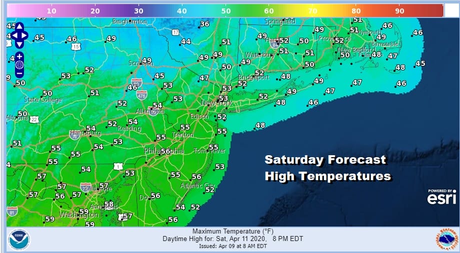
Saturday will start breezy but winds should begin to ease Saturday afternoon. We should also see plenty of sunshine but highs will be only in the low to mid 50s. Saturday is definitely the better of the two weekend days. Clear skies Saturday night will give way to late night clouds. Lows will be in the 30s to near 40.
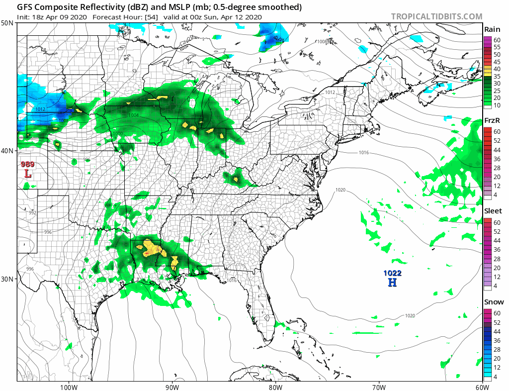
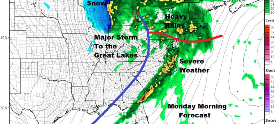
Easter Sunday will be dry with rain holding off until Sunday night but we still see clouds increasing as the day wears on. It should warm up some as the highs off the South Atlantic coast so we see highs reaching the 60s away from the ocean. A major storm will be coming out of the Southern Plains and head to the Great Lakes.

This storm is going to have some wide ranging impacts from heavy snow in the Western Lakes accompanied by fierce winds, severe weather across the Gulf States this weekend and to the Southeast coast on Monday, for much of the Middle Atlantic and Northeast look for heavy rain coming in during the overnight hours Sunday night and lasting into Monday afternoon. Winds will pick up strongly after that. We could see highs in the 60s to low 70s Monday before the cold front sweeps by and colder air returns for Tuesday and Wednesday of next week.
BE SURE TO DOWNLOAD THE FREE METEOROLOGIST JOE CIOFFI WEATHER APP &
ANGRY BEN’S FREE WEATHER APP “THE ANGRY WEATHERMAN!
MANY THANKS TO TROPICAL TIDBITS FOR THE USE OF MAPS
Please note that with regards to any severe weather, tropical storms, or hurricanes, should a storm be threatening, please consult your local National Weather Service office or your local government officials about what action you should be taking to protect life and property.


