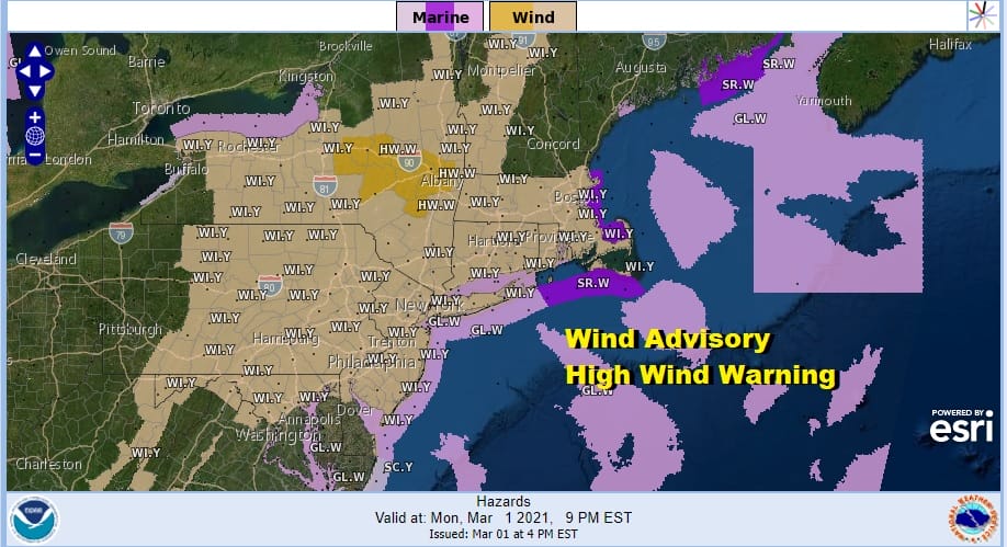
Wind Advisory Tonight Tuesday Gusts 40-50 MPH Cold Air Arriving

Weather in 5/Joe & Joe Weather Show Latest Podcast
Wind Advisory Tonight Tuesday Gusts 40-50 MPH Cold Air Arriving
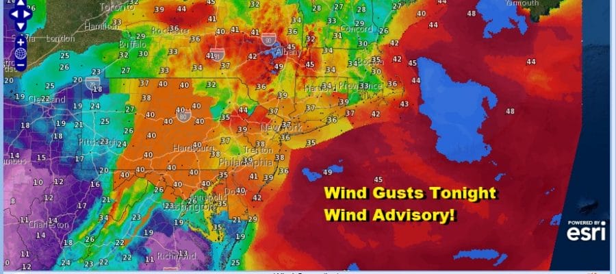
The March lion is roaring as winds have picked up quickly this afternoon. Gusts of over 40 mph have already been recorded and the Wind Advisory continues overnight and for many areas it has been extended through the daytime Tuesday.
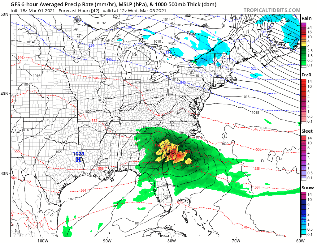
The cold front has passed offshore and clouds are thinning out this evening behind it. Rain has also moved out to the east and it looks like we are beginning a rather long stretch of dry weather that could last into next week provided we get no surprises from any coastal low this weekend. The odds of that happening however remain very low.
SATELLITE

Regional radars show the rain has moved offshore. Now we are seeing the lake effect snow machine going to work in Western NY and in Central and Western Pennsylvania. Those snow showers are moving southeastward but they should dry up before reaching the coast.
F5 WEATHER RADARS


Tonight the wind will howl and add to that dropping temperatures and you have a very cold night indeed. Morning lows will be in the upper teens to mid 20s. Factor in these 40 mph wind gusts at 6qm Tuesday and we are talking about wind chills down in the single digits in some areas

Tuesday will remain windy with the strongest gusts likely from Northern New Jersey to NYC and points east and northeast. Winds to the southwest of there will be lower but still gusty. We will have sunshine on Tuesday but highs will be confined to the low and middle 30s at best.
Winds will relax a bit on Wednesday and we should see temperatures climb into the mid 40s to lower 50s with some sunshine. However another cold front will pass. This one will be dry and that allows a cold high to build in for Thursday and holding right through the weekend. This will keep temperatures below average through Sunday. Thursday’s highs will be in the leftover 40s and Friday Saturday and Sunday highs will only be in the 30s each day. Two waves of low pressure will pass to our south. One on Wednesday and the other over the weekend. Neither one will be an issue here.
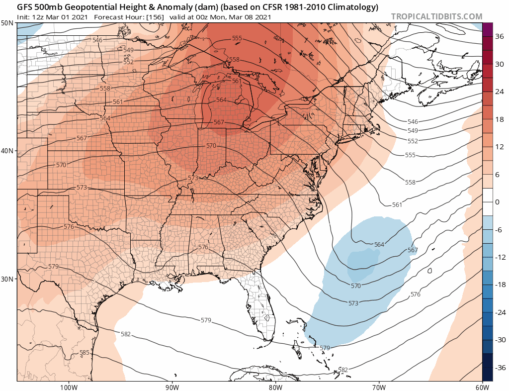
Good news could be coming for warmer weather lovers. Once the upper trough along the east coast pulls out on Sunday a strong ridge builds in the Eastern US. This will not only keep us dry but it will also bring warmer temperatures for much of next week! We could see our first 60s since Christmas Eve if this verifies. It will also come with some sunshine which will make it enjoyable and get rid of the remaining big snow piles that are still sitting in some parking lots.
BE SURE TO DOWNLOAD THE FREE METEOROLOGIST JOE CIOFFI WEATHER APP &
ANGRY BEN’S FREE WEATHER APP “THE ANGRY WEATHERMAN!

MANY THANKS TO TROPICAL TIDBITS & F5 WEATHER FOR THE USE OF MAPS
Please note that with regards to any severe weather, tropical storms, or hurricanes, should a storm be threatening, please consult your local National Weather Service office or your local government officials about what action you should be taking to protect life and property.


