Wind Advisory Continues Into This Afternoon Temperatures Bounce Wednesday

Weather in 5/Joe & Joe Weather Show Latest Podcast
Wind Advisory Continues Into This Afternoon Temperatures Bounce Wednesday
What a cold morning it is across the Northeast and Northern Mid Atlantic. Temperatures bottomed in the upper teens and low 20s. We still have a busy wind gusting to 30 to 40 mph at times and that has produced wind chills down in the single digits in many locations. It hurts more in March than it does in January because in our minds, we a longing for winter to just go away. However that season still has a few arrows in its quiver.
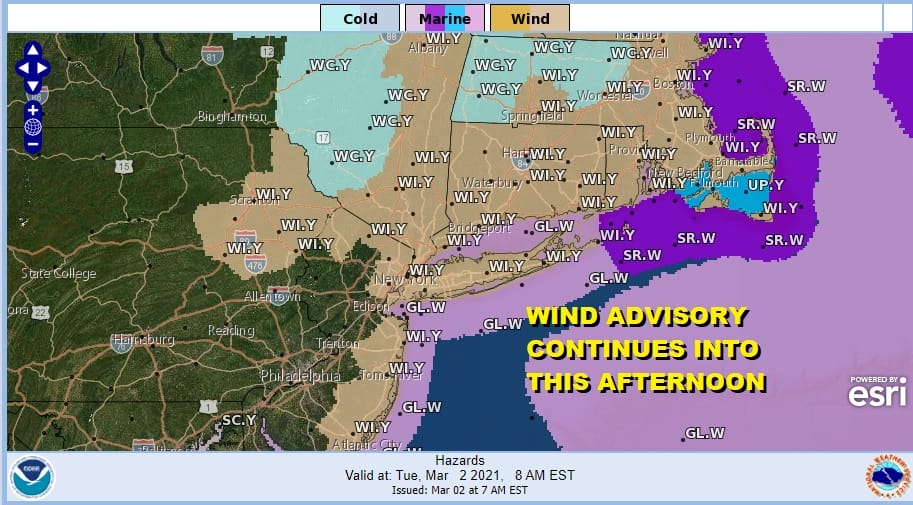
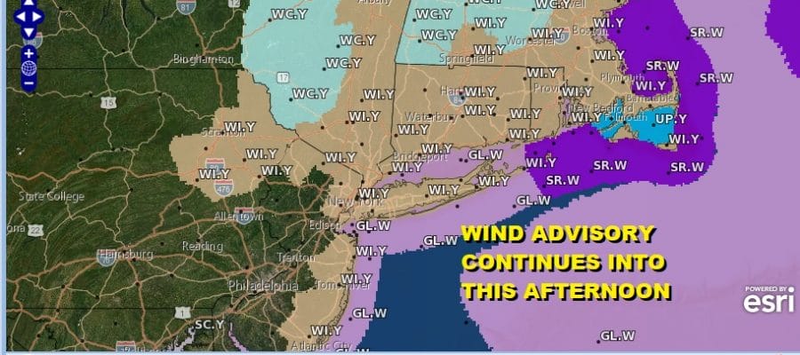
Wind advisories continue this morning mainly for the New Jersey coast and for areas north and northeast of NYC. Areas to the south across Pennsylvania, interior New Jersey southward are below advisory criteria but there still will be a busy wind gusting to 20 to 30 mph or more at times.
SATELLITE

At least we have the strengthening March sun working in our favor and that should take some of sting of the cold out of the air this afternoon. Highs will reach the low and mid 30s. Skies are mainly clear on the satellite picture today and on the radar we are seeing no activity showing up in either region.
F5 WEATHER RADARS


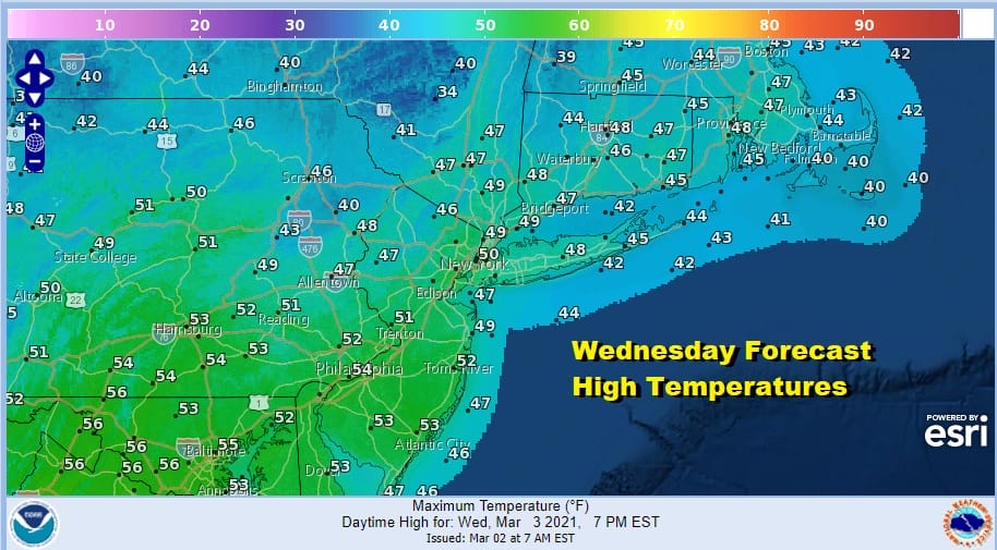
Winds will drop off overnight and we will have clear skies. Lows will be mostly in the 20s with teens in cold spots. We should see temperatures moderate on Wednesday with sunshine taking highs to the upper 40s to lower 50s.
Another cold front passes Wednesday night but this front comes through dry. Thursday look for some sunshine with highs in the 40s. Friday and Saturday we are looking at some sunshine both days with most highs in the 30s to around 40 or so. Sunday will also be dry with sunshine and clouds. Highs will reach into the 40s as the cold high to the north drops down to the Mid Atlantic coast.
We can say that will be no rain or snow for the next 9 days! The next cold front of even minimal importance doesn’t show up until next Thursday! Beginning Monday of next week we should start to warm up nicely. Highs Monday will be in the 40s and I think we have a shot for 60s next Tuesday and Wednesday.
BE SURE TO DOWNLOAD THE FREE METEOROLOGIST JOE CIOFFI WEATHER APP &
ANGRY BEN’S FREE WEATHER APP “THE ANGRY WEATHERMAN!

MANY THANKS TO TROPICAL TIDBITS & F5 WEATHER FOR THE USE OF MAPS
Please note that with regards to any severe weather, tropical storms, or hurricanes, should a storm be threatening, please consult your local National Weather Service office or your local government officials about what action you should be taking to protect life and property.


