
Warmer Wednesday Chilly But Dry Through Sunday Warmer Next Week

Weather in 5/Joe & Joe Weather Show Latest Podcast
Warmer Wednesday Chilly But Dry Through Sunday Warmer Next Week
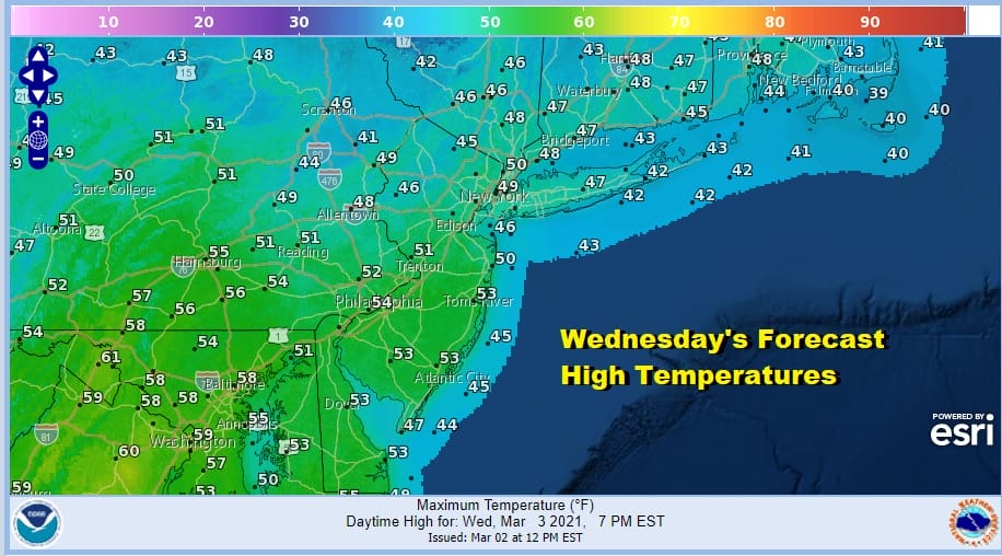
The harshness of yesterday has now eased and we are headed for a warmer Wednesday. This time of year it doesn’t take much for temperatures to bounce higher and we will see this happen today. Sunshine should dominate the skies today and highs will reach the upper 40s to mid 50s. More importantly is that the wind will be much lower and should not be a major factor.
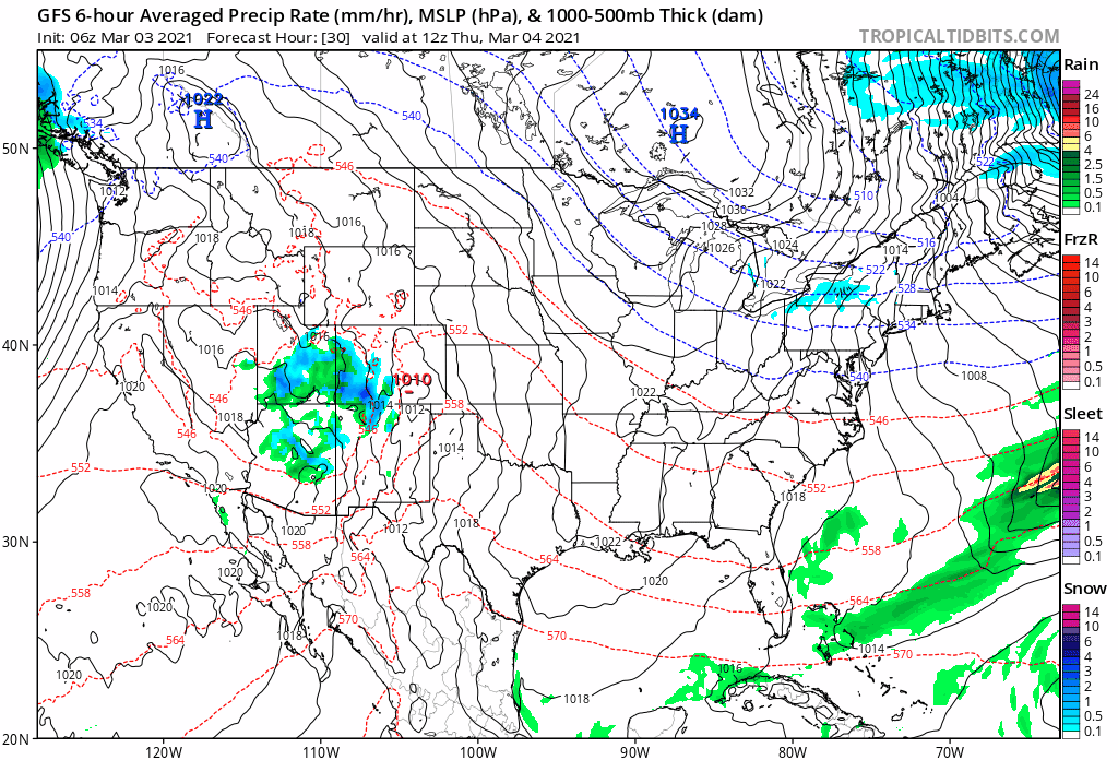
While we do have a cold front approaching from the northwest, there isn’t much with it on the satellite view and ahead of it we are seeing very little in the way of clouds so enjoy the sunshine as there should be plenty of it. To the south we have a wave of low pressure that has moved off the southeast coast but that wave is headed east and is of no concern.
SATELLITE

Regional radars are quiet and we are entering a stretch where we will see little if any precipitation over the next 7 days!
F5 WEATHER RADARS


Once the front passes tonight winds will go to the northwest to north again and that will bring down colder air. However it will come as a result of a large building high dropping southward from Canada and not due to a strengthening low to our immediate east. This will bring temperatures down to a little below average starting Thursday and lasting through Sunday but we will not see the harsh conditions of yesterday repeated.
We are on cruise control Thursday through Sunday. Look for sunshine or at least some sunshine each day. Highs by day will be in the low to mid 40s. Overnight lows will be in the 20s to lower 30s. The cold high will drop to the Middle Atlantic Coast Monday and a southwest flow develops. Temperatures will start moving up with highs Monday in the 40s to near 50. A warm front to trigger a shower Monday night but other than that, the next cold front arrives with showers on Thursday. This leaves us Tuesday and Wednesday to enjoy sunshine and highs reaching the mid 50s to lower 60s on Tuesday and 60s Wednesday. There will be exceptions of course as the sea breeze will be an issue along the coast. However inland areas could warm up nicely on this go around.
BE SURE TO DOWNLOAD THE FREE METEOROLOGIST JOE CIOFFI WEATHER APP &
ANGRY BEN’S FREE WEATHER APP “THE ANGRY WEATHERMAN!

MANY THANKS TO TROPICAL TIDBITS & F5 WEATHER FOR THE USE OF MAPS
Please note that with regards to any severe weather, tropical storms, or hurricanes, should a storm be threatening, please consult your local National Weather Service office or your local government officials about what action you should be taking to protect life and property.


