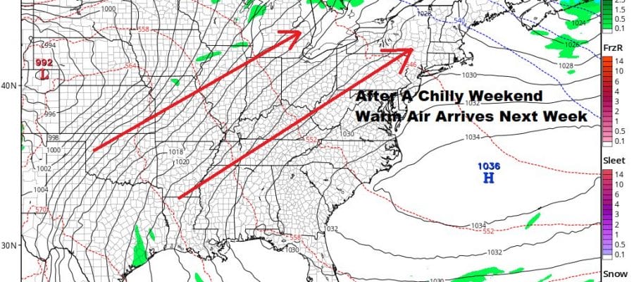
Chilly Air Returns Warmer Air Arrives Next Week
Dry Through At Least Wednesday

Weather in 5/Joe & Joe Weather Show Latest Podcast
Chilly Air Returns Warmer Air Arrives Next Week Dry Through At Least Wednesday
The one day warm up is done and another weak cold front has passed through overnight. We have a strong block to the northeast that is stronger than what we saw back in January. The block is going to keep it cold around here today through the weekend but it will keep it bone dry. In fact this block is so strong that the next weather system in the southern part of the jet stream will pass so far south, it will move across Southern Florida and through the Bahamas on Saturday before heading out to sea!
SATELLITE

The satellite is showing a few clouds around the Great Lakes with an upper trough moving southeast. We should see some sunshine and a few clouds today with temperatures just topping out in the low to mid 40s. Some lake effect snow is going on in Western NY but that stays there.
F5 WEATHER RADARS


This cold air mass will not be nearly as harsh as what we saw Monday night and Tuesday. It will be much more reasonable. Tonight will be cold and clear with lows in the teens to lower 20s. Friday Saturday and Sunday we will see sunshine with highs in the 30s by day and lows in the upper teens to mid 20s at night. It is a fairly easy forecast. Other than a few passing clouds there are no issues through the weekend.
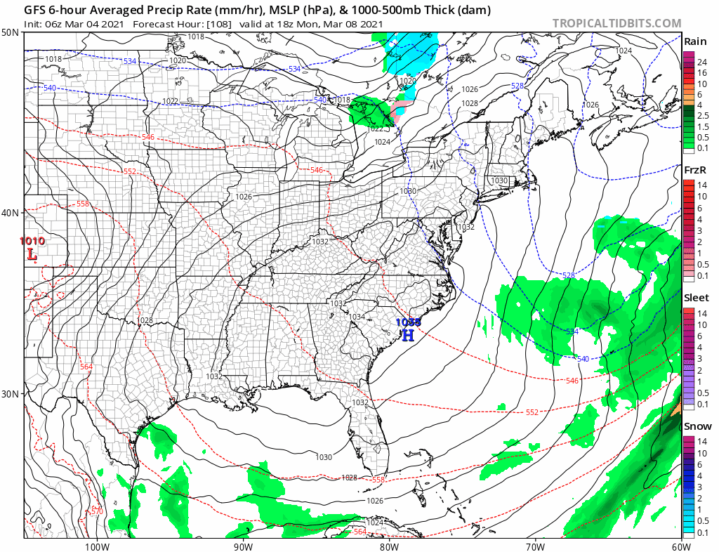
Next week the cold high becomes the warm high as it moves from Eastern Canada to the Middle Atlantic states. This brings a west southwest flow and other than maybe a passing brief shower Monday night as a warm front passes, there should be no issues. Monday’s highs will be in the 40s to near 50 with sun and high clouds.
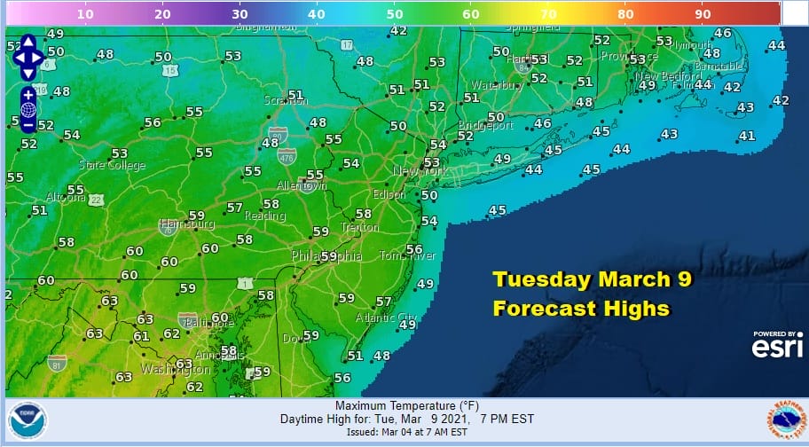
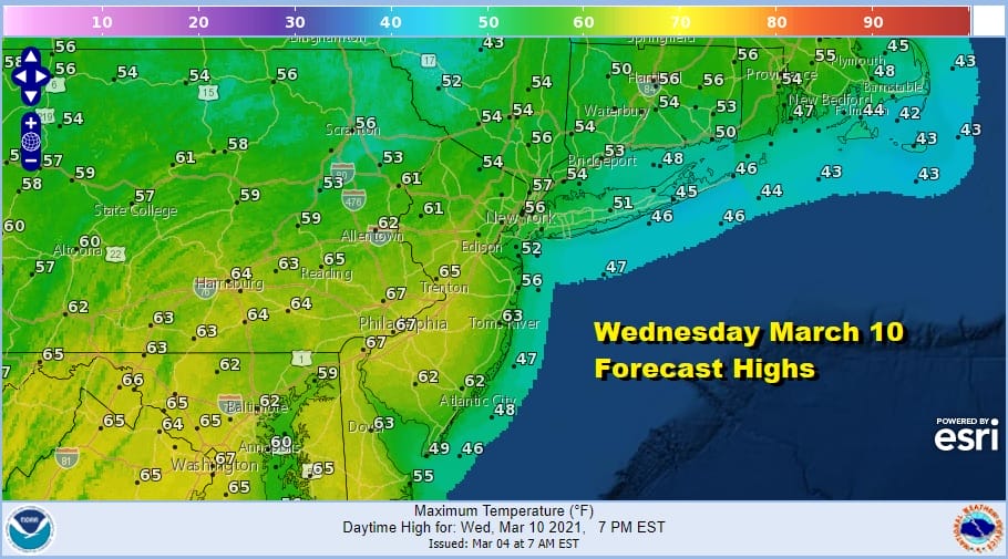
Usually in March when you get enough sun and the wind behaves and stays mostly land based rather than ocean based, we can see highs outperform and I think there is a chance that we could see 50s and 60s further north than these initial forecasts. That means 70 degrees on Wednesday might not be out of the question ahead of the coast. We should have enough sun both Tuesday and Wednesday to be higher than these early forecasts. The next cold front arrives next Thursday with a chance for showers and that should be followed by chilly air behind it.
BE SURE TO DOWNLOAD THE FREE METEOROLOGIST JOE CIOFFI WEATHER APP &
ANGRY BEN’S FREE WEATHER APP “THE ANGRY WEATHERMAN!

MANY THANKS TO TROPICAL TIDBITS & F5 WEATHER FOR THE USE OF MAPS
Please note that with regards to any severe weather, tropical storms, or hurricanes, should a storm be threatening, please consult your local National Weather Service office or your local government officials about what action you should be taking to protect life and property.


