Rain Ending Wind Advisory Later Today Cold Shot Tonight Tuesday

Weather in 5/Joe & Joe Weather Show Latest Podcast
Rain Ending Wind Advisory Later Today Cold Shot Tonight Tuesday
The new month is here and March is the first of the three fastest warming months of the year (along with April and May). This the beginning of meteorological spring. No magic switch is flipped nor is there some sort of idyllic adventure of beautiful weather. It will be just be the annual howls of “wear is spring” that will come from the same people year in and year out. The reality is that spring in the Northeast is usually a horrible time of year.
SATELLITE

The satellite picture has us socked in with clouds as a cold front approaches from the northwest. We have loaded radars with rain that will move through this morning and gradually end from northwest to southeast by midday.
F5 WEATHER RADARS


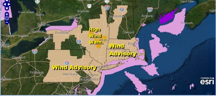
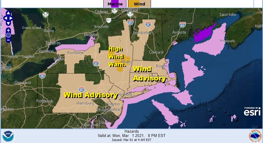
Weather conditions will improve this afternoon with decreasing clouds and increasing sunshine. Winds will increase rather sharply. The National Weather Service has placed many areas from Pennsylvania to New England under a wind advisory. Winds are forecast to gust to 40 to 50 mph. I was leaning to the idea of the wind speeds falling in the lower end of this range.
Tonight is going to be a very cold night indeed with very cold air coming down from Eastern Canada combined with gusty winds that will continue overnight into Tuesday morning. Lows by morning will be in the teens to around 20 degrees.
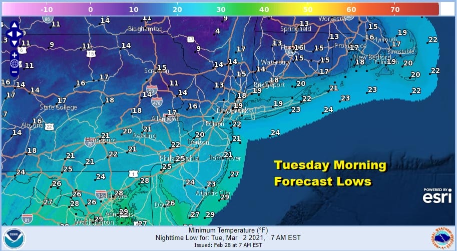
Tuesday will be a cold day with sunshine and a gusty wind at least for awhile. Highs will be just in the low to mid 30s. We will see lows Tuesday night in the 20s so it will be a little higher than the previous day.
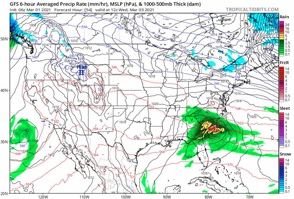
This looks like a dry uneventful week. We have a strong blocking pattern that has developed in the North Atlantic but much like we saw during January, the block is so strong that it is suppressing everything well to the south. 2 waves will be moving along across the south this week. The one on Wednesday will pass to the south. The second one this weekend is also likely to pass to the south and east. This leaves us high and dry. Wednesday we will see highs in the 40s with sun and high clouds. A weak cold front passes from the northwest and another cold high builds in for Thursday into Saturday. This will leave us dry and cold but remember that normals now are rising 1 degree every three days. Thursday highs will be in the 40s. Friday and weekend highs will likely be in the 30s or at best upper 30s and lower 40s. No rain or snow is forecast unless there is a surprise with the second wave moving northwest of its current projection.
BE SURE TO DOWNLOAD THE FREE METEOROLOGIST JOE CIOFFI WEATHER APP &
ANGRY BEN’S FREE WEATHER APP “THE ANGRY WEATHERMAN!

MANY THANKS TO TROPICAL TIDBITS & F5 WEATHER FOR THE USE OF MAPS
Please note that with regards to any severe weather, tropical storms, or hurricanes, should a storm be threatening, please consult your local National Weather Service office or your local government officials about what action you should be taking to protect life and property.


