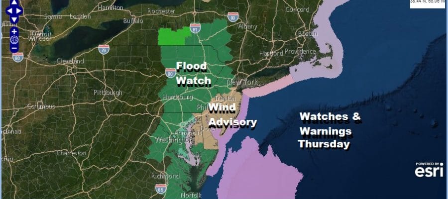
Wind Advisory New Jersey Coastal Counties
Flood Watch Western and Northern New Jersey Eastern Pennsylvania

The flood watch continues from the Catskills south to Northern New Jersey and then continues south through the western New Jersey counties, most of the Eastern half of Pennsylvania south into Delaware Maryland and Eastern Virginia. Let’s add wind advisories to the mix for much of Central and South Jersey Friday for gusts of 40 mph or higher at times thanks to the tightening pressure gradient along the coast. We might see the wind advisory expanded northeastward on Thursday. Rain will be coming later Thursday and lasting into early Friday.
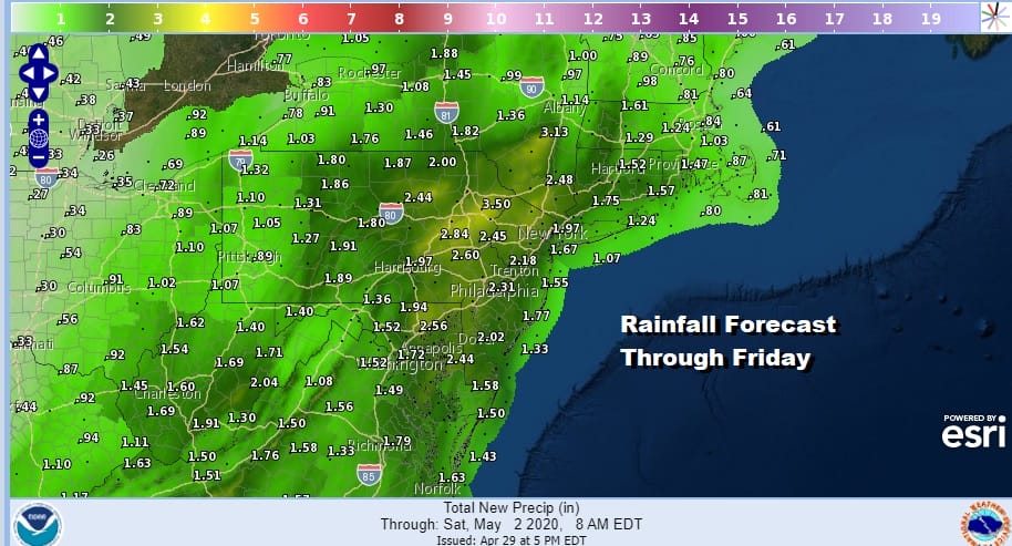
Some areas under theflood watch could see 2 to 3 inches of rain thanks to slow moving showers and thunderstorms that will start to move in during the day Thursday, especially in the late morning and afternoon but they won’t reach coastal areas until late afternoon or Thursday evening, and not until later Thursday night in Southern New England. This 2 to 3 inch rainfall potential comes on top of 2 other rain event s in the last 5 days so the ground is saturated.
SATELLITE

REGIONAL RADAR

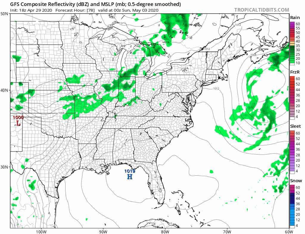
Meanwhile tonight our storm system to the west is setting up as is the warm front to the south. You can see arm of showers moving northeast this evening but there isn’t much of anything behind it so once those showers go by we will be left with lots of clouds. Overnight temperatures will hold steady in the 40s to near 50.
LOCAL RADAR NEW YORK CITY

LOCAL RADAR PHILADELPHIA


Rain arrives from west to east as described above on Thursday. It will become windy especially along the coast with a southeast to south wind at 20 to 30 mph with higher gusts. The heavy rain moves through Thursday night with embedded thunderstorms in the mix. Temperatures on Thursday will be in the 50s along the coast and into the 60s inland.

Friday and part of Saturday poses a problem. The upper trough responsible for this system is only crawling eastward. As a result we could see some scattered showers or even a thunderstorm Friday as the upper low moves overhead. Otherwise look for lots of clouds with highs in the 60s. Clouds will linger into Saturday afternoon it seems with highs also in the 60s. Hopefully there will be no rain issues Saturday.
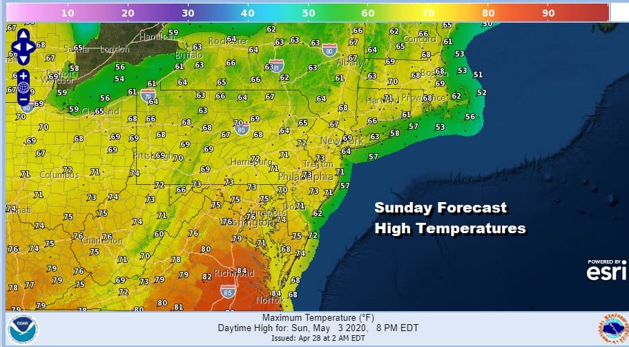
I was hoping for at least a decent weekend but it is looking a little more dicey. Sunday should be warmer ahead of a cold front and perhaps we see some sun in the morning before clouds and showers move in later in the day or Sunday night ahead of yet another cold front. Highs could reach into the 70s in some areas.
Next week looks problematic with another chilly high building to our north and the chance for lows to pass to our south putting us in onshore flow potential. We may have to wait until mid May for the pattern to do its annual switch into something warmer.
BE SURE TO DOWNLOAD THE FREE METEOROLOGIST JOE CIOFFI WEATHER APP &
ANGRY BEN’S FREE WEATHER APP “THE ANGRY WEATHERMAN!
MANY THANKS TO TROPICAL TIDBITS FOR THE USE OF MAPS
Please note that with regards to any severe weather, tropical storms, or hurricanes, should a storm be threatening, please consult your local National Weather Service office or your local government officials about what action you should be taking to protect life and property.


