DOWNLOAD MY NEW FREE JOESTRADAMUS WEATHER APP FOR ANDROID
THE APP IS ABSOLUTELY FREE TO ALL BUT CONSIDERING SUBSCRIBING TO PATREON FOR A WEATHER EXPERIENCE FREE OF ADS, EXCLUSIVE VIDEOS FOR MEMBERS ONLY AND MUCH MORE…STARTS AT $2 A MONTH..MESSAGE ME AT ANY TIME
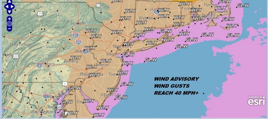
Wind Advisory Into This Afternoon, Light Snow Chance Wednesday Night
New Year’s Day finds us sitting in warm air that arrived overnight once the rains were over with. Temperatures reached the upper 50s to near 60 this morning which makes for a very warm spring like day to start of 2019. We still have some cloud cover to work through this morning but we should see some sunshine develop through the clouds as we go through the day. Temperatures are going to begin to ease slowly this afternoon but they should remain in the 50s. Colder air will be arriving for tonight as temperatures trend down to where they should be this time of year. Skies will clear with Wednesday morning lows in the 20s to lower 30s. There are minimal issues on the radar to worry about.
EASTERN SATELLITE

REGIONAL RADAR

Wednesday we see some sunshine and it will be a typical January day with highs in the upper 30s to lower 40s. Clouds will arrive later in the day in advance of a weak upper air disturbance that will be moving through Wednesday night. Low pressure to the south will develop offshore and move to the northeast. This is another situation where the northern stream feature in the jet stream and the southern stream feature stay basically separate and weak.
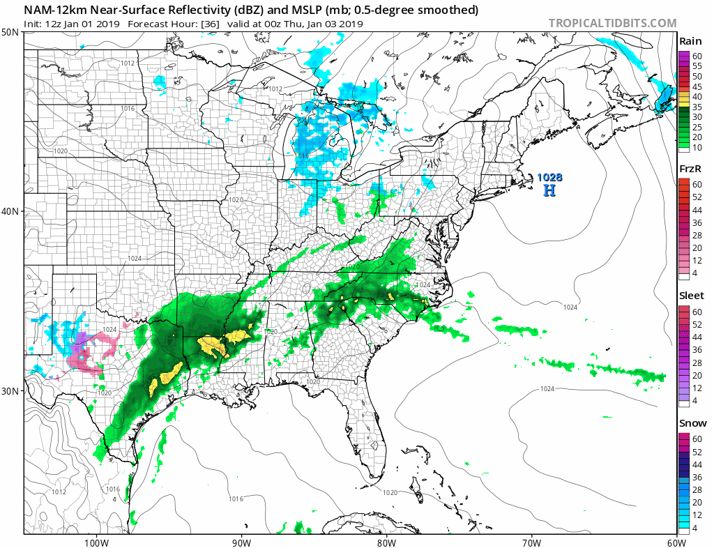
Based on temperatures there could a period of light snow inland areas in New Jersey (along and north of Route 78) to NYC, Hudson Valley into Connecticut. Some light snow could also occur over Long Island. To the south in Central and South Jersey it could be a mix or just rain. There might be enough with a little bit of intensity to produce a coating to an outside chance that some areas get an inch. Im not expecting much more from this. Temperatures Thursday will be in the upper 30s to lower 40s. We can also see on the NAM model another low getting ready to move out to the northeast. We should be dry on Friday before more rain arrives Friday night and Saturday. There is no cold air of consequence left after Wednesday so once again this is an all rain event.
MANY THANKS TO TROPICAL TIDBITS FOR THE USE OF MAPS
Please note that with regards to any tropical storms or hurricanes, should a storm be threatening, please consult your local National Weather Service office or your local government officials about what action you should be taking to protect life and property.


