THUNDERSTORMS IN PENNSYLVANIA MOVING EAST
SOME ISOLATED STRONG STORMS POSSIBLE BUT NO WIDESPREAD OUTBREAK
MORE WORK TO DO BEFORE NICE WEATHER ARRIVES FOR THE WEEKEND
You are going to notice a couple of things on the satellite loop this evening which argues against a widespread severe weather outbreak. First off notice the clouds along the coast. That is the marine layer or cooler marine air that is getting drawn northward into coastal areas as well as Southern New England and Long Island. To the west of this we have a sliver of clearing where temperatures climbed into the 80s today across New Jersey and Easternmost Pennsylvania and then the clouds to the west of that with some thunderstorms. This suggests that the thunderstorms coming out of Pennsylvania might hold together when they move into Western New Jersey in the next couple of hours but then they should weaken as the move further east. There could be an isolated strong thunderstorm in the mix but as far as a widespread solid line of thunderstorms, it seems to me that the chances for that are very low.
EASTERN SATELLITE

REGIONAL RADAR

Radar this evening is showing a line of thunderstorms moving across Eastern Pennsylvania. So far at least we haven’t seen much in the way of severe thunderstorms however rain is probably the bigger issue with the saturated ground. Be advised that a quick inch or two of rain will set the waters flowing again so be on the alert for some possible quick flash flooding.
LOCAL RADAR NEW YORK CITY

LOCAL RADAR PHILADELPHIA


The cold front moves through and stalls to our south (again) and a wave develops on the front (again) so that clouds may be a bit stubborn on Thursday. Some sun is possible in Northern New Jersey, the Hudson Valley and interior Connecticut. Temperatures there could reach into the 70s but it will likely be in the 60s to near 70 everywhere else. Some rain moves through Thursday night into Friday morning before the wave goes by and then weather conditions improve later Friday. Highs will be in the 60s.
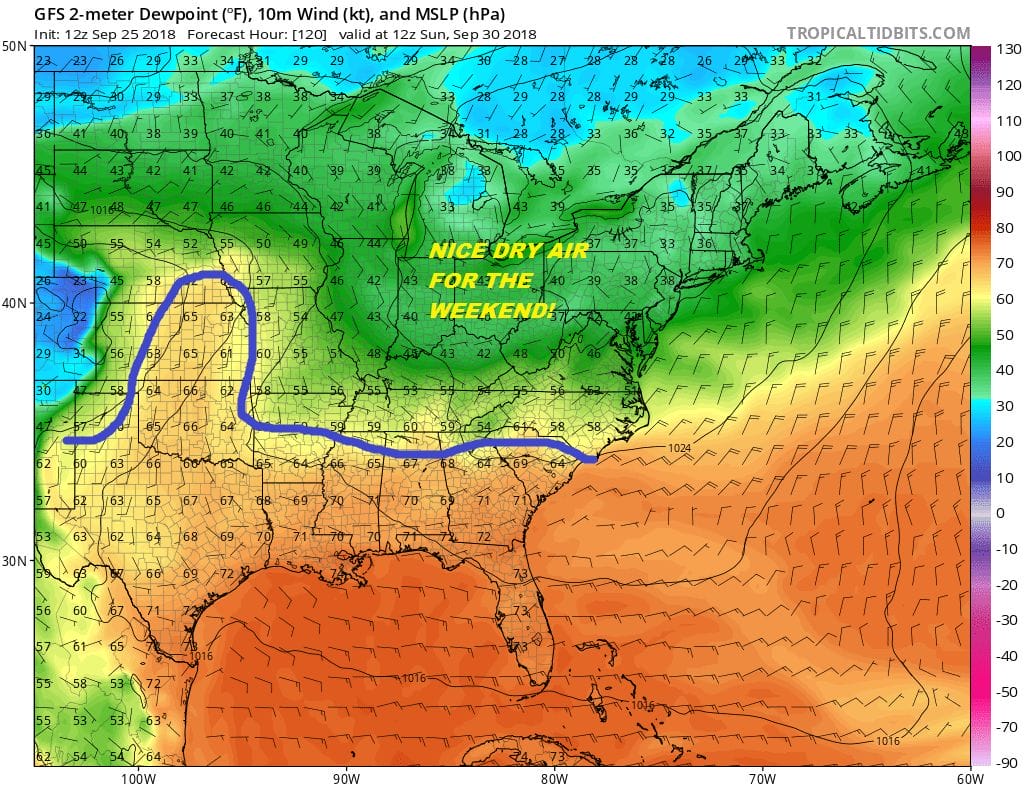
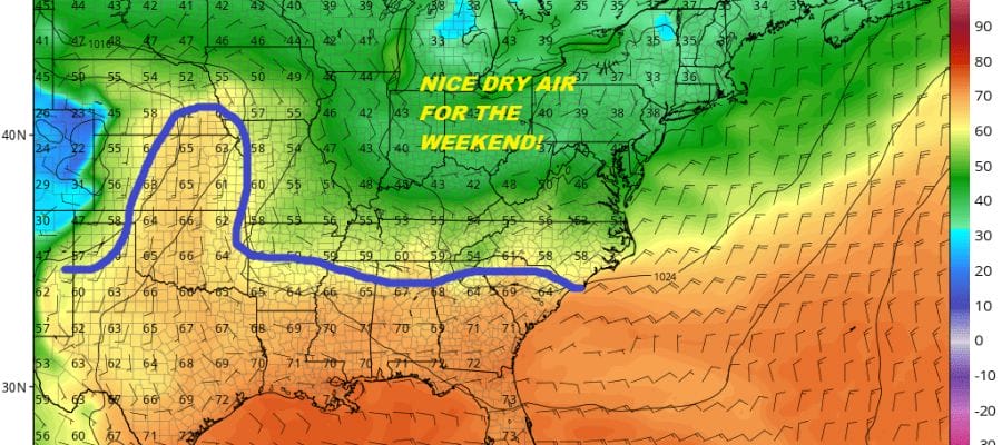
We can celebrate low dew points and sunshine for the weekend as high pressure builds in. Highs will be in the low to mid 70s on Saturday and in the upper 60s to lower 70s on Sunday. Saturday night will be nice and cool with lows in the upper 40s to mid 50s. It looks like we should have a good weekend.
JOIN US FOR A LIVE STREAM ON TROPICAL STORM KIRK, HURRICANE ROSA, & THE LONG RANGE AT 7PM EASTERN TIME ON YOUTUBE.
![]()
SUBSCRIBE TO PATREON FOR A WEATHER EXPERIENCE FREE OF ADS, EXCLUSIVE VIDEOS FOR MEMBERS ONLY AND MUCH MORE…STARTS AT $2 A MONTH..MESSAGE ME AT ANY TIME

MANY THANKS TO TROPICAL TIDBITS FOR THE USE OF MAPS
Please note that with regards to any tropical storms or hurricanes, should a storm be threatening, please consult your local National Weather Service office or your local government officials about what action you should be taking to protect life and property.
LATEST JOESTRADAMUS ON THE LONG RANGE

