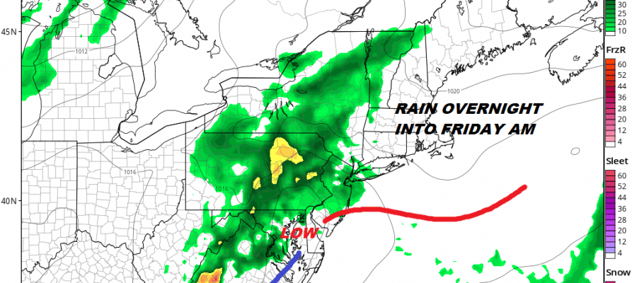
FLOOD WATCH POSTED FOR RAIN TONIGHT INTO FRIDAY MORNING
Rain is in the forecast again but at least not for the day side today. We do however have lots of clouds around this morning thanks to last night’s cold front that has come through and stalled out to the south of us. This has been the signature pattern for the last 2 months with weather fronts coming to a grinding halt. A wave will develop on that front bringing rain here tonight into Friday morning. At least for today however we are not forecasting rain but just lots of clouds with perhaps some breaks of sun especially north and west of the coast. Temperatures today will be in the 60s to near 70 in most places.
EASTERN SATELLITE

REGIONAL RADAR

Radars this morning are quiet locally other than the odd sprinkle. Some rain is developing in the mountains of West Virginia and Virginia and that rain will be headed our way.
LOCAL RADAR NEW YORK CITY

LOCAL RADAR PHILADELPHIA


Tonight we see rain moving in from southwest to northeast coming into Southeast Pennsylvania and Southern New Jersey this evening and reaching the Hudson Valley and Western Connecticut during the early morning hours. The heaviest rain will be north and west of the coast.
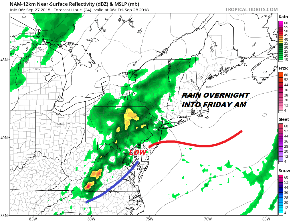
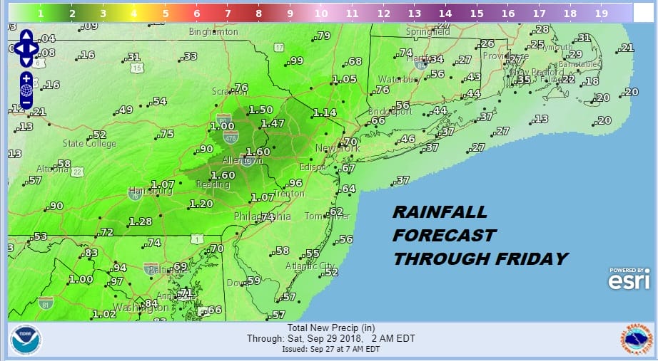
Weather models are centering on the idea of up to a couple of inches of rain possible in the flood watch area. Since much of this area has seen a lot of rain in the last week or so the ground remains saturated and the threshold for flooding remains pretty low. There is potential for an upside surprise again though it is hard to envision it being to the extreme of a few days ago since we don’t have a well defined warm front this time around.

Once the wave goes by weather conditions should improve Friday afternoon with leftover clouds and perhaps some breaks of sunshine developing with highs in the 60s. The weekend looks good with sunshine for both Saturday and Sunday with low humidity and highs both days into the 70s.
SUBSCRIBE TO PATREON FOR A WEATHER EXPERIENCE FREE OF ADS, EXCLUSIVE VIDEOS FOR MEMBERS ONLY AND MUCH MORE…STARTS AT $2 A MONTH..MESSAGE ME AT ANY TIME

MANY THANKS TO TROPICAL TIDBITS FOR THE USE OF MAPS
Please note that with regards to any tropical storms or hurricanes, should a storm be threatening, please consult your local National Weather Service office or your local government officials about what action you should be taking to protect life and property.
LATEST JOESTRADAMUS ON THE LONG RANGE

