Weekend Weather Wet Pattern Develops Coastal Low Moves North
Weekend Weather Wet Pattern Develops
Coastal Low Moves North
Before we get to the weekend outlook, let us get the easy part of the forecast out of the way. The next 2 days we will see sunshine, low humidity and temperatures into the 80s with cooler readings along the shore. That pretty much describes Thursday and Friday. Tonight and Thursday night will be nice and clear with lows in the mid 50s inland to mid 60s urban areas and coastal locations. Enjoy the next 2 days as we will have nothing more than some occasional passing clouds and no weather issues on the radars.
EASTERN SATELLITE

REGIONAL RADAR

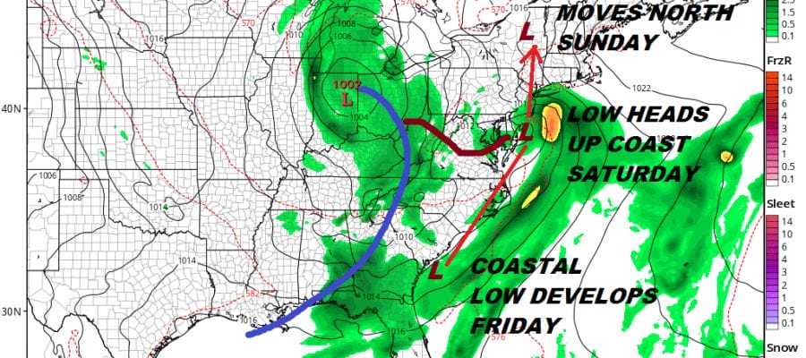
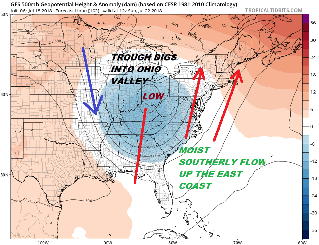
Looking ahead to the weekend we have problems developing. The jet stream is taking a decided shift in the Eastern US with a rather deep trough carving itself out along and just west of the Appalachians. The result is a strengthening southerly flow along the coastal plain which brings tropical moisture northward.
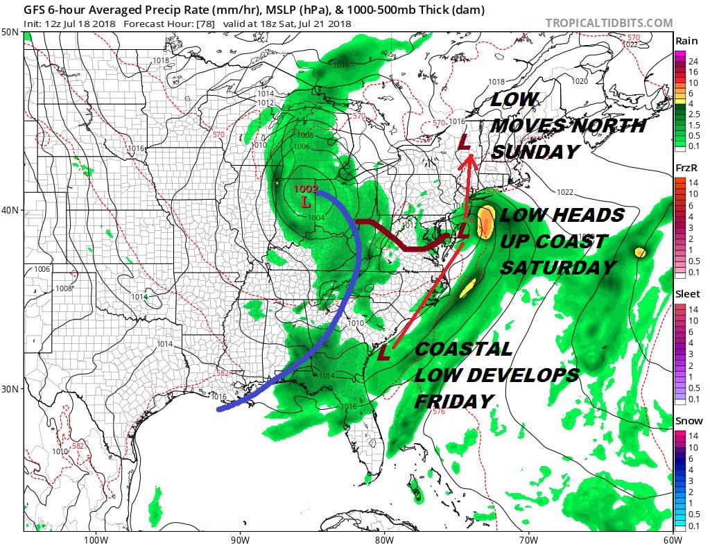
Low pressure develops along the Georgia South Carolina coast and heads northward Saturday. This is going to produce a small circular area of rain and even a bit of wind along the coast. Rain should develop later in the day Saturday and then it should be mostly gone by Sunday morning. The southerly flow aloft due to the upper trough to the west could be a week long problem for next week with the threat for downpours every day.
GFS RAINFALL FORECAST THROUGH FRIDAY JULY 27, 2018

Rainfall forecasts for Saturday through next Friday morning are on the order of several inches but as always with these things there is going to be some variability. There are still a few questions asking about the low for Saturday and Saturday night. Could it be a tropical system? It is certainly possible it could get some tropical characteristics however it may be moving too fast for that and I don’t know that it matters that much with regards to the outcome. The ocean is warm and a strong inflow from the southeast has produced some flooding rains in situations like this in the past. Systems like this can surprise in a big way rain wise and with a track hugging the coast, it could put Long Island and Southern New England in the path for some big rain. There are a lot of variables aloft here that have to be worked out yet. It does seem however that this weekend will have some rain issues along the way on both weekend days.
Please note that with regards to any tropical storms or hurricanes, should a storm be threatening, please consult your local National Weather Service office or your local government officials about what action you should be taking to protect life and property.
 GET JOE A CIGAR IF YOU LIKE

LATEST JOESTRADAMUS ON THE LONG RANGE