Weekend Weather Looking Wet Sunday

Weekend Weather Looking Wet Sunday
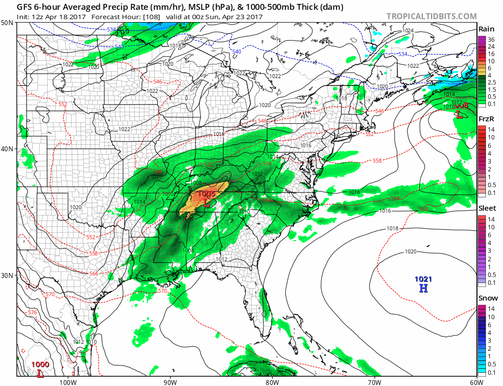
One thing about this time of year is that when you have a day as spectacular as today was, it usually doesn’t last long. The overall view of weather across the country is a busy one with several disturbances in play. None of them appear to be anything major but it will mean opportunities for clouds and rain. The first such opportunity comes Wednesday night into Thursday as low pressure moves across Southern Canada and a cold front moves through. Combined with a strengthening onshore flow Wednesday and we will see sunshine give way to increasing clouds. Wednesday night into Thursday morning there could be some showers or some light rain or drizzle. Temperatures on Wednesday will be quite cool with highs mostly in the 50s. A second system behind the first will bring another round of showers and maybe a thunderstorm Thursday night and on Friday. Temperatures will be on the rise into Friday until the front passes and then we start to set things up for the weekend.
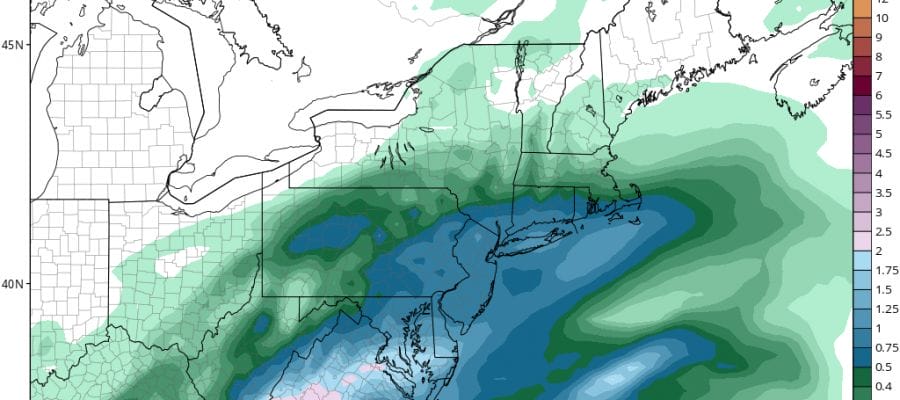
Nothing much has changed since yesterday. Saturday looks to be dry with some clouds around. Weather models are a little faster and rain could be moving in by Sunday morning. The slow movement of low pressure to the south will put is in a chilly raw ocean flow Sunday with highs in the 40s and low 50s.
WEEKEND WEATHER GFS RAIN FORECAST THROUGH 8AM MONDAY
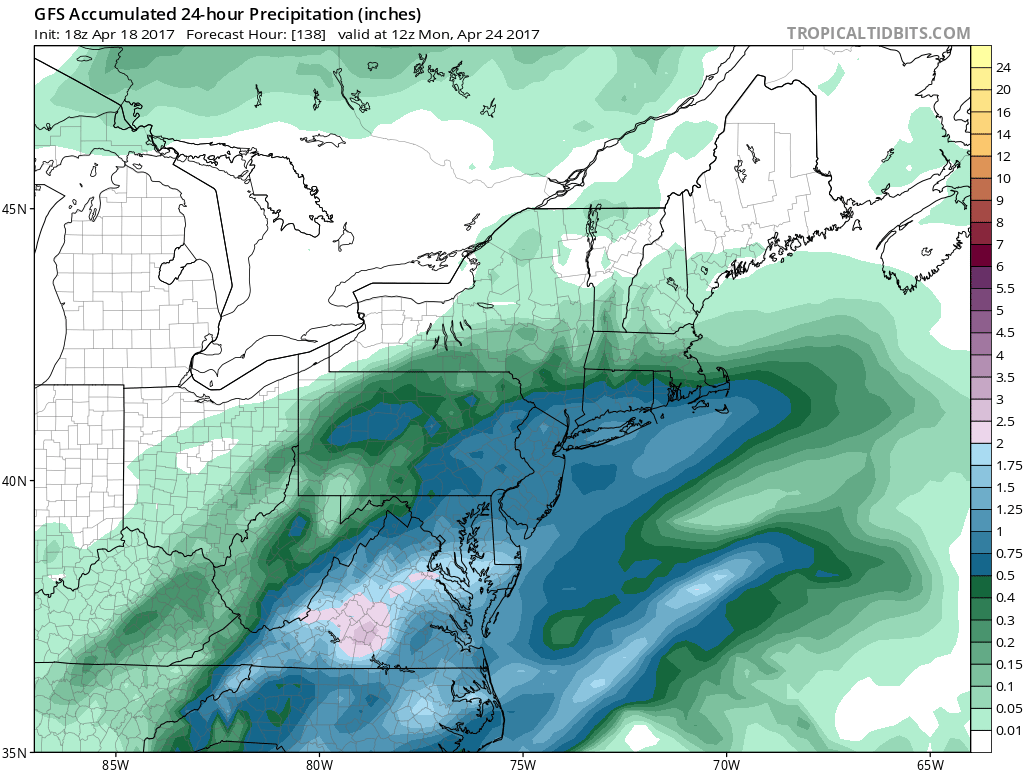
This system could be a one inch rain producer on average. Low pressure should start to move out during the day Monday and weather conditions will improve on Tuesday.
MANY THANKS TO TROPICAL TIDBITS FOR THE WONDERFUL USE OF THE MAPS

GET JOE A CIGAR IF YOU LIKE!
LANDSCAPE COMPANIES FOR YOUR SPRING SUMMER FALL NEEDS
LONG ISLAND ROCKLAND COUNTY Connecticut

![]()

ROCKLAND COUNTY TRI STATE SNOW REMOVAL JOHNSTOWN PA


FiOS1 News Weather Forecast For Long Island
FiOS1 News Weather Forecast For New Jersey
FiOS1 News Weather Forecast For Hudson Valley
NATIONAL WEATHER SERVICE SNOW FORECASTS
LATEST JOESTRADAMUS ON THE LONG RANGE
Weather App

Don’t be without Meteorologist Joe Cioffi’s weather app. It is really a meteorologist app because you get my forecasts and my analysis and not some automated computer generated forecast based on the GFS model. This is why your app forecast changes every 6 hours. It is model driven with no human input at all. It gives you an icon, a temperature and no insight whatsoever.
It is a complete weather app to suit your forecast needs. All the weather information you need is right on your phone. Android or I-phone, use it to keep track of all the latest weather information and forecasts. This weather app is also free of advertising so you don’t have to worry about security issues with your device. An accurate forecast and no worries that your device is being compromised.
Use it in conjunction with my website and my facebook and twitter and you have complete weather coverage of all the latest weather and the long range outlook. The website has been redone and upgraded. Its easy to use and everything is archived so you can see how well Joe does or doesn’t do when it comes to forecasts and outlooks.
Just click on the google play button or the apple store button on the sidebar for my app which is on My Weather Concierge. Download the app for free. Subscribe to my forecasts on an ad free environment for just 99 cents a month.
Get my forecasts in the palm of your hand for less than the cost of a cup of Joe!
![]()
