
Low Clouds Chilly Ocean Wind Wednesday
Low Clouds Chilly Ocean Wind Wednesday
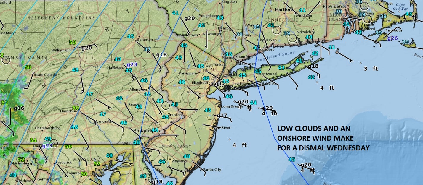
To me nothing says ugly more than low clouds and an ocean wind on a spring day and that is exactly what we are seeing for this Wednesday. Low clouds came in from the east a lot faster than I thought yesterday and last night. I figured we might start with a few hours of sun but it is not to be. Temperatures this morning are chilly as well as we have settled in the 40s. At the same time we have low pressure and a front moving across the Great Lakes with some showers. Combine that with the onshore flow set up and we will probably see some rain move in tonight into Thursday morning. Some light rain or drizzle is also possible later today into this evening with this ocean wind.
SATELLITE LOOP

REGIONAL RADAR

LOCAL RADAR NEW YORK CITY

LOCAL RADAR PHILADELPHIA


For now at least we seem to be sandwiched in between two areas of rain on the radar as some is going to our north and some to our south. At some point we should see it fill in but I don’t think we are going to see rain of any importance with amounts generally under a quarter of a inch.
Thursday some warmer air may try and move northward as yet another weather system approaches. We will probably see some showers from this Thursday night and Friday some showers and thunderstorms are possible. I would not be surprised to see temperatures had back briefly into the 70s Friday before the cold front passes. Then is dry and cooler Saturday and yet another system arrives for Sunday setting us up for another chilly rain with an ocean wind situation. This could be a 1 inch rain producer as low pressure moves off the Middle Atlantic coast Sunday night into Monday morning.
 GET JOE A CIGAR IF YOU LIKE

LANDSCAPE COMPANIES FOR YOUR NEEDS
LONG ISLAND ROCKLAND COUNTY Connecticut

![]()

ROCKLAND COUNTY TRI STATE SNOW REMOVAL JOHNSTOWN PA


FiOS1 News Weather Forecast For Long Island
FiOS1 News Weather Forecast For New Jersey
FiOS1 News Weather Forecast For Hudson Valley
NATIONAL WEATHER SERVICE SNOW FORECASTS
LATEST JOESTRADAMUS ON THE LONG RANGE
Weather App

Don’t be without Meteorologist Joe Cioffi’s weather app. It is really a meteorologist app because you get my forecasts and my analysis and not some automated computer generated forecast based on the GFS model. This is why your app forecast changes every 6 hours. It is model driven with no human input at all. It gives you an icon, a temperature and no insight whatsoever.
It is a complete weather app to suit your forecast needs. All the weather information you need is right on your phone. Android or I-phone, use it to keep track of all the latest weather information and forecasts. This weather app is also free of advertising so you don’t have to worry about security issues with your device. An accurate forecast and no worries that your device is being compromised.
Use it in conjunction with my website and my facebook and twitter and you have complete weather coverage of all the latest weather and the long range outlook. The website has been redone and upgraded. Its easy to use and everything is archived so you can see how well Joe does or doesn’t do when it comes to forecasts and outlooks.
Just click on the google play button or the apple store button on the sidebar for my app which is on My Weather Concierge. Download the app for free. Subscribe to my forecasts on an ad free environment for just 99 cents a month.
Get my forecasts in the palm of your hand for less than the cost of a cup of Joe!


