Weekend Weather Clouds Later Today Cold Front Next Week
SHOP THE JOESTRADAMUS STORE
Weekend Weather Clouds Later Today Cold Front Next Week
We begin our Saturday with some sunshine and some chilly morning lows however there is an upper air disturbance swinging across the Great Lakes that will bring in some clouds this afternoon. The clouds will not bring a complete overcast but they will blot out a good chunk sunshine.
WEEKEND WEATHER HIGH TEMPERATURES SATURDAY
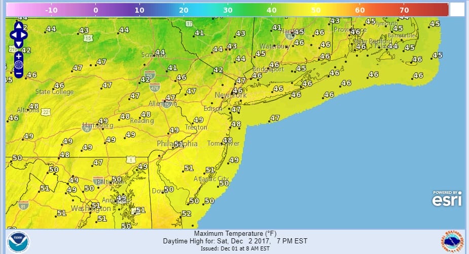
No showers are in the forecast so we have no rain to worry about this weekend. Radars will be quiet through Monday. Temperatures today will reach the upper 40s to lower 50s.
SATELLITE LOOP

REGIONAL RADAR

The clouds will linger this evening but they should pull out to the east overnight with slow clearing. Lows will be in the 30s to near 40. Then we should see more sunshine on Sunday and Monday. As a result temperatures will be a shade higher both days with readings topping out between 50 and 55.
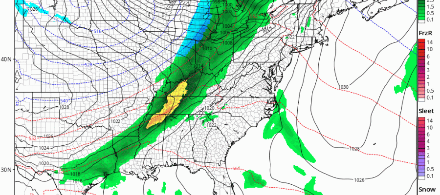
COLD FRONT TUESDAY NIGHT CLICK TO ANIMATE
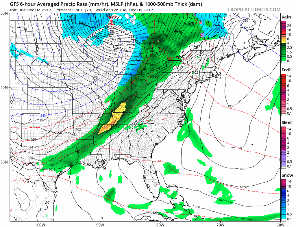 The next cold front will begin to approach on Tuesday and we will see clouds increase with the chance for passing showers. Then main area of showers will be arriving Tuesday night. Highs will be in the 50s. That front starts the downhill ride in temperatures as Canada begins to open up with cold air. Showers will end Wednesday morning and we could see the rain end as sleet or snow in some places. The front is going to stall offshore and energy swinging around from the Midwest will probably cause a wave to develop late this week and move up the coast just offshore. We will talk more about the prospects for this wave and whether there will be any snow issues with this later today.
 GET JOE A CIGAR IF YOU LIKE

FiOS1 News Weather Forecast For Long Island
FiOS1 News Weather Forecast For New Jersey
FiOS1 News Weather Forecast For Hudson Valley


