Weekend Underway Sunshine Humidity Up Today Heat Up Tomorrow
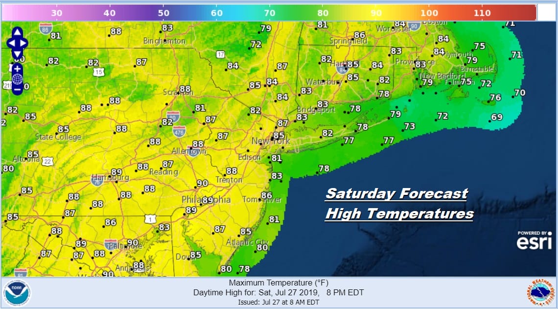
This is the last weekend of the month of July and we will finish off the month with what could be the best weekend of the summer. The satellite picture shows cloud free conditions and this should be the dominating feature for most if not all of today. The flow today has a bit of an ocean influence to it so that will bring the humidity up somewhat it won’t be too unreasonable nor will it be hazy. Temperatures today will be in the 80s and coastal areas will be in the lower 80s. Well inland there is a very small chance for an isolated pop up downpour or thunderstorm. They will be few and far between and 99 percent of you won’t see a thing.
SATELLITE

REGIONAL RADAR

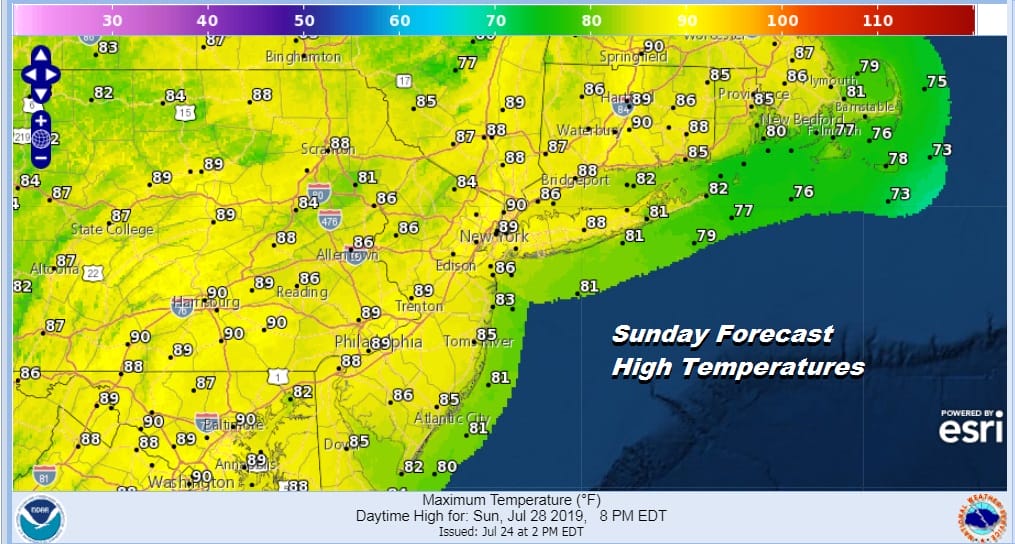
Sunday the winds will turn southwest as the high offshore drops to well off the Mid Atlantic coast. This will bring the temperatures higher as well as the humidity. Sunday I would consider uncomfortable as highs reach the upper 80s and lower 90s. Again other than a pop up shower or thunderstorm for the vast majority of you it will be rain free.
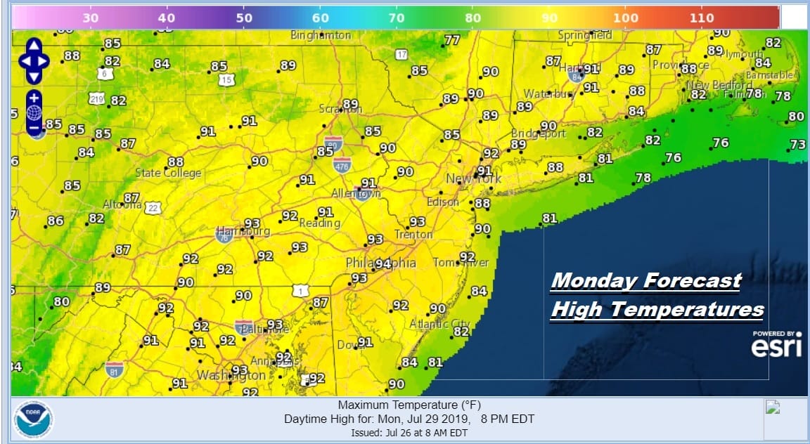
Sunday night we will see a weak trough move through upstate NY and New England with a dying area of showers and thunderstorms that should fall apart before they get here. This will turn the wind more westerly on Monday. This makes Monday the hottest day of the last round of heat with sunshine taking highs in to a range of 90 to 95. Again other than an isolated pop up thunderstorm it will be a rain free day.
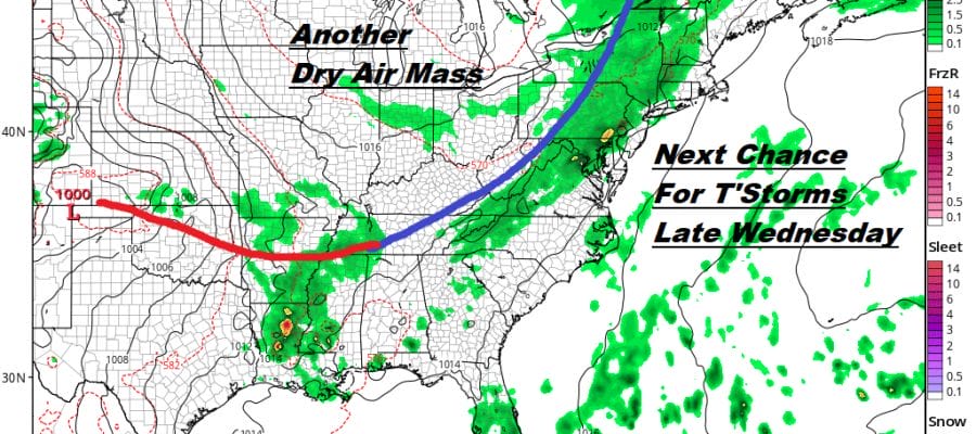
Tuesday will be very warm to borderline hot and humid as the winds start to turn more southwest again. We are setting the table for the arrival of the next cold front on Wednesday. Tuesday’s highs will be in the upper 80s to lower 90s. Wednesday brings a genuine threat for showers and thunderstorms late in the day as a cold front approaches and moves through from west to east.

Much like the last cold front this one is likely to slow down and get hung up for an extra day leaving us in line with an onshore flow and a chance for rain Thursday and possible into Friday as the next high pushes to our north . This at least will cool us down again and depending on the set up we could see a day where temperatures don’t get out of the 70s.
MANY THANKS TO TROPICAL TIDBITS FOR THE USE OF MAPS
Please note that with regards to any tropical storms or hurricanes, should a storm be threatening, please consult your local National Weather Service office or your local government officials about what action you should be taking to protect life and property.


