Sunshine Summer Weekend Humidity Increases Into Next Week
Today is the third day in a row that we will enjoy sunshine and low humidity. The satellite picture this morning shows clear skies from Maine down into Virginia. The old frontal boundary is offshore. A wave developing east of the Carolinas is actually going to help to pinch high pressure over us for an extra day. Humidity levels remain subdued however temperatures today will be a few degrees higher than yesterday as we reach the mid to upper 80s. There are no issues regarding showers or thunderstorms right through the weekend. In fact we may not see any showers or thunderstorms until next Wednesday which is when the next cold front will arrive.
SATELLITE

REGIONAL RADAR

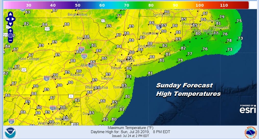
High pressure moves out to the east of Cape Cod Saturday which creates a light flow from off the ocean for Saturday. This leads humidity levels to come up but it also will keep temperatures in check in the 80s with a fair amount of sunshine. Sunday we will be the first day with hot and humid conditions with a southwest flow developing. Sunshine will take highs in the upper 80s to lower 90s.
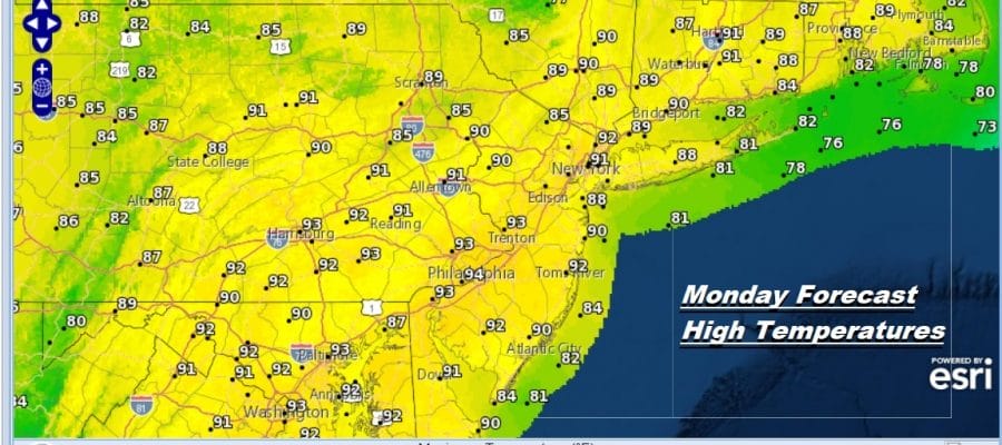
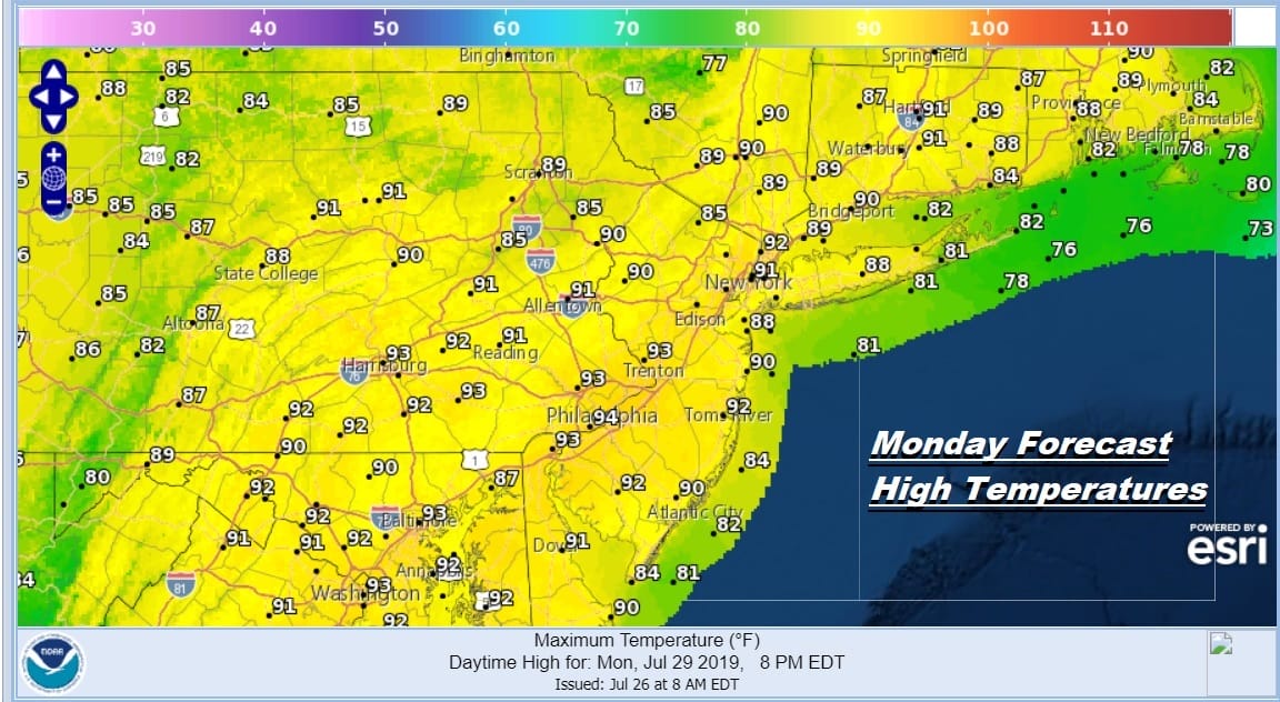
Monday looks to be the hottest day of this stretch of weather as a weak front goes by to our north across New England Sunday night which will turn the winds more to the west on Monday. This will put us in a range of 90 to 95 for afternoon highs. It will a hot humid day with sunshine and little chance for a shower or a thunderstorm.
Tuesday will be a hot humid day with highs reaching the upper 80s to lower 90s. It appears Monday will be the hottest day as winds will become more southwest on Tuesday. Again other than a pop up shower or thunderstorm there are no rain risks until Wednesday. this is when the next cold front is due to arrive.

The jet stream across Southern Canada continues to remain busy this summer as it flexes north and south on a regular basis. This is another cold front that will push well into the Middle Atlantic States. Ahead of it Wednesday we could see showers and thunderstorms with highs in the 80s to near 90. The question whether the front gets hung up for an extra day is there for next Thursday before improvement sets in with sunshine and a shot of lower humidity. Such is our pattern which continues to mean heat (temperatures 90 or higher) will be limited to a few days before a cold front cuts it off. This is the last weekend of July. The summer is moving right along folks! August is next!
MANY THANKS TO TROPICAL TIDBITS FOR THE USE OF MAPS
Please note that with regards to any tropical storms or hurricanes, should a storm be threatening, please consult your local National Weather Service office or your local government officials about what action you should be taking to protect life and property.


