Weekend Starts Nice Rain Tonight into Sunday Morning Warmer Week Ahead

Weather in 5/Joe & Joe Weather Show Latest Podcast
Weekend Starts Nice Rain Tonight into Sunday Morning Warmer Week Ahead
The satellite picture is showing the Northeast and Northern Mid Atlantic states enjoying plenty of sunshine to start off the weekend. However it also shows clouds to the west and south and those clouds are moving northeastward. While the sun is out temperatures will make a run for 70 or better however those clouds will start to increase this afternoon and gradually shut the sun off. North and east of NYC highs will reach the lower 70s while south and west of Philadelphia most highs will be in the 60s thanks to the cloud cover. No rain is forecast during the daytime.
SATELLITE

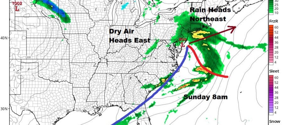
By this evening (8pm) rain will have reached Southernmost Pennsylvania and Southern New jersey and it will continue to advance northward reaching NYC around or a little before midnight and Southern and Southeastern New England during the early morning hours. Low pressure heads to the Virginia coast and then offshore Sunday morning.

Rain will end during Sunday morning from southwest to northeast and should be mostly done by early afternoon except for Southeastern New England. Temperatures Sunday will reach the low and mid 60s south and west of NYC with leftover clouds with mostly 50s to the east.
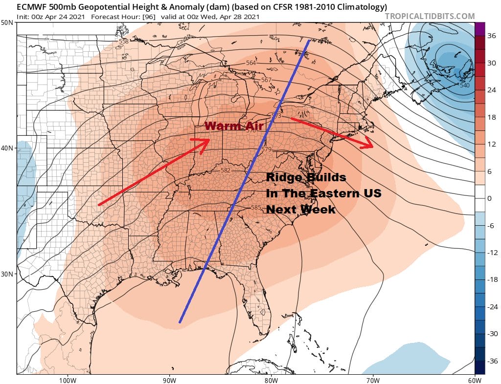
Next week we follow the flow and a nice ridge builds into the Eastern US. This means that our air will be coming from the Southern Plains and that means we warm up. Monday we will be under cool high pressure from the north but we will have a good deal of sunshine and highs in the 60s. Then the high moves off the coast and winds go westerly for Tuesday and Wednesday. This is important because a west wind this time of year can warm things up in a hurry and it also keeps the sea breeze from coming in and keeping things cooler. Tuesday we will see sunshine. Highs will be back into the 70s.
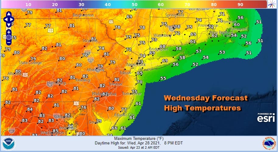
Wednesday is shaping up to be the warmest day of the week with sunshine and highs into the 80s in many locations. The exceptions will probably be the immediate coast of New Jersey and Eastern Long Island/Southern Connecticut where the sea breeze will eventually win out but is should be limited. Beyond Wednesday it gets a little complicated with a warm front forming virtually overhead and that may mean some cloud and shower issues for late week. I still think that we could squeeze out one more very warm day Thursday if the warm front sets up to the north rather than overhead. This will be the forecast dilemma for the week. Eventually a cold front could bring showers and thunderstorms here late Friday as we begin the next round of air mass changes.

BE SURE TO DOWNLOAD THE FREE METEOROLOGIST JOE CIOFFI WEATHER APP &
ANGRY BEN’S FREE WEATHER APP “THE ANGRY WEATHERMAN!
MANY THANKS TO TROPICAL TIDBITS FOR THE USE OF MAPS
Please note that with regards to any severe weather, tropical storms, or hurricanes, should a storm be threatening, please consult your local National Weather Service office or your local government officials about what action you should be taking to protect life and property.


