Long Island Rain Tonight Into Sunday Warmer Weather Next Week

Weather in 5/Joe & Joe Weather Show Latest Podcast
Long Island Rain Tonight Into Sunday Warmer Weather Next Week
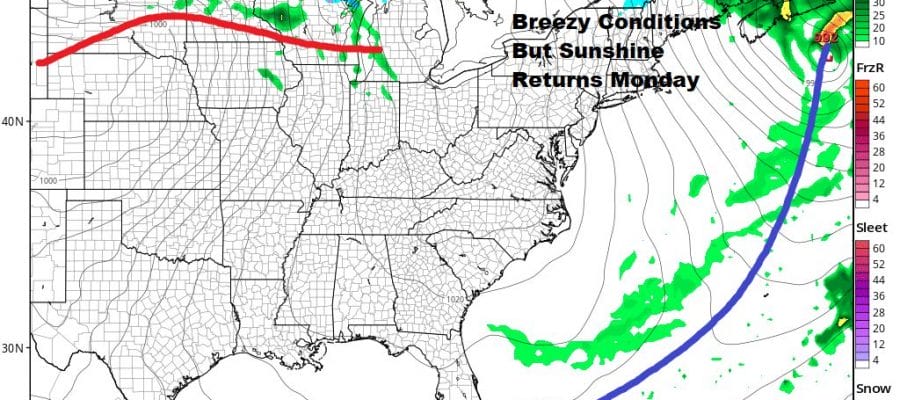
The better day of the weekend is now behind us and you hopefully enjoyed the sunshine. Now clouds are increasing and thickening up as the satellite picture shows. Low pressure is heading across the Tennessee Valley and heading for the Mid Atlantic coast Sunday morning. Rain will overspread Long Island tonight and continue through Sunday morning. Temperatures tonight will settle in the upper 40s and lower 50s.
SATELLITE

The low will be off the Delaware coast Sunday morning and it will continue to move to the east with nothing blocking it. Look for the back edge of the rain to move out around midday or early afternoon. That will only leave us with a few hours for weather conditions to improve. Look for lots of leftover clouds around in the afternoon with most highs just in the 50s.

Monday starts off breezy but we will have plenty of sunshine. Highs will be in the low to mid 60s. The wind should start to ease later in the day. That high will slide off the coast Monday night and Tuesday and that should begin a nice warm up.

Winds will turn west but there might be enough of a sea breeze to keep coastal temperatures cooler while inland Northern Nassau and Northwest Suffolk County should be able to reach 70 or better. Wednesday there will be more of west wind and that should confine the sea breeze to the coast and the East End. We should see plenty of sunshine for both Tuesday and Wednesday.

Whether the warm air hangs on for Thursday will depend on the high to the south and a warm front that will likely form overhead or just to the north Wednesday night and Thursday. If it forms to the north than we could see 70s to near 80 again on Thursday with some sunshine. The next cold front and the next chance for any showers or thunderstorms will likely come later on Friday.
BE SURE TO DOWNLOAD THE FREE METEOROLOGIST JOE CIOFFI WEATHER APP &
ANGRY BEN’S FREE WEATHER APP “THE ANGRY WEATHERMAN!

MANY THANKS TO TROPICAL TIDBITS & F5 WEATHER FOR THE USE OF MAPS
Please note that with regards to any severe weather, tropical storms, or hurricanes, should a storm be threatening, please consult your local National Weather Service office or your local government officials about what action you should be taking to protect life and property.