Weekend Outlook Warm Rain Next Week
SHOP THE JOESTRADAMUS STORE
Weekend Outlook Warm Rain Next Week
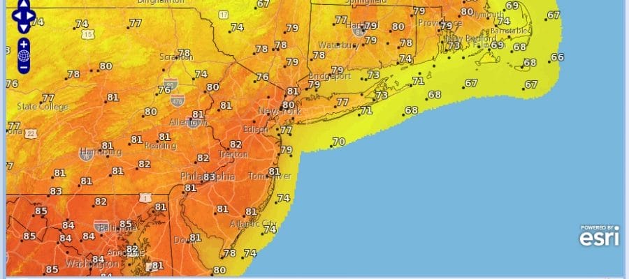
We are at Thursday and this is going to be the warmest day of the current stretch. A cold front is moving through this morning but there is very little with it other than a few clouds. There are also some clouds to the west in the Ohio Valley that will come streaming through today. That will limit some of the sun but temperatures this afternoon will still get into the 80s in most locations. Even along coastal areas the sea breeze will be limited in its scope.
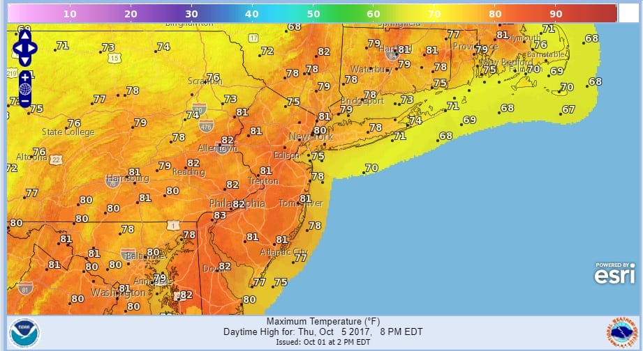
THURSDAY’S FORECAST HIGH TEMPERATURES
There are a few showers on the radar showing up in parts of Northern Pennsylvania. More than likely those showers will weaken as they move eastward. A stray isolated shower north and west of the coast can’t be ruled out.
SATELLITE LOOP

REGIONAL RADAR

Over the next several days the weather won’t be too bad. This weak front stalls out to the south and then backs up northward on Friday & Friday night. Other than a passing brief shower we will see clouds and some sun Friday with highs in the low to middle 70s. That trend continues for both Saturday and Sunday with clouds and some sunshine both days with highs in the upper 70s to lower 80s on Saturday and mid to upper 70s on Sunday.
WEEKEND OUTLOOK HURRICANE TRACKING MODELS
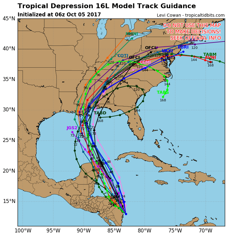
Tropical Storm Nate continues moving northward from the Southwest Caribbean. Weather models overnight have shifted to the west with the forecast track more toward the Central Gulf Coast. This is going to change the situation regarding the remnant rains from Nate since whatever is left will be going west of the Appalachians which is where the heavier rain will be if this verifies. We will look closely at Tropcial Storm Nate later today.
 GET JOE A CIGAR IF YOU LIKE

FiOS1 News Weather Forecast For Long Island
FiOS1 News Weather Forecast For New Jersey
FiOS1 News Weather Forecast For Hudson Valley


