Weekend Forecast Looks Good Rain Free Until Next Wednesday
Weekend Forecast Looks Good Rain Free Until Next Wednesday
It was bound to happen eventually and it could not be better timed to start a nice stretch of weather taking us through the weekend. In fact we should manage to keep things nice right through Tuesday though temperatures will be on the cool side of normal. Temperatures at least will be gravitating toward average for this time of year at least and combined with a strong April sun, it should feel good to be outside right through and the wind should behave itself as well.
US SATELLITE

The latest satellite picture shows virtually cloud free conditions across much of the Eastern US except for upstate NY and Northern New England as they still deal with some leftover cloud issues. To the west the next storm system is moving into the Rockies and heading only very slowly eastward so it will be no factor here until perhaps on Tuesday when some high clouds will begin to arrive.
REGIONAL RADAR

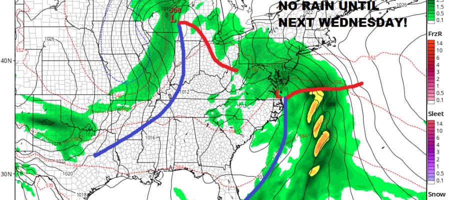
Daytime highs Saturday should reach 60 plus or minus a couple of degrees. Monday and Tuesday 60 to 65 is doable both days with perhaps only immediate coastal areas vulnerable to a sea breeze. The southern storm system creeps along and then makes a turn up the coast bringing rain here by Wednesday.
GFS MODEL WEDNESDAY APRIL 25, 2018
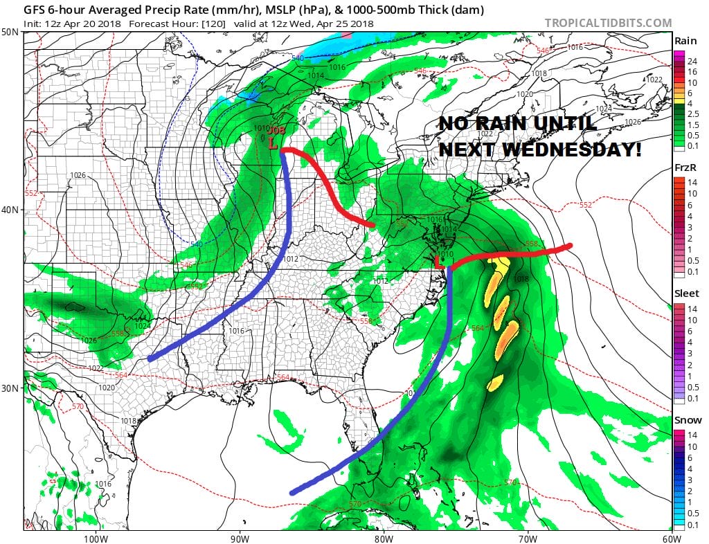
Since everything is moving slowly this system is likely to hang around for a day or two once it gets here. At this point who cares since we have the next 4 days to enjoy the sun!
 GET JOE A CIGAR IF YOU LIKE

FiOS1 News Weather Forecast For Long Island
FiOS1 News Weather Forecast For New Jersey
FiOS1 News Weather Forecast For Hudson Valley


