We
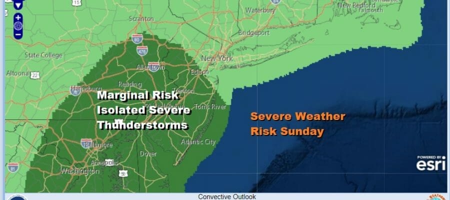
Weekend Changeable Skies Showers Thunderstorms Severe Weather Risk Sunday

Weekend Changeable Skies Showers Thunderstorms Severe Weather Risk Sunday
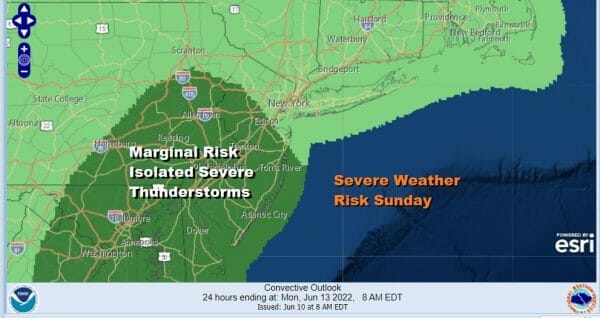
Earlier this week it seemed like the weekend was going to be in a bit of jeopardy but the weather situation has evolved differently. A storm system offshore is turning out to be be nothing more than a weak front for Saturday which probably means changeable skies to partly sunny at times with a slight chance for a shower or thunderstorm. Sunday now looks like a larger risk for thunderstorms in the afternoon and evening and the Storm Prediction Center has a marginal risk indicated for now for most of New Jersey and Eastern Pennsylvania south into Maryland Delaware & Virginia with general thunderstorms elsewhere. Meanwhile we have a nice finish to the weather this Friday as we have sunshine and not much cloud cover to speak of. Highs this afternoon will be in the upper 70s to lower 80s with reasonable humidity.
SATELLITE

WEATHER RADAR

Saturday night a weak warm front develops to our south and heads northward and that could bring in a few showers or a thunderstorm in the early morning hours to around daybreak. The warm from should continue but that sets up a cold front and upper trough to approach Sunday afternoon with showers and thunderstorms and the possibility of an isolated severe thunderstorm
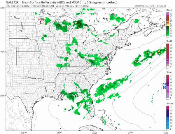
I think there is the possibility we could see the severe weather risk expanded a bit to the north and to the south depending on how much daytime heating we get and how far north that warm front gets. Highs Sunday will be in the mid 70s to near 80. If the morning showers do not materialize, there is a higher chance for severe weather later in the day.
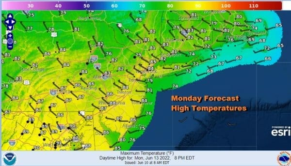
The low moves offshore Monday morning and there could be some leftover showers early from NYC eastward but we should go to some sunshine. We may warm up nicely Monday with highs reaching the low and middle 80s. High pressure starts to build southward from Eastern Canada and that will be a player for the first half of next week.

Enough of that high builds in where we should be some sunshine but there will be a south wind Tuesday and thay will hold temperatures back a bit but as each day passes the ocean warms up little by little and the influence on temperatures weakens, Most highs Tuesday will be in the mid to upper 70s coast and mostly between 80 and 85 degrees inland. The high should hold on Wednesday as it drops southward and that will keep showers away for one more day. Highs Wednesday will be in the upper 70s to mid 80s with some sun. Then as the next front nears Thursday we will throw in the chance for some showers and thunderstorms. Perhaps we will have a higher chance for thunderstorms next Friday with a cold front and then a dry nice air mass builds in for next weekend.
BE SURE TO DOWNLOAD THE FREE METEOROLOGIST JOE CIOFFI WEATHER APP &
ANGRY BEN’S FREE WEATHER APP “THE ANGRY WEATHERMAN!
MANY THANKS TO TROPICAL TIDBITS & F5 WEATHER FOR THE USE OF MAPS
Please note that with regards to any severe weather, tropical storms, or hurricanes, should a storm be threatening, please consult your local National Weather Service office or your local government officials about what action you should be taking to protect life and property.


