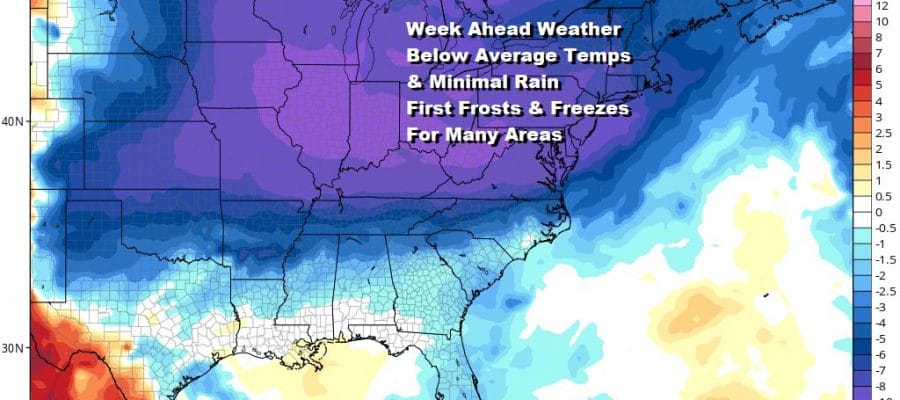
Week Ahead Stair Step Decline In Temperatures Mostly Dry All Week Long

Weather in 5/Joe & Joe Weather Show Latest Podcast
Week Ahead Stair Step Decline In Temperatures Mostly Dry All Week Long
The upper trough that has been sitting over us for the last 3 is finally making its exit. A new air mass arrives on Monday but as we move through the week, we will see a stairstep decline in temperatures. The last of the clouds are now beginning to move to the east and overnight skies should clear out nicely. Overnight lows wlll be in the 40s to around 50. There are a few leftover light scattered sprinkles on the radar but they should disappear shortly.
SATELLITE

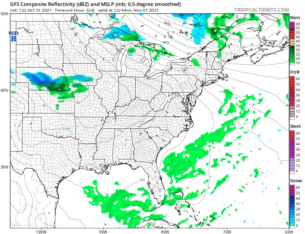
WEATHER RADAR

Monday will be a nice day overall. We should see sunshine for much of the day. Temperatures will be at seasonal levels with highs mostly in the mid 50s to around or just over 60 degrees. Radars will be nice and quiet with no precipitation issues.

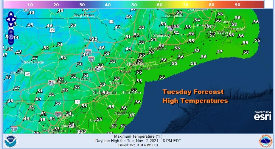
A cold front will approach for Tuesday thanks to a northwest flow from Canada. Some clouds will arrive during Monday night and Tuesday will be a mostly cloudy type day. There might be a couple of scattered showers. It appears that if they happen, it would be in the afternoon. Tuesday highs will be taking that step down with highs in the low to middle 50s.
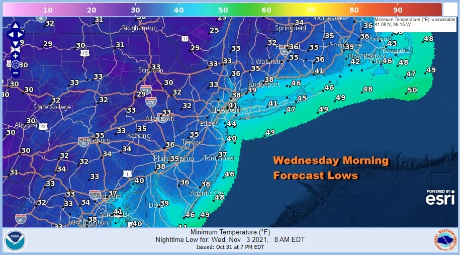
The front goes by and then a re-enforcement of colder air comes in Tuesday night. Wednesday morning lows will be in the 30s with some areas inland close the freezing mark. Coastal areas and warmer urban locations will be closer to 40. Some inland areas could see a light freeze or some patchy frost.
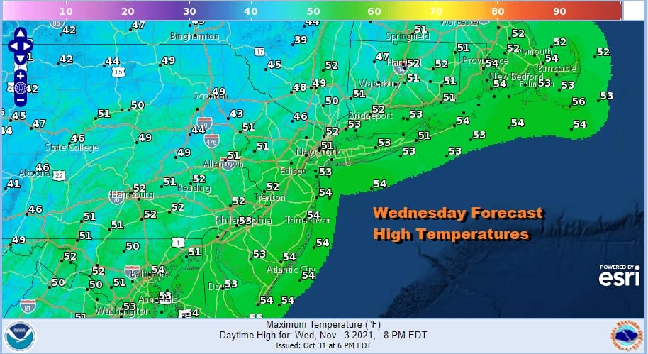
Wednesday will be a sunny but chilly day with highs just in the upper 40s and lower 50s. No precipitation is forecast as high pressure very slowly builds in.
Another colder push of air comes in Wednesday night and that sets up for a cold Thursday morning. Lows will probably be in the mid to upper 20s in colder spots well inland and 30s to around 40 elsewhere. There probably will be more areas experiencing a light frost or even a light freeze by sun up Thursday. Dayside Thursday should be sunny but quite chilly with highs just in the 40s and perhaps only the warmest spots will reach 50. That is about 10 degrees below the seasonal average.
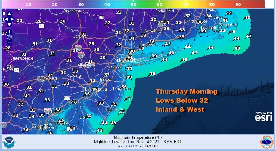
Of course this sets up for another cold night for Thursday night into Friday morning. Depending on the wind this could be a night where a widespread frost occurs away from warmer urban locations. Most lows will be in the 20s to near 30 inland and 30s to near 40 in those warm spots and along the coast.

Friday we should see a small bounce higher in temperatures with sunshine. Highs Friday should reach back up into the 50s in most places. As far as precipitation goes the northwest flow from Canada will dominate the weather scene all week. This will suppress any lows developing to the south from moving up the coast. They should pass well south and east of us. One wave goes by Thursday and the other Saturday.
This may actually mean that next weekend will be a nice dry weekend for a change with sunshine Saturday and Sunday as well with highs in the 50s over the weekend. Nights will still be cold away from warmer urban locations. No major storms are in the cards this week and we may not see any widespread rain until next Monday!
BE SURE TO DOWNLOAD THE FREE METEOROLOGIST JOE CIOFFI WEATHER APP &
ANGRY BEN’S FREE WEATHER APP “THE ANGRY WEATHERMAN!

MANY THANKS TO TROPICAL TIDBITS & F5 WEATHER FOR THE USE OF MAPS
Please note that with regards to any severe weather, tropical storms, or hurricanes, should a storm be threatening, please consult your local National Weather Service office or your local government officials about what action you should be taking to protect life and property.


