Week Ahead Quiet September Weather Humberto Heads East Toward Bermuda
We have a great week of weather ahead of us but we have to get through today where a weak cold front will be approaching. We see clouds on the satellite picture this morning covering parts of Southern New England back into Pennsylvania and Southern NY state. This front is relatively weak and there really isn’t much for this system to work with. We will see clouds and the risk for some passing showers. Most of the area won’t see much. Clouds will be holding temperatures down today with highs in the upper 70s to some lower or even middle 80s from South Jersey to Southeastern Pennsylvania southward where there is far less cloud cover and more sunshine.
SATELLITE

REGIONAL RADAR

We aren’t seeing too much on the regional or on the local radars. Some scattered showers are showing up to the north and west of the coast and moving southeastward. We don’t expect any thunderstorms in the mix today. This is a rather simple cold front moving through and no severe weather is forecast.
LOCAL RADAR NEW YORK CITY

LOCAL RADAR PHILADELPHIA


Once the front passes high pressure builds to the north in Southeastern Canada & New England. We should see sunshine on Tuesday with highs in the low to mid 70s. Wednesday we will the high press southward. An upper air disturbance passing to the east brings cool air southward.
Wednesday and Thursday we will have sunshine but temperatures will be quite cool with highs just in the 60s and nighttime lows in the 50s with 40s in many cooler inland locations. Friday the high settles further south. We will see sunshine with highs back into the 70s. The weekend the high will be to the south of us. Sunshine continues for the last weekend of summer with highs in the 70s.
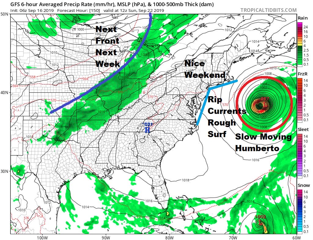
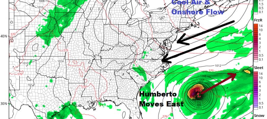
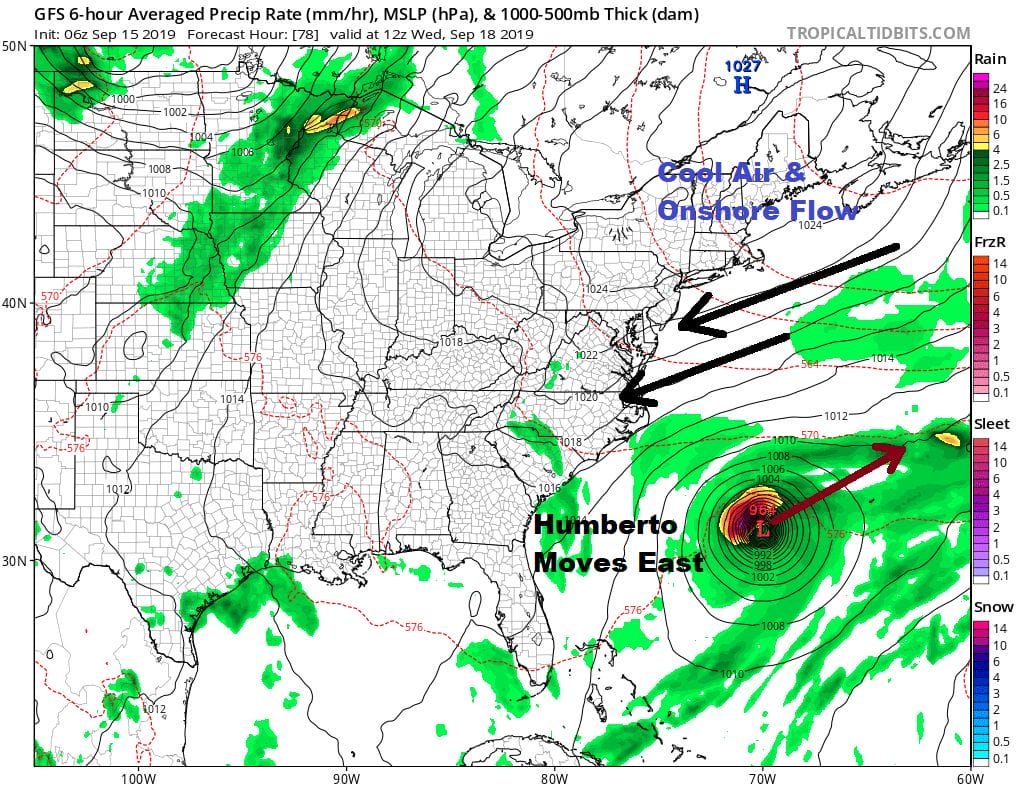
With regards to Hurricane Humberto the official National Hurricane Center forecast is for a track to the east or east northeast with a relatively close pass to Bermuda sometime Wednesday night or early Thursday. Beyond that there is a little uncertainty as Humberto may not get picked up by the deep trough that is off the coast of Southeastern Canada into the Northwest Atlantic.

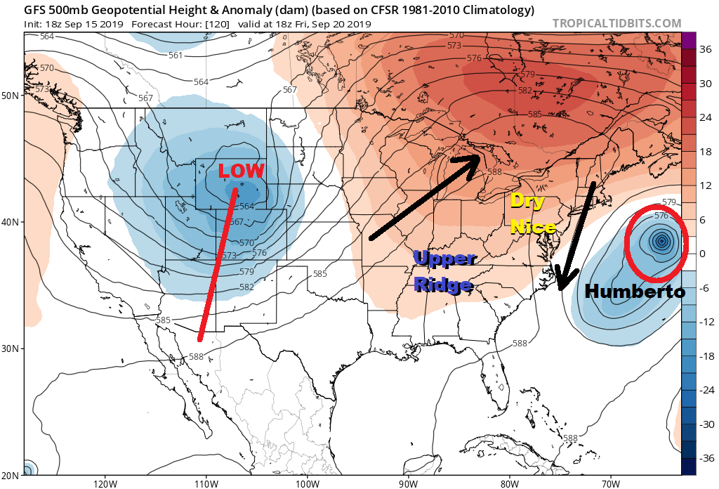
If that is the case then we could see issues at the shore with regards to rip currents and rough seas as well as some coastal flood issues late this week and this coming weekend. There is uncertainty regarding this though ultimately Humberto does get ejected northeast and out to sea. The trough in the west will be swinging eastward as the upper air pattern begins to shift in the long range. We will be looking closely at the long range pattern and the impact on Humberto later today.
MANY THANKS TO TROPICAL TIDBITS FOR THE USE OF MAPS
Please note that with regards to any tropical storms or hurricanes, should a storm be threatening, please consult your local National Weather Service office or your local government officials about what action you should be taking to protect life and property.


