Humberto Strengthening Bermuda Bound Tropical Atlantic System Better Organized
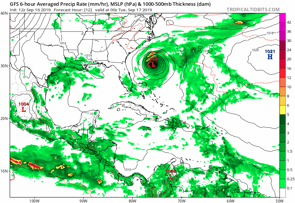
High clouds from Hurricane Humberto are touch the Carolina coastline this afternoon. Humberto continues to get better organized with a well defined eye showing up on the satellite picture this afternoon. The center of the hurricane is well offshore and it is likely to strengthen further over the next 48 hours or so. Humberto could reach major hurricane status during this time frame. It is moving east northeast at 7 mph and it will continue in that direction for the next 2 days.
SATELLITE

Humberto is about 700 miles west of Bermuda. No watches are posted for the island at the moment but it is likely that watches may go up for Bermuda either tonight or Tuesday morning. Based on latest forecasts Humberto will pass close to Bermuda but a bend more to the northeast will bring the center north of the island by a fair distance. It is close though and any subtle change in the track or a delay in a more northeast course could make for an even closer pass Wednesday night and early Thursday.
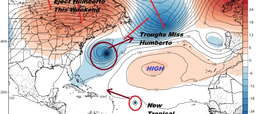
Two upper air troughs are going to impact the track of Humberto. The first one is off the coast southeast of Newfoundland into Wednesday. It appears that this trough will not be able to pick up Humberto though it is the trough that for now is pulling it out to the east northeast toward Bermuda.
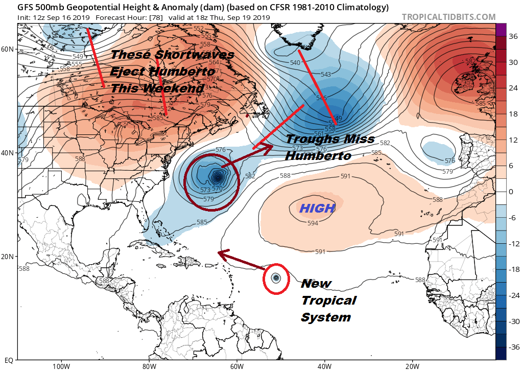
Humberto will wait for two upstream troughs in Northern Canada that will move east and take Humberto northeast and out to sea. In the meantime Humberto could linger off our coastline by about 400 miles or so. This will create rough ocean seas as well as rip currents and higher than normal tides in the Middle Atlantic and coastal Southern & Southeastern New England. This will create some coastal flooding issues late this week though fortunately the moon phase moves into a favorable part of the cycle reducing tidal flooding impact.
ATLANTIC BASIN SATELLITE

About half way out in the Tropical Atlantic we have low pressure that has developed in a tropical wave 1200 miles east of the Leeward Islands This will likely develop into a tropical depression or a tropical storm over the next several days as it moves west northwestward. The wave will be underneath an upper high driving it westward however a large weakness in that ridge will exist left behind by Humberto. Odds right now favor this system to eventually recurve in the Atlantic.
MANY THANKS TO TROPICAL TIDBITS FOR THE USE OF MAPS
Please note that with regards to any tropical storms or hurricanes, should a storm be threatening, please consult your local National Weather Service office or your local government officials about what action you should be taking to protect life and property.