Week Ahead Mostly Dry Trending Warmer No Major Precipitation Events

Week Ahead Mostly Dry Trending Warmer No Major Precipitation Events

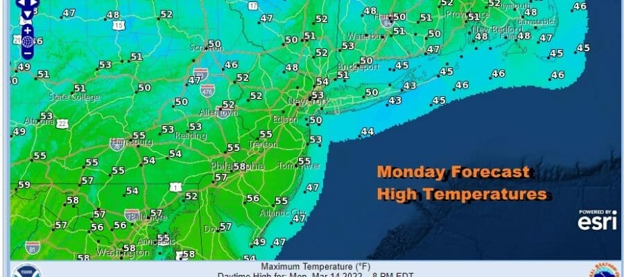
A new week begins with a warm up today. The core of the cold air is now offshore and our satellite shows mainly clear skies so we should see temperatures bounce up nicely today. Highs will reach the 50s in most places thanks to sunshine and west wind. The radars are nice and quiet other than snow showers in Northern New England. This week will be a quiet one with weak weather systems and an uneven fluctuation in temperatures but on the whole it is on an uptrend.
SATELLITE

WEATHER RADAR

We will be in a ridge position along the east coast for this week some some embedded weak systems moving along in the flow. The first such weak system will pass to our north on Tuesday with some rain and snow showers well to the north. We should be no worse than partly sunny from Eastern Pennsylvania with highs reaching into the 60s with the exception of south facing shorelines. They will deal with afternoon sea breezes that are common this time of year.

Wednesday should be a nice day of sunshine though we will have a wind off the ocean. It is not a strong flow but it is enough to keep temperatures from moving higher. Highs will be in the 60s inland and mostly 50s along the coast with 40s right at the shore. A weak low will be moving across the Gulf States and then it turns northward. It will only get so far north before it turns east. We may get clipped with some rain Thursday. It will definitely be a cloudy day with highs in the mid 50s to lower 60s.
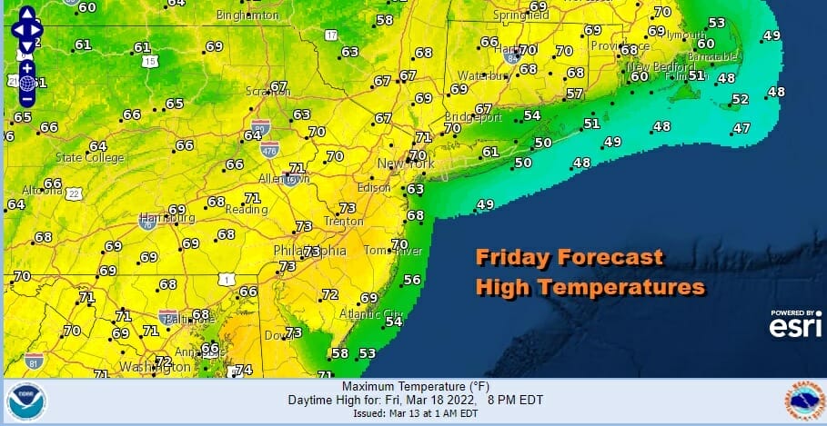
Once the low exits it leaves us in a developing southwest flow on Friday so that will lead to the warmest day of this week with some sunshine. Highs will likely reach the upper 60s to lower 70s. Again it will be cooler along south and east facing shorelines when local sea breezes develop though these areas should reach into the 60s before that happens. A cold front brings the chance for some showers Friday night into Saturday though the timing and extend of showers remains questionable at this point.
BE SURE TO DOWNLOAD THE FREE METEOROLOGIST JOE CIOFFI WEATHER APP &
ANGRY BEN’S FREE WEATHER APP “THE ANGRY WEATHERMAN!
MANY THANKS TO TROPICAL TIDBITS & F5 WEATHER FOR THE USE OF MAPS
Please note that with regards to any severe weather, tropical storms, or hurricanes, should a storm be threatening, please consult your local National Weather Service office or your local government officials about what action you should be taking to protect life and property.


