Week Ahead Mostly Dry Cooler Wednesday Through Friday,
Hurricane Sam To Pass Well To The East

Weather in 5/Joe & Joe Weather Show Latest Podcast
Week Ahead Mostly Dry Cooler Wednesday Through Friday,
Hurricane Sam To Pass Well To The East
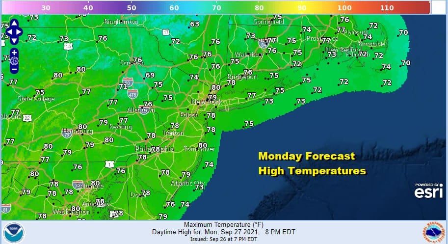
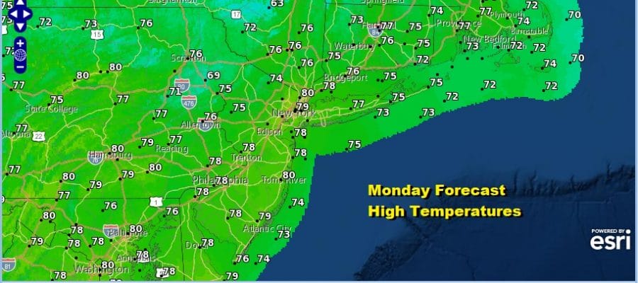
The new week begins with a transition to warmer air. Some showers are going by in Upstate NY and into Western New England but they will be weakening. Other than some clouds over parts of the area this morning most of the day should be fine with no worse than partly sunny skies. Highs this afternoon will be in the 70s to around 80 degrees.
SATELLITE


An east west cold front in Southeastern Canada will move southward tonight and pass through the area early Tuesday afternoon. It won’t push through areas from Southern New Jersey southward until late in the day. That means temperatures where the front passes by early afternoon will trop out in the low to mid 70s and areas to the south will see highs in the 70s to near 80.
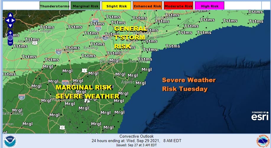
There will be a few showers or a scattered thunderstorm or two with the front and the Storm Prediction Center has a marginal risk for severe weather from Southern New Jersey and Southernmost Pennsylvania southward. Then once the front passes it keeps on going so there is no danger of stalling. This leads to rather cool conditions for the second half of the week.
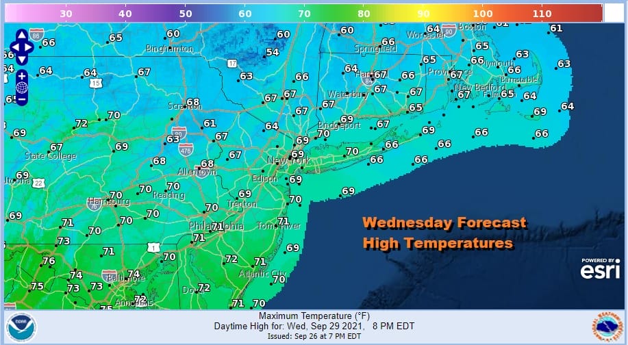
The northerly flow aloft in the Eastern US is due to the upper trough is going to be just off the East Coast. That not only keeps us dry and cool, it also allows Hurricane Sam (which appears on the lower right late Thursday), to move northward just east of Bermuda and pass well to the east of the US East Coast. It does appear that Sam could slingshot northward into Newfoundland over the weekend. For us Wednesday we will see sunshine and clouds. The unstable cold air aloft could lead to an isolated brief shower inland. Highs will be just in the 60s to near 70.
Cool dry conditions continue Thursday and Friday with partly to mostly sunny skies both days with highs in the 60s. Nights will be quite cool with most lows in the 40s to lower 50s. We will hold on to dry weather for Saturday when the flow becomes more onshore but that could lead to clouds on Sunday. Whether rain or showers are an issue Sunday remain to be seen.
BE SURE TO DOWNLOAD THE FREE METEOROLOGIST JOE CIOFFI WEATHER APP &
ANGRY BEN’S FREE WEATHER APP “THE ANGRY WEATHERMAN!

MANY THANKS TO TROPICAL TIDBITS & F5 WEATHER FOR THE USE OF MAPS
Please note that with regards to any severe weather, tropical storms, or hurricanes, should a storm be threatening, please consult your local National Weather Service office or your local government officials about what action you should be taking to protect life and property.


