Week Ahead Colder Windy Dry No Major Storms Ahead

Weather in 5/Joe & Joe Weather Show Latest Podcast
Week Ahead Colder Windy Dry No Major Storms Ahead
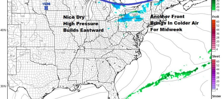
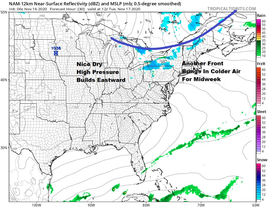
Last night’s severe weather outbreak across the area was about as widespread a severe weather outbreak that I have ever seen in November would rival some outbreaks in the summer months. Often after big events the weather takes a bit of a breather and in fact we have a relatively quiet week ahead. No major storms are on the horizon not just for the work week but for the upcoming weekend. Meanwhile we are seeing sunshine today but there are clouds to the northwest and we might see a few clouds pop into the mix today. Also the wind will be on the busy side gusting to 20 to 30 mph at times but below advisory criteria. Radar is showing some lake effect snow showers in upstate NY and that will continue right through Tuesday. Temperatures today will top out in the upper 40s and lower 50s.
SATELLITE

REGIONAL RADAR

Tonight should be mainly clear with lows mostly in the 30s. We have another cold front and upper trough moving through Tuesday and that brings in colder air for midweek. Look for sun and clouds on Tuesday with probably more clouds in the afternoon. There might be a rain or snow shower when the front goes by. Highs will be in the 40s. It will still be on the breezy to windy side with gusts of 20 to 30 mph at times.
Tuesday night will be a cold night under clearing skies. Lows Wednesday will be in the 20s to near 30. Wednesday looks nice and sunny and the wind should start to ease some. Highs will be in the low to mid 40s. Another cold night follows Wednesday night into Thursday morning with lows in the 20s to lower 30s. Thursday looks nice and sunny with highs in the 40s to near 50.

The next high moves out off the southeast coast and that sets up a west wind and a warm up through next weekend. We are looking at sunshine for the weekend and it will at least get back into the 60s and possibly nearing 70 or low 70s on Sunday. The next cold front arrives next Monday with some showers.
BE SURE TO DOWNLOAD THE FREE METEOROLOGIST JOE CIOFFI WEATHER APP &
ANGRY BEN’S FREE WEATHER APP “THE ANGRY WEATHERMAN!
MANY THANKS TO TROPICAL TIDBITS FOR THE USE OF MAPS
Please note that with regards to any severe weather, tropical storms, or hurricanes, should a storm be threatening, please consult your local National Weather Service office or your local government officials about what action you should be taking to protect life and property.


