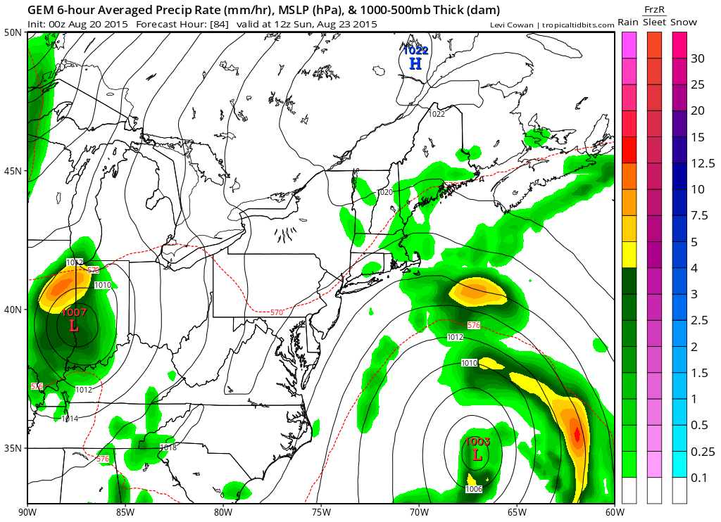
There is really no change in the outlook today as anywhere in the region there could be downpours and thunderstorms that can produce locally heavy rains and flooding while the rest of the area gets little or nothing. The good news however is that everyone from Eastern Pennsylvania to Southern New England and everyone in between including the Long Island Sahara desert is going to get some rain and in many areas desperately needed rain beginning overnight in western areas and during the day Friday in Eastern areas (east of NYC).
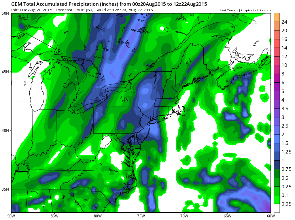
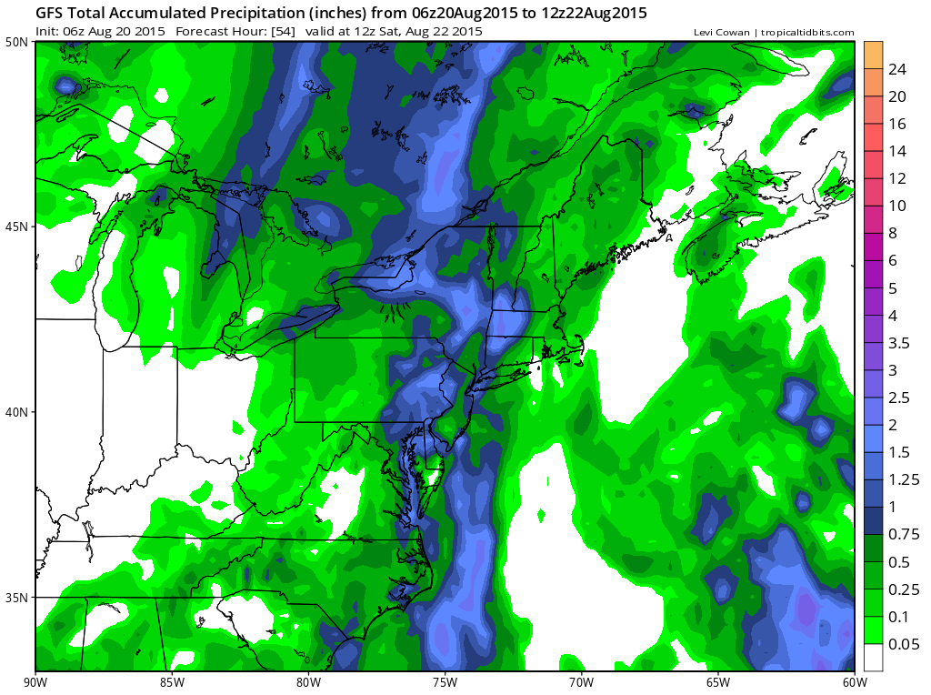
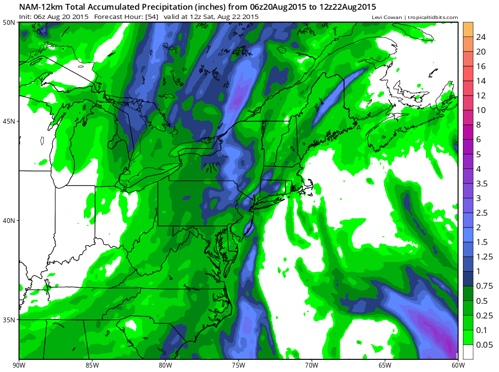
These are what the 3 models (Canadian, GFS, NAM) are producing. They all have decent rains for eastern and northeastern Pennsylvania and then it varies for the other areas. Bottom line is that it looks good for a widespread rainfall.
One more thing. There is a low that will be developing out in the ocean this weekend and the Canadian actually goes a little hog wild with it and implying that a sub tropical or tropical storm could develop. The National Hurricane Center is speaking of this and has raised the probability of this happening. I think in the end it will be of interest to boaters as it could really rough up waters around here. I will take a look at this more in depth later today