
...DANNY STRENGTHENS INTO THE FIRST HURRICANE OF THE 2015 ATLANTIC
HURRICANE SEASON...


SUMMARY OF 1100 AM AST...1500 UTC...INFORMATION
-----------------------------------------------
LOCATION...12.5N 44.8W
ABOUT 1090 MI...1755 KM E OF THE WINDWARD ISLANDS
MAXIMUM SUSTAINED WINDS...75 MPH...120 KM/H
PRESENT MOVEMENT...WNW OR 295 DEGREES AT 12 MPH...19 KM/H
MINIMUM CENTRAL PRESSURE...992 MB...29.30 INCHES
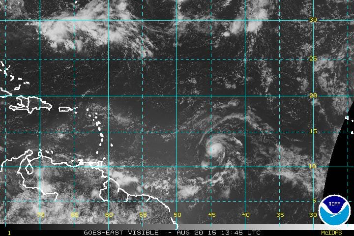
Danny becomes the first hurricane of the Atlantic season. It began getting better organized overnight and the trend continues this morning. It appears that thunderstorms have clustered around the center. Danny is still sitting in a low shear environment so the strengthening could continue for awhile.
The track continues to the west at a slow but steady 12 mph. It is still no immediate threat to any land area at this time and it is still a few days away from the islands based on its current speed of movement.
The longer term issues remain with dry air, shearing to the west, etc etc so we will have to see whether new model runs relax the shearing environment that exists west of 55W. If the shearing environment migrates westward that could allow for a more favorable set up but that of course is a big if.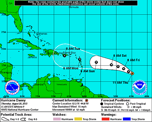
The forecast track maintains hurricane status over the northern Leeward Island and takes it south of Puerto Rico as a tropical storm.
The other are that needs to be watched is an upper low off the east coast. Right now it remains a cold core low however it has been sitting there for days and will be sitting there for a few more. More pressure is forming at the surface and since it is sitting over 80 degree plus water tropical storm development here is possible. The satellite shows the circulation aloft and you can almost pick out a surface circulation as well that is trying to form. The Canadian model is very bullish with this system and has a well formed low that it takes northwest. If this happens it could be an issue for ocean conditions over the weekend.
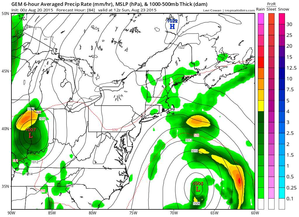 Tropical storm formation from cold upper lows are a long slow process as they make the transition from cold to warm core. The National Hurricane Center has increased the probability of tropical cyclone formation to 60 percent.