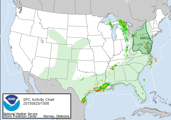
 The storm prediction center has Southwest and westernmost New Jersey and all of Eastern Pennsylvania in the area of marginal risk for severe weather beginning later today and continuing into Friday morning. The next weather front is approaching and that front will slow down as it moves east so I don’t think its a big issue until later today when pop up storms are likely to develop. Then the line moves into Eastern Pennsylvania this evening and for tonight and into New Jersey overnight, to about NYC for the morning rush and then east across Long Island and Connecticut as the morning wears on. 1 to 2 inches of rain likely for everyone and there will be locally higher amounts for sure which could cause some flooding. Yesterdays’s storms over parts of Union County NJ produced 3 to 6 inches of rain in a big hurry and lots of street flooding there. So that risk exists. At least this front will give everyone a widespread rainfall we really need to alleviate the dry conditions here.
