Weather Pattern Looks Active This Weekend

Weather Pattern Looks Active This Weekend
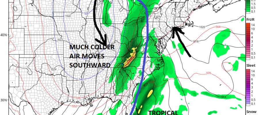
We are going to at this point jump ahead to the weekend as we will have another weather system swinging eastward from the Midwest with a cold front and the possibility of low pressure developing to the south. There could be a tropical connection here as there will be lower than normal pressures in the Northwest Caribbean later this week and low pressure could develop there and move northward.
GFS WEATHER MODEL SATURDAY NIGHT
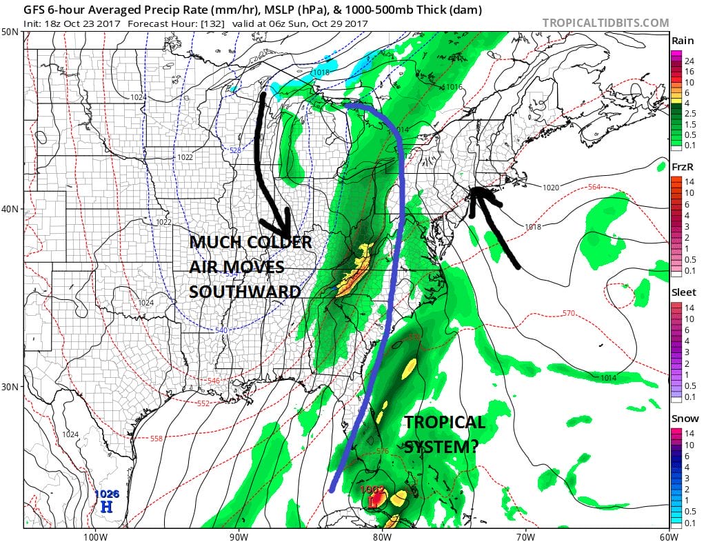
It is likely that any system that comes out of the Northwest Caribbean either will not have time to develop or even if it did, would likely get absorbed by all the energy piling on into the East Coast. The upper air shows another deep trough developing which will bring us more rain probably on Sunday. The southeast low level flow from the offshore high will feed in some moisture.
GFS UPPER AIR JET STREAM SUNDAY MORNING

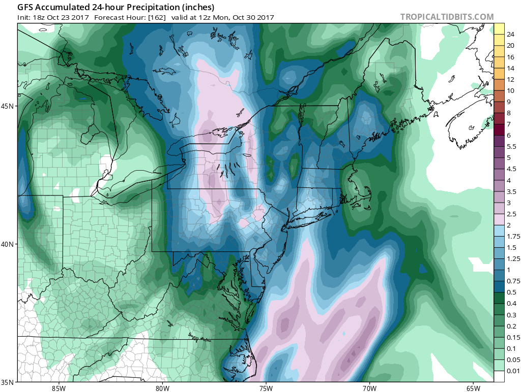
All this energy will probably cause low pressure to develop probably some where just inland of the Carolinas and then move northward. Should this play out according to plan another 1 to 2 inches of rain are possible.
GFS RAINFALL FORECAST ENDING MORNING MORNING
Behind this system we will see the coldest air of the fall season so far which isn’t exactly saying much since we haven’t seen any chilly air to speak of except for the odd day here in there in the last month. The pattern change to active and storm is now bringing down cooler air masses from Canada. It is likely that this will lead to the first taste of snow for some of the snow belts in elevation driven areas.
GFS SNOWFALL FORECAST THROUGH NEXT THURSDAY
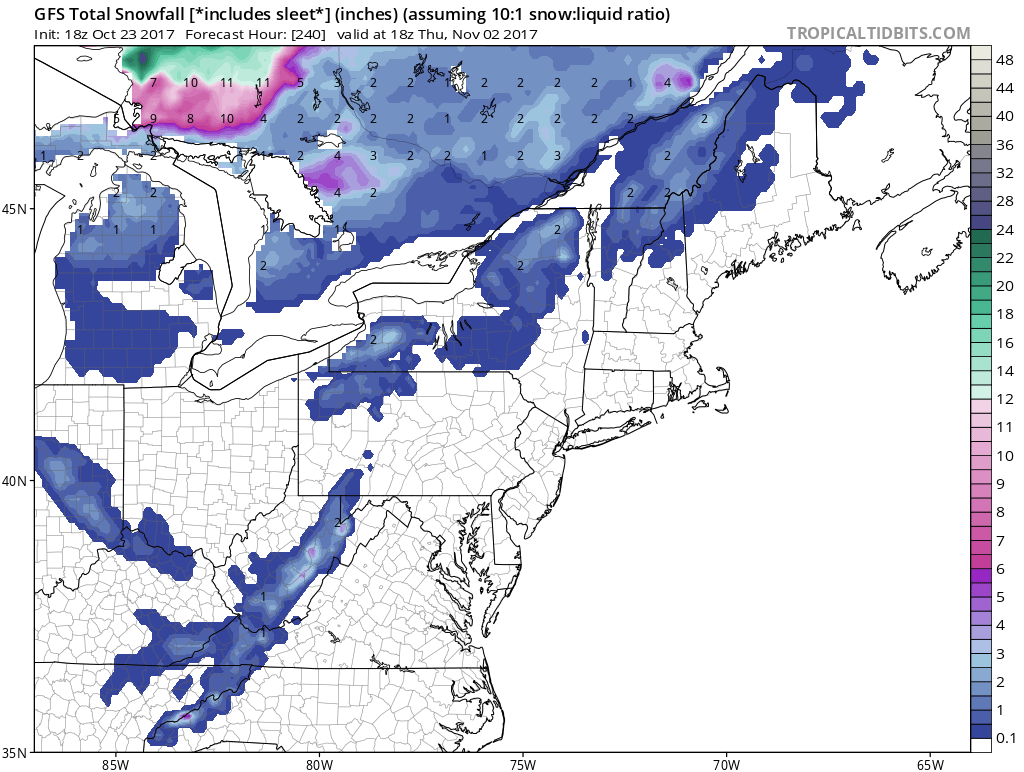
It isn’t much but it’s a start. It should be noted that the European model is showing a bit more rain with this next system than the GFS and a bit less on the backside snow.
MANY THANKS TO TROPICAL TIDBITS FOR THE WONDERFUL USE OF THE MAPS

GET JOE A CIGAR IF YOU LIKE!
FiOS1 News Weather Forecast For Long Island
FiOS1 News Weather Forecast For New Jersey
FiOS1 News Weather Forecast For Hudson Valley
NATIONAL WEATHER SERVICE SNOW FORECASTS
LATEST JOESTRADAMUS ON THE LONG RANGE
Weather App

Don’t be without Meteorologist Joe Cioffi’s weather app. It is really a meteorologist app because you get my forecasts and my analysis and not some automated computer generated forecast based on the GFS model. This is why your app forecast changes every 6 hours. It is model driven with no human input at all. It gives you an icon, a temperature and no insight whatsoever.
It is a complete weather app to suit your forecast needs. All the weather information you need is right on your phone. Android or I-phone, use it to keep track of all the latest weather information and forecasts. This weather app is also free of advertising so you don’t have to worry about security issues with your device. An accurate forecast and no worries that your device is being compromised.
Use it in conjunction with my website and my facebook and twitter and you have complete weather coverage of all the latest weather and the long range outlook. The website has been redone and upgraded. Its easy to use and everything is archived so you can see how well Joe does or doesn’t do when it comes to forecasts and outlooks.
Just click on the google play button or the apple store button on the sidebar for my app which is on My Weather Concierge. Download the app for free. Subscribe to my forecasts on an ad free environment for just 99 cents a month.
Get my forecasts in the palm of your hand for less than the cost of a cup of Joe!