Weather Pattern Change Next Week On Course

Weather Pattern Change Next Week On Course
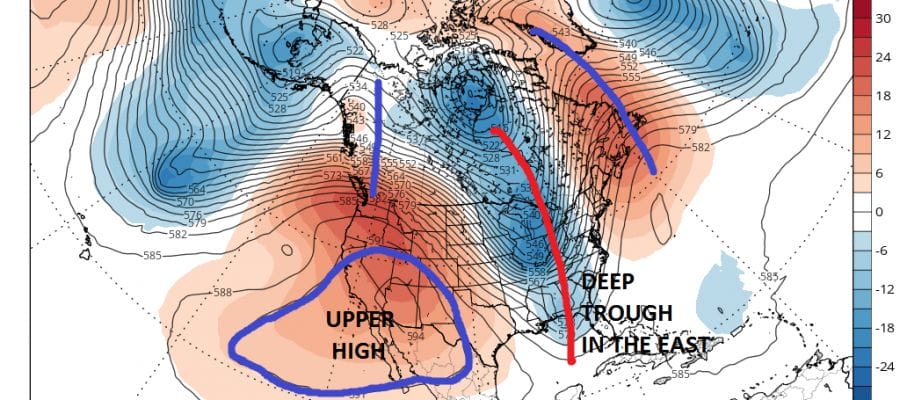
The last several runs of weather models all have next week’s pattern change on course and in full view. The ridge that builds in the Eastern US this week will break down early next week and we are going to be seeing wholesale changes in the upper air pattern from one coast to the other. Yesterday we highlighted the GFS model and today we look at the European model which shows the first of several systems coming into the East. The first will arrive a week from today as a cold front moves through and a wave develops on that front.
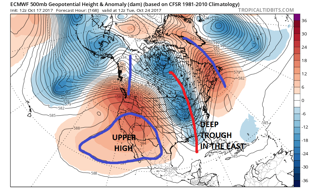
It has been a long time since we have seen an upper air set up like this with a lot of depth and amplitude. The West sees a radical change from weeks of a deep trough to a very strong ridge. Also a strong ridege develops out in the Atlantic along and east of 70 west. This allows the jet stream to plunge southward into the Great Lakes, Ohio Valley & the East Central Gulf States. This should bring at least a general rainfall next Tuesday with cooler air to follow. Three could be complications with wave development on the front as well.
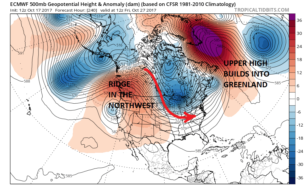
Another development is as we move out to the Day 10 time frame is the building of a very strong upper high into Greenland and some models are showing some high latitude blocking developing from all this. We are always skeptical of models showing this because experience has taught us that weather models have predicted 20 out of the last 2 blocking patterns in the last 2 years. Nonetheless the appearance here on the European model and other weather models leads us to believe it might be the case this time. This will at least keep things near or cooler than average for longer than a week or so as we head into November.
MANY THANKS TO TROPICAL TIDBITS FOR THE WONDERFUL USE OF THE MAPS

GET JOE A CIGAR IF YOU LIKE!
FiOS1 News Weather Forecast For Long Island
FiOS1 News Weather Forecast For New Jersey
FiOS1 News Weather Forecast For Hudson Valley
NATIONAL WEATHER SERVICE SNOW FORECASTS
LATEST JOESTRADAMUS ON THE LONG RANGE
Weather App

Don’t be without Meteorologist Joe Cioffi’s weather app. It is really a meteorologist app because you get my forecasts and my analysis and not some automated computer generated forecast based on the GFS model. This is why your app forecast changes every 6 hours. It is model driven with no human input at all. It gives you an icon, a temperature and no insight whatsoever.
It is a complete weather app to suit your forecast needs. All the weather information you need is right on your phone. Android or I-phone, use it to keep track of all the latest weather information and forecasts. This weather app is also free of advertising so you don’t have to worry about security issues with your device. An accurate forecast and no worries that your device is being compromised.
Use it in conjunction with my website and my facebook and twitter and you have complete weather coverage of all the latest weather and the long range outlook. The website has been redone and upgraded. Its easy to use and everything is archived so you can see how well Joe does or doesn’t do when it comes to forecasts and outlooks.
Just click on the google play button or the apple store button on the sidebar for my app which is on My Weather Concierge. Download the app for free. Subscribe to my forecasts on an ad free environment for just 99 cents a month.
Get my forecasts in the palm of your hand for less than the cost of a cup of Joe!