Weather Models On Snow For Early Next Week

Weather Models On Snow For Early Next Week
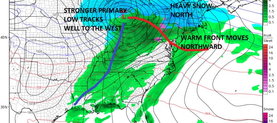
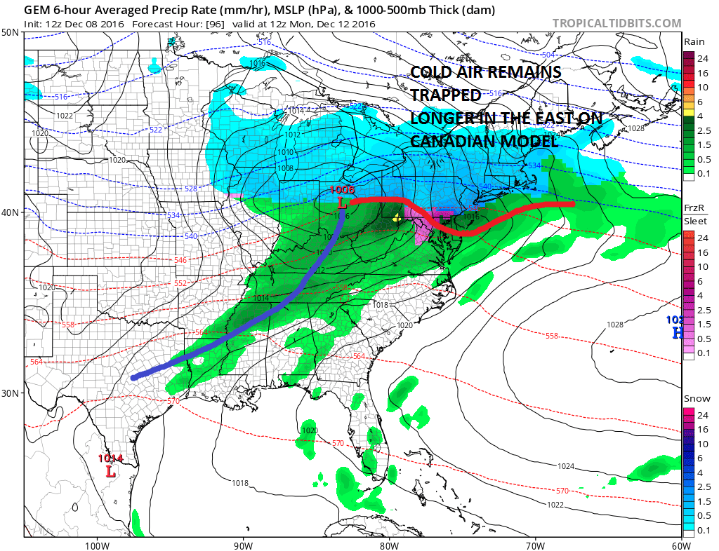
This remains a difficult call from the standpoint of which models have the right idea on what is going to happen Sunday night and Monday. The worst case scenario is a weak flat low that runs into the Ohio Valley and redevelops along the coast. The Canadian and European weather models depict this idea and are the most bullish for snow. This would keep cold air trapped longer even along coastal areas from New York City north and east.
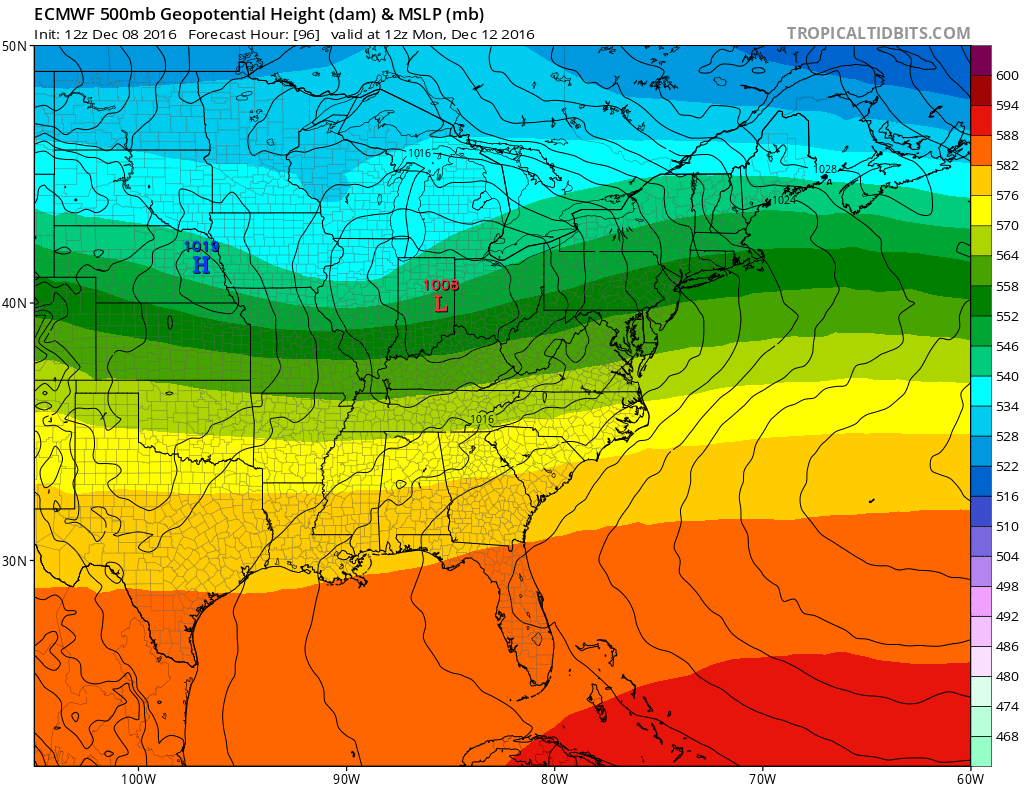
The European weather model and the Canadian are almost the same. The GFS weather model which was on the same page as the others has gone a different route today as it intensifies the primary low and takes it well to the west. This was much like the European run yesterday until that model flipped last night and matched the GFS!!!

So how does this translate to snow forecast amounts on the weather models? You can see the differences below between the GFS and Canadian weather models
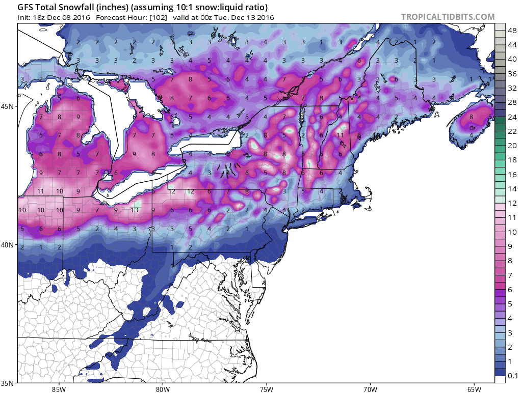

How this storm winds up tracking and how the primary low behaves will be the determining factor. Is the system going to be deeper as the GFS model now shows but didn’t show yesterday or last night, or are the European and Canadian model more correct with a weaker feature coming out from the west. In the meantime here is my early call in case you missed it. It actually matches up better with the late afternoon GFS model run then the more robust Canadian.
MANY THANKS TO TROPICAL TIDBITS FOR THE WONDERFUL USE OF THE MAPS
SNOW REMOVAL COMPANIES FOR YOUR WINTER NEEDS
LONG ISLAND ROCKLAND COUNTY Connecticut

![]()


JOHNSTOWN PA
COLOSIMO LAWNCARE

FiOS1 News Weather Forecast For Long Island
FiOS1 News Weather Forecast For New Jersey
FiOS1 News Weather Forecast For Hudson Valley
NATIONAL WEATHER SERVICE SNOW FORECASTS
LATEST JOESTRADAMUS ON THE LONG RANGE
Weather App

Don’t be without Meteorologist Joe Cioffi’s weather app. It is really a meteorologist app because you get my forecasts and my analysis and not some automated computer generated forecast based on the GFS model. This is why your app forecast changes every 6 hours. It is model driven with no human input at all. It gives you an icon, a temperature and no insight whatsoever.
It is a complete weather app to suit your forecast needs. All the weather information you need is right on your phone. Android or I-phone, use it to keep track of all the latest weather information and forecasts. This weather app is also free of advertising so you don’t have to worry about security issues with your device. An accurate forecast and no worries that your device is being compromised.
Use it in conjunction with my website and my facebook and twitter and you have complete weather coverage of all the latest weather and the long range outlook. The website has been redone and upgraded. Its easy to use and everything is archived so you can see how well Joe does or doesn’t do when it comes to forecasts and outlooks.
Just click on the google play button or the apple store button on the sidebar for my app which is on My Weather Concierge. Download the app for free. Subscribe to my forecasts on an ad free environment for just 99 cents a month.
Get my forecasts in the palm of your hand for less than the cost of a cup of Joe!
![]()
