Weather Models Continue Christmas Insanity

Weather Models Continue Christmas Insanity
Congratulations to any weather forecaster out there who has this all figured out. I don’t. The amount of model variability is amazing and frustrating since we are now inside 5 days of Christmas and the general flow of how things are going to play out remains completely unresolved and at literally polar opposites. At the same time the upper air jet stream structure on all the models carries a general similarity. The devil is in the details.
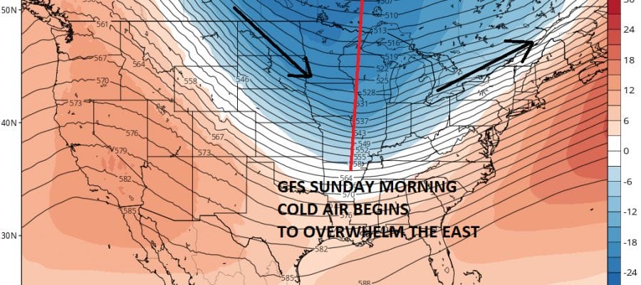
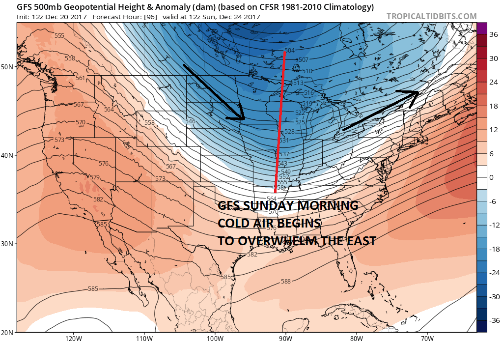
GFS FORECAST SUNDAY 12/24/2017 7AM
EUROPEAN FORECAST SUNDAY 12/24/2017 7AM
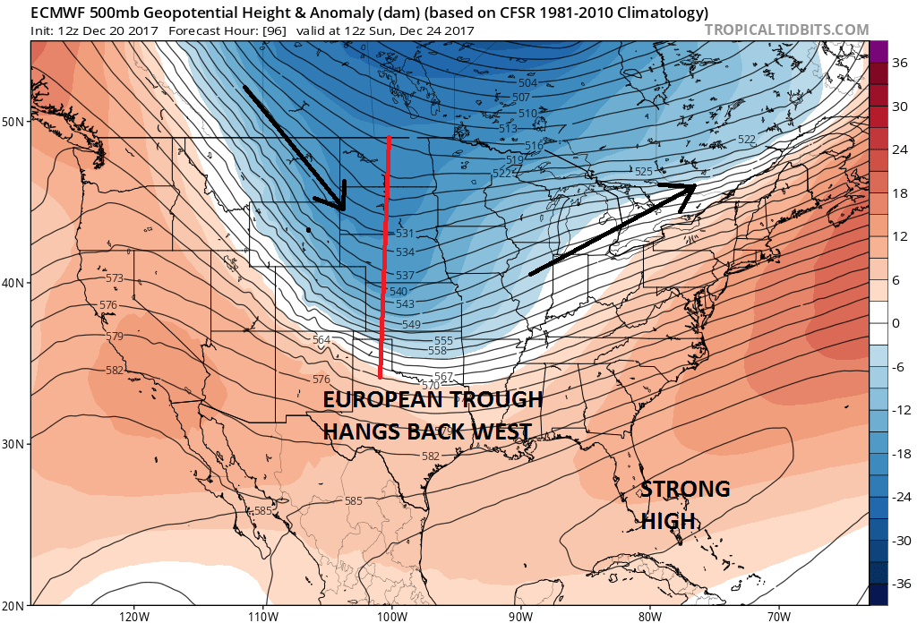
It is the same trough on both models but they are both handled differently. The GFS has a broader trough further east with a weaker ridge off the Southeast coast. The result is the model overwhelms cold air everywhere beginning Sunday which means it turns cold and dry for Sunday and Monday. The European has the same trough much further west with a stronger high off the Southeast US coast. This keeps the stalling cold front back across the Tennessee Valley back through Texas. Holding back the energy is something the European is guilty of from time to time so this idea while plausible is by no means a certainty. On the other hand the GFS loves to overwhelm cold air too fast and pushes fronts further offshore then reality and you wind up adjusting back westward.
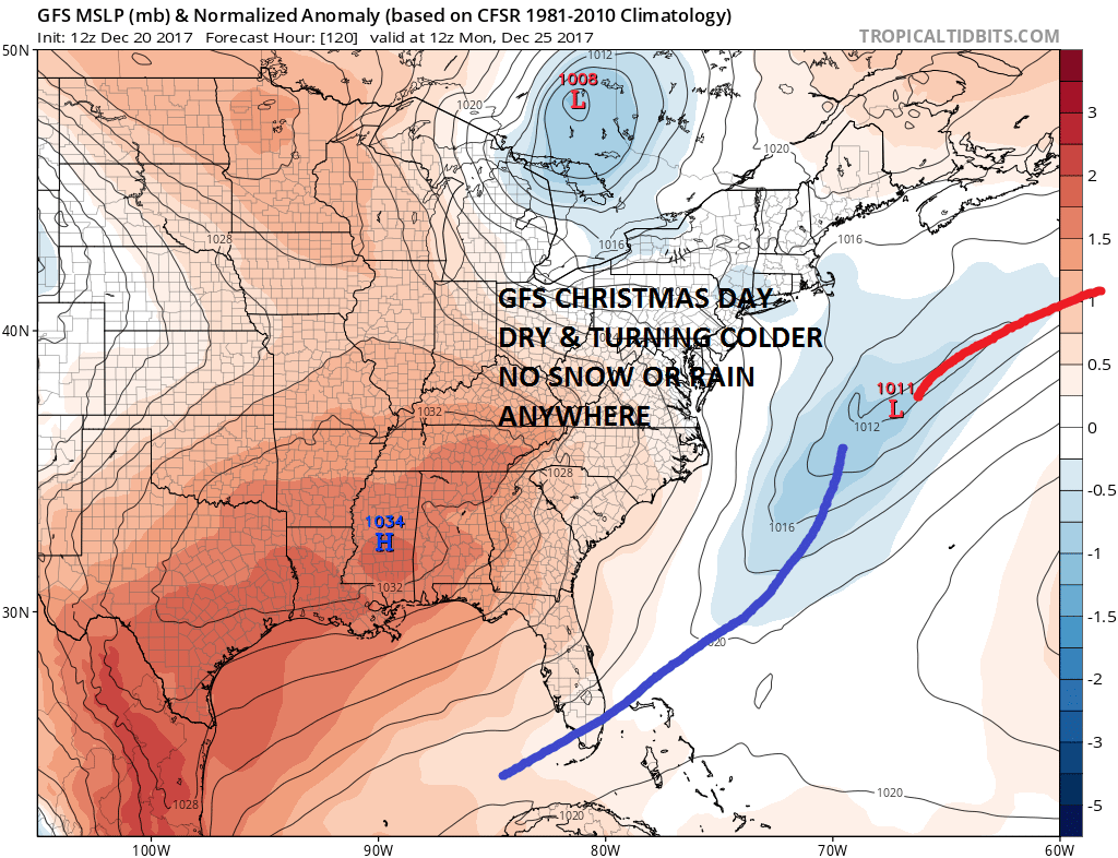
GFS SURFACE FORECAST CHRISTMAS MORNING
EUROPEAN SURFACE FORECAST CHRISTMAS MORNING
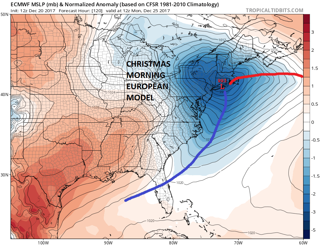
The surface maps for Christmas morning are in two different worlds. The European would have a snowstorm across much of upstate New York & New England away from the coast with a cold soaking rain along the coast Sunday night into Monday. The GFS would simply have a dry day with sun and clouds with temperatures in the 20s & 30s. If you compromise the two models you come up with a promising look for snow lovers but I don’t feel comfortable with a compromise at this point since both models paint pictures that are entirely possible.
One thing all the models seem to agree on is the possibiltiy for 2 more snow threats later next week but I don’t even want to begin looking at those until we get through this one and resolve the Christmas Eve Christmas Day dilemma.
MANY THANKS TO TROPICAL TIDBITS FOR THE WONDERFUL USE OF THE MAPS

GET JOE A CIGAR IF YOU LIKE!
FiOS1 News Weather Forecast For Long Island
FiOS1 News Weather Forecast For New Jersey
FiOS1 News Weather Forecast For Hudson Valley
NATIONAL WEATHER SERVICE SNOW FORECASTS
LATEST JOESTRADAMUS ON THE LONG RANGE
Weather App

Don’t be without Meteorologist Joe Cioffi’s weather app. It is really a meteorologist app because you get my forecasts and my analysis and not some automated computer generated forecast based on the GFS model. This is why your app forecast changes every 6 hours. It is model driven with no human input at all. It gives you an icon, a temperature and no insight whatsoever.
It is a complete weather app to suit your forecast needs. All the weather information you need is right on your phone. Android or I-phone, use it to keep track of all the latest weather information and forecasts. This weather app is also free of advertising so you don’t have to worry about security issues with your device. An accurate forecast and no worries that your device is being compromised.
Use it in conjunction with my website and my facebook and twitter and you have complete weather coverage of all the latest weather and the long range outlook. The website has been redone and upgraded. Its easy to use and everything is archived so you can see how well Joe does or doesn’t do when it comes to forecasts and outlooks.
Just click on the google play button or the apple store button on the sidebar for my app which is on My Weather Concierge. Download the app for free. Subscribe to my forecasts on an ad free environment for just 99 cents a month.
Get my forecasts in the palm of your hand for less than the cost of a cup of Joe!