Colder Air Returns Today Thursday
SHOP THE JOESTRADAMUS STORE
Colder Air Returns Today Thursday
We are seeing the wind kicking up a bit today as a cold front has passed to the east and colder air returns for a couple of days. To the south on the satellite loop we have low pressure moving across the Gulf States and Southeast US but none of this moisture is headed our way other than some high clouds that will clip parts of Southern New Jersey and Southeastern Pennsylvania. The rain on the radar is barely in range of our regional view. At least into Friday morning it will be dry. We should see some sunshine today and temperatures will probably top in the low to middle 40s which is really not that far from where we started this morning and then drop to the 20s tonight.
SATELLITE LOOP

REGIONAL RADAR

Thursday looks nice and sunny for most of the day with highs in the upper 30s and lower 40s. Some clouds should approach in the late afternoon. Friday begins our interaction with an arctic boundary to the west and a warm front to the south. This is going to mean for lots of clouds Friday. It now appears that boundary will set up a little further north which means less a threat for frozen or freezing precipitation. Areas in Northwest New Jersey, Northeast Pennsylvania, Hudson Valley north of Route 84, and Connecticut north of Route 84 may be at risk for something late Thursday night or Friday morning. Then temperatures will rise from the 30s to the 50s on Saturday.
WEATHER OUTLOOK THROUGH CHRISTMAS DAY
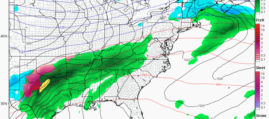
We still remain in a state of flux regarding what is going to happen this weekend. I’m beginning to like the Canadian’s idea with all of this where the front comes through on Saturday in a weaker state and the main energy waits until later Sunday to come up from the Southwest with the front offshore. The problem in all of this is the cold air and the upper trough to the west. It is a delicate balance between the cold air overwhelming and pushing to the East or underwhelming us where it is basically too warm and it rains. There is a very fine line here between the two.
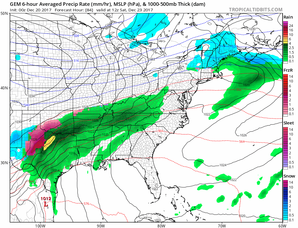
Right now look for some showers on Saturday and then a break. Christmas Eve looks dry until evening before we deal with this wave. It will be rain or snow or both into Monday Christmas Day. We really can’t say much beyond this until we get a real sense of how all of this is going to play. The weight of the cold air to the northwest will be key to all this.
 GET JOE A CIGAR IF YOU LIKE

FiOS1 News Weather Forecast For Long Island
FiOS1 News Weather Forecast For New Jersey
FiOS1 News Weather Forecast For Hudson Valley


