DOWNLOAD MY NEW FREE JOESTRADAMUS WEATHER APP FOR ALL DEVICES
Weather Improves Today Chance Showers Friday Weekend Weather Outlook
We begin the day with the latest weather system moving through. We had some overnight showers and this morning there is one last batch of showers to the south across Southeastern Pennsylvania and Southern New Jersey. Those showers are moving to the southeast and should be gone shortly. Then we segue to partly sunny skies. The satellite picture this morning shows some clouds to the north across Upstate NY and into New England. Some of those clouds will drop southeastward today. To the northwest of that over the Great Lakes we see the next system in the strong northwest flow. Another cold front arrives on Friday with the chance for some showers.
SATELLITE

REGIONAL RADAR

Radars this morning are reflecting low pressure developing out to the east and pulling away offshore. Most of the shower activity as of 8am is over with except for the last batch heading for the Delmarva Peninsula and that area is not coming here.
LOCAL RADAR NEW YORK CITY

LOCAL RADAR PHILADELPHIA


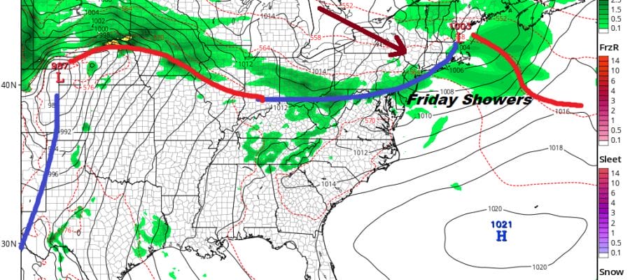
Partly sunny skies today should send temperatures up into the upper 60s and lower 70s without too much difficulty. Then tonight we will see clear skies give way to some late night arriving clouds with most lows in the 50s. The next front comes through on Friday. Low pressure moves off the coast of Maine. There isn’t a whole lot for this front to work on but there is enough for a few scattered showers or a thunderstorm, mainly from midday to late afternoon. Otherwise we should see some sun ahead of it with highs reaching the 70s.
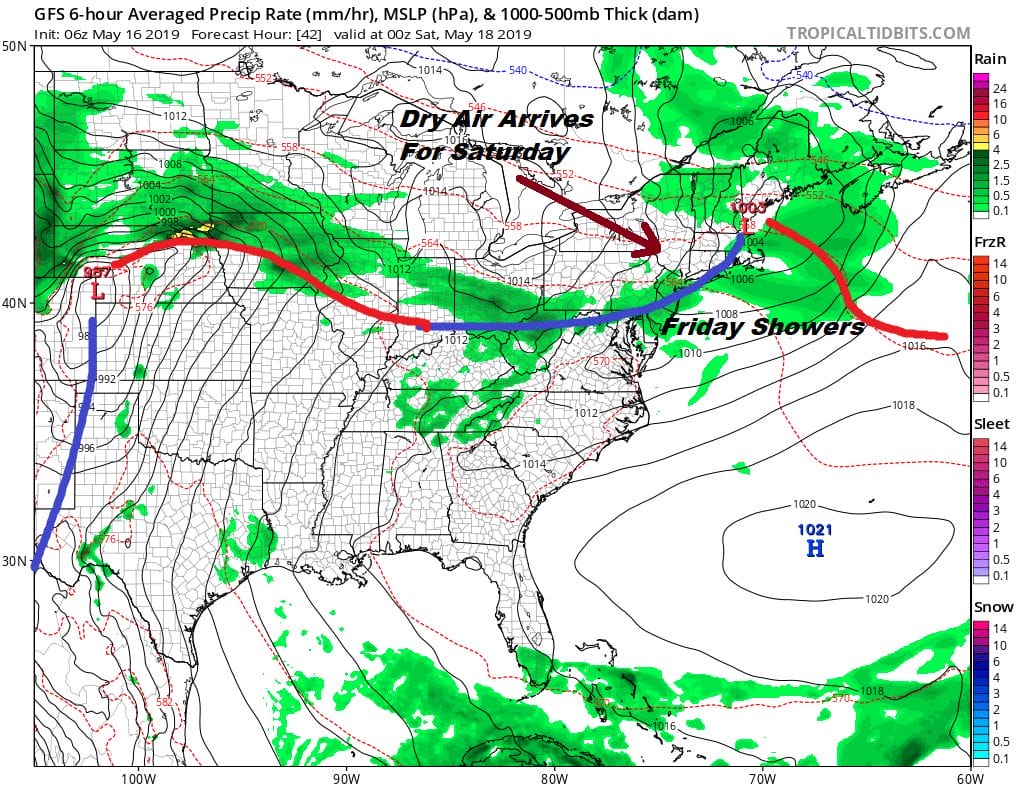
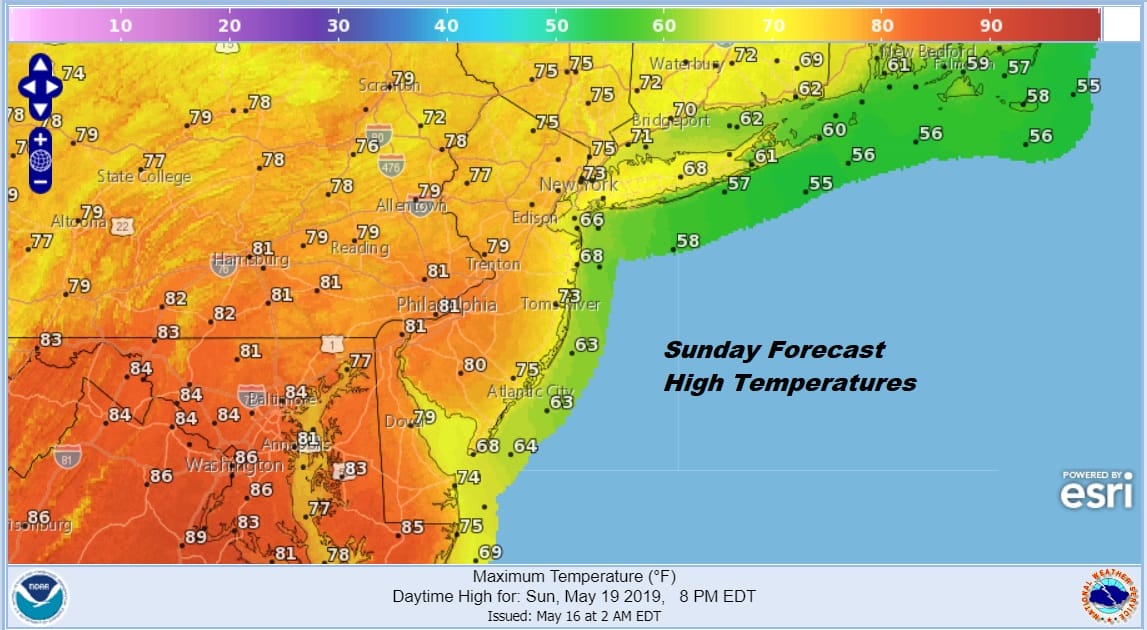
This is another situation where the front will stall out to the south but there should be enough dry air for sunshine on Saturday with highs reaching the upper 60s and lower 70s in most places. We have been debating the issue for Sunday regarding this front. It seems that it basically has little impact and that the warm air boundary will set up to our north. This should put us in a better place for Sunday with partly sunny skies. Highs will reach the 70s to near 80 except cooler along the shore.
Next week sees an interesting pattern shift. Actually that pattern shift has already begun. We see a screaming jet stream across the Pacific again as the trough shifts back to the west and is unusually strong for this time of hear. This is going the bring heavy rain and heavy mountain snows to the west. Here in the East it at least brings a temporary reprieve to prolonged onshore flow situations.

Instead we will see lows tracking to our west to the Great Lakes and cold fronts coming through every couple of days. At least this lets us puts some space between cold fronts and keep weather systems moving along. A front arrives Monday with the chance for showers with another that follows late in the week. This should allow for some dry weather in between. It might also allow for a decent outlook for the Memorial Day holiday weekend.
MANY THANKS TO TROPICAL TIDBITS FOR THE USE OF MAPS
Please note that with regards to any tropical storms or hurricanes, should a storm be threatening, please consult your local National Weather Service office or your local government officials about what action you should be taking to protect life and property.


