DOWNLOAD MY NEW FREE JOESTRADAMUS WEATHER APP FOR ALL DEVICES
Showers Overnight Sunshine Returns Thursday
Showers Friday Dry Saturday Clouds Sunday
SATELLITE

We are seeing the next cold front getting ready to move through here tonight and it is producing smoe pop up showers on the regional radar along with another area of showers over Western NY & Western Pennsylvania. Using what i often refer to as the 8 hour Pittsburgh rule it would bring those showers through our area between midnight and 4 am from west to east and then done before daybreak. Temperatures overnight will likely hold in the 50s.
REGIONAL RADAR

None of the showers appears to be particularly heavy and while there could certainly be the odd downpour scattered around this evening and then from the showers later tonight it shouldn’t amount to much rain wise. By daybreak they will be long gone.
LOCAL RADAR NEW YORK CITY

LOCAL RADAR PHILADELPHIA


Thursday it is back to partly sunny skies with highs in the upper 60s to mid 70s on average. Local sea breezes will develop as usual late in the day along the immediate coast. Then here comes the next front for Friday. Weather models today really didn’t show much in the way of change with this system with clouds and the chance for scattered showers or a thunderstorm late Friday morning into the afternoon as the front goes by.
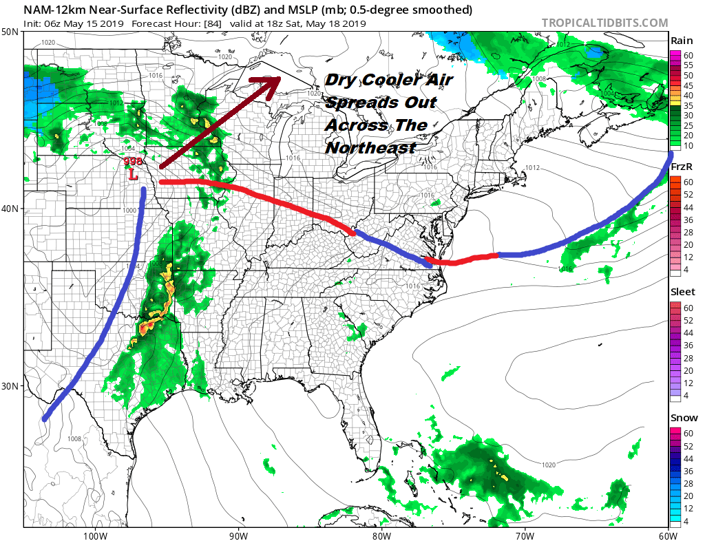
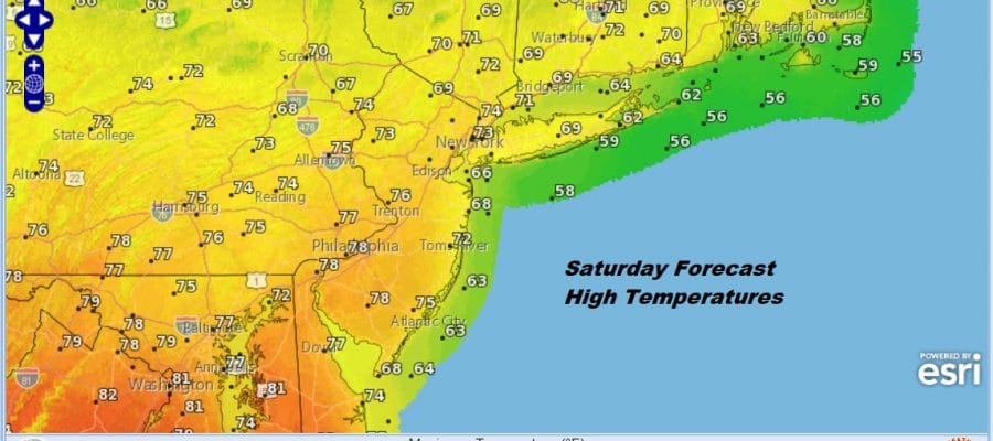
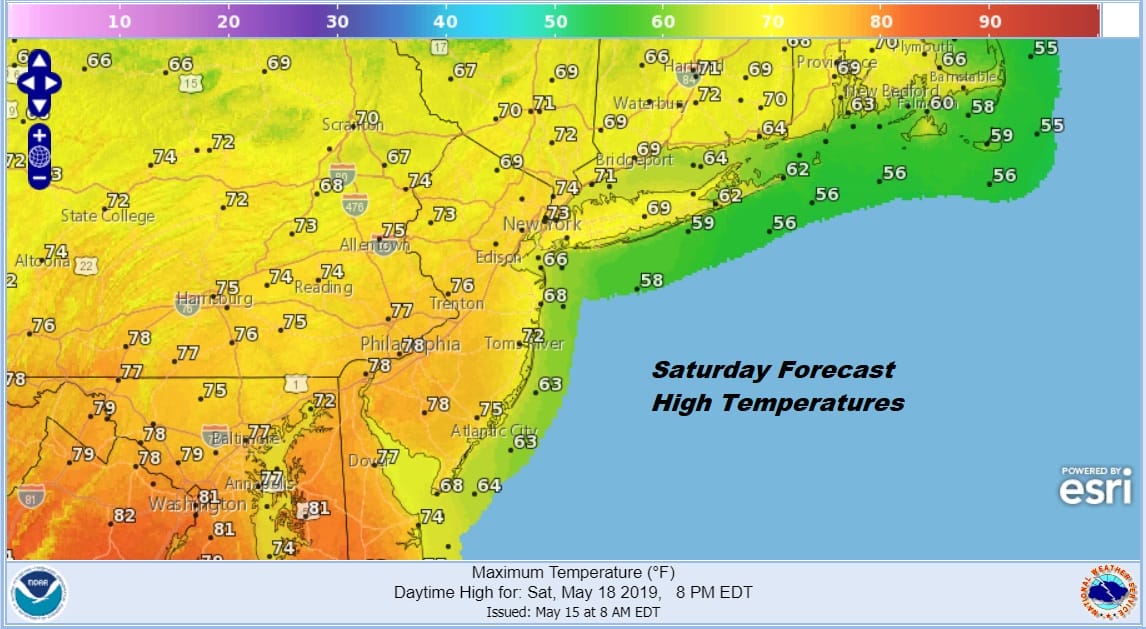
Saturday will be the better of the two weekend days with no worse than partly sunny skies. Enough of that high to the north will build in and the onshore flow really doesn’t get going until Sunday. Today’s weather models seem to keep the warm front to the south or perhaps it get through Central and South Jersey and Southeastern Pennsylvania on Sunday with temperatures reaching the upper 70s and lower 80s in these areas and staying in the 60s just about everywhere else.
Showers might be scattered around late on Sunday but could become more numerous on Monday into Tuesday. At least it would be with a northeast wind and temperatures in the 40s like what we saw this week. At least we should see temperatures in the 60s and 70s early next week until the cold front passes.
MANY THANKS TO TROPICAL TIDBITS FOR THE USE OF MAPS
Please note that with regards to any tropical storms or hurricanes, should a storm be threatening, please consult your local National Weather Service office or your local government officials about what action you should be taking to protect life and property.


