Weather Improves Overnight Dry Nice Spring Weather Tuesday Wednesday
We are working through some scattered thunderstorms this evening as a cold front passes through. The satellite picture this evening shows the high cloud tops stretched out along the coast. Unlike yesterday when we saw clusters of severe thunderstorms move out of Pennsylvania and into New Jersey and the Catskills this line today formed further to the east and seems more subdued from what we saw yesterday. A severe thunderstorm watch is up north of Route 84 for Ulster, Dutchess county northward and Litchfield county in Connecticut northward until 9pm. So far it seems this watch will expire with not too much fanfare.
SATELLITE

REGIONAL RADAR

Regional and local radars are showing the scattered activity that is around this evening. To the north and west it is all gone and the air is nice and dry. That air will come in later this evening. Skies will clear and morning lows will be mostly in the low to mid 50s.
LOCAL RADAR NEW YORK CITY

LOCAL RADAR PHILADELPHIA


There are no issues for the next 2 days. We are actually going to experience 48 hours of rain free conditions. Lots of sunshine is forecast for Tuesday and much of Wednesday with nothing more than a few passing clouds. Highs will be in the upper 60s and lower 70s. Local sea breezes will occur along immediate coastal areas. Finally we are seeing 2 back to back days and nights with not a drop of rain.
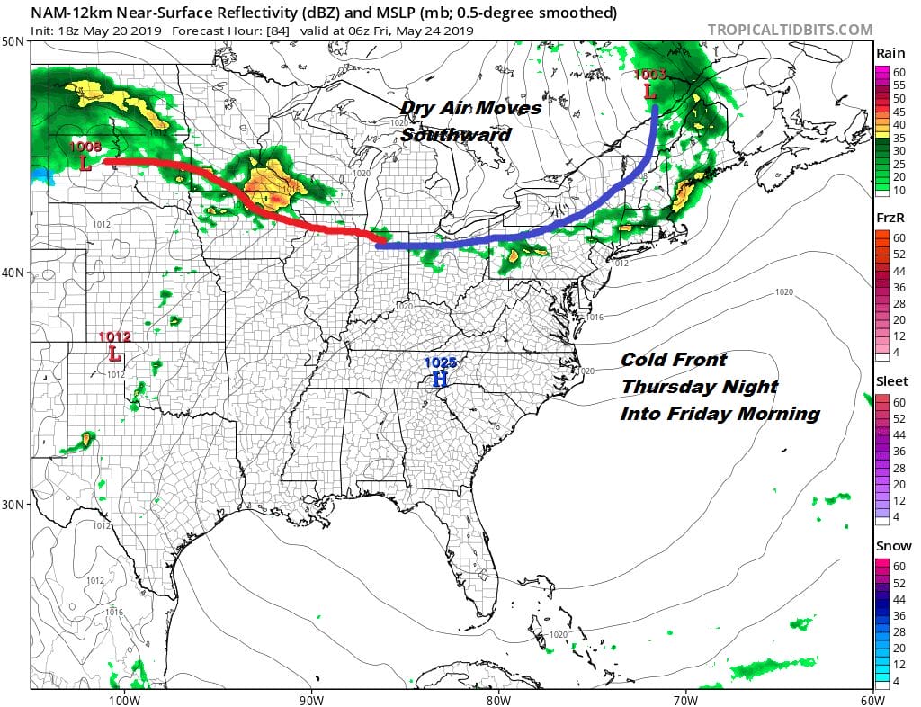
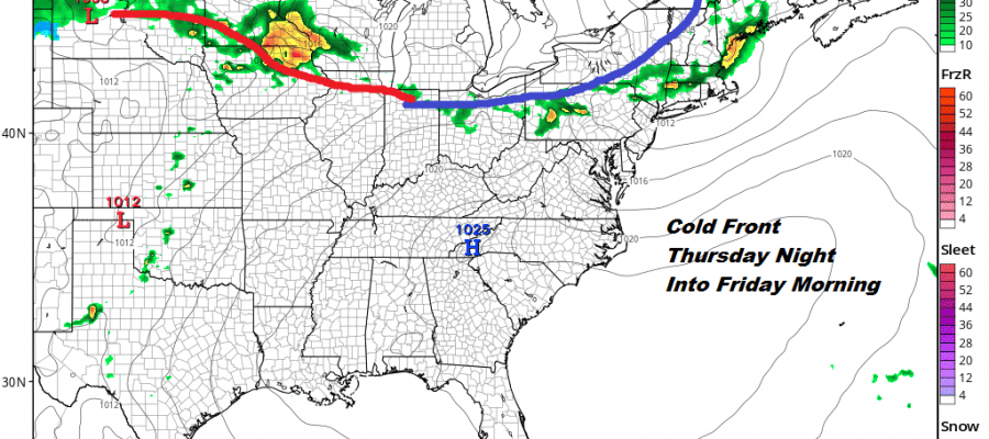
Thursday the high will go to our south and we should see sunshine and clouds along with warmer temperatures we could see highs back into the 80s. The next cold front drops southward and moves through Thursday night or early Friday morning with a few showers. Then we should see some sunshine return Friday with highs in the upper 60s to middle 70s.

With regards to the Memorial Day holiday weekend I’m being cautiously optimistic. There will be another front passing through Saturday night which means that the daytime Saturday right now looks dry and that we may see a couple of shower Saturday night. Does the front keep moving? Or does it stall out to the south and we have to contend with a bit of an onshore flow Sunday and possibly into Monday. I think those are the critical questions. This is the holiday weekend that usually has the most forecast issues so it seems this year won’t be different from others. For now we will lean on the idea that if the front does stall it will be far enough south to spare us any serious issues for Sunday and Monday.
MANY THANKS TO TROPICAL TIDBITS FOR THE USE OF MAPS
Please note that with regards to any tropical storms or hurricanes, should a storm be threatening, please consult your local National Weather Service office or your local government officials about what action you should be taking to protect life and property.


