
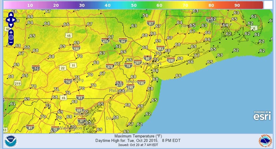
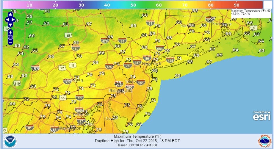
The weather forecast couldn’t be better for this time of year if you like a couple of nice warm days. Warmer air has arrived and we will see it each afternoon of the next 3 days with temperatures getting into the 70s especially Wednesday and Thursday as there is nothing really to stop it. A west southwest flow brings up warm from the Southern Rockies and Southern Plains where the air is relatively warm and dry so enjoy this after the extreme record setting cold temperatures we experienced over the weekend.

The next cold front will begin its approach on Thursday but as has been the case so many times lately there is very little moisture for the front to play around with so it comes through dry or at worst just a passing shower Thursday afternoon or Thursday evening.

Now beyond Thursday, Friday and into the weekend it should be cooler and dry but not overly cold. Then here comes the next cold front for Sunday which again should come through dry. Temperatures Friday and Saturday will probably be no higher than upper 50s to lower 60s with nights in the 30s and 40s. Now beyond Sunday models next week are showing the jet stream pattern getting rather active which seems to be coinciding with a negative Atlantic Oscillation and an increasingly active Pacific and Canadian jet stream pattern that should yield at least one and possibly 2 decent events later next week and a more active pattern as we head into November.

Models of course carry this in different directions with the European being the most aggressive during the later stages of the long range period. However all the models seem to have this general idea to start so we will go from here and see how this evolves. The overall look of the pattern suggests we are about to entire a phase of increasing activity over the coming weeks.
Siberian snow cover in the coming weeks is forecast to explode which could have serious implications regarding the upcoming winter of 2015-2016 plus there are other indications that may be pointing to..in my view..some early chances for wintry weather. We saw this weekend and early cold air mass intrusion and there is likely to be a few more of those down the road. JOESTRADAMUS wrote about this overnight as he thinks about perhaps making a winter forecast.
Be sure to download my app and subscribe to my forecasts. The app is free and a subscription is just 99 cents a month for the latest local forecasts.


