Weather Conditions Slowly Improving Cooler Air Arriving
Weather Conditions Slowly Improving Cooler Air Arriving
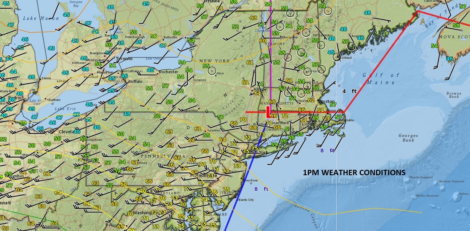
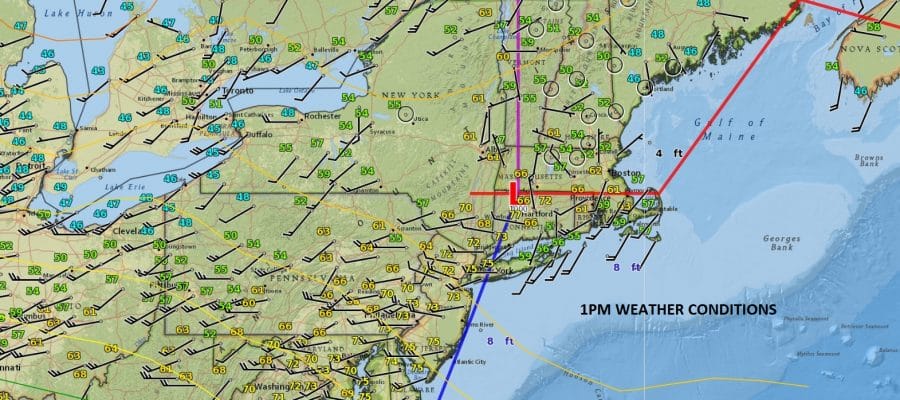
Weather conditions have been slow to improve today however some sunshine has broken through the cloud cover. The surface map above shows a cold front moving through and there is cooler air to the north that will gradually move in later this afternoon and for the next several days. Clouds are still a problem as a large upper air storm system churns over the Eastern Great Lakes. Showers are occuring to the north and west of us in the colder unstable air. We will see the clouds around here through Wednesday but the showers will stay north and west of the mountains. Temperatures have reached the 70s but they should begin to level off and ease a bit going into this evening.
SATELLITE LOOP

REGIONAL RADAR

LOCAL RADAR NEW YORK CITY

LOCAL RADAR PHILADELPHIA


Dry breezy conditions will continue through Wednesday with some sunshine and clouds and highs just in the upper 50s and lower 60s on average..middle 60s across Southeastern Pennsylvania and Southern New Jersey. Thursday looks dry with sunshine giving way to arriving clouds with highs in the 60s.
WEATHER CONDITIONS DETERIORATE THURSDAY NIGHT AND FRIDAY
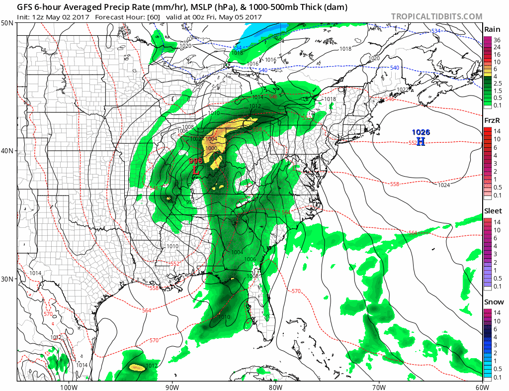
Low pressure from the Southern Plains will be headed into the Central Appalachians for Thursday night and Friday. Rain is likey and we continue to think this will be a 1 to 2 inch rain producer. Due to the developing blocking pattern the upper air storm driving all this will be along the East Coast through the weekend and into next week. That certainly means clouds and there will be showers around particularly on Saturday in the colder unstable air aloft. Weather conditions overall do not look very promising through early next week as this upper air system continues to spin while it sits here in the Eastern US until the block breaks down.
 GET JOE A CIGAR IF YOU LIKE

LANDSCAPE COMPANIES FOR YOUR NEEDS
LONG ISLAND ROCKLAND COUNTY Connecticut

![]()

ROCKLAND COUNTY TRI STATE SNOW REMOVAL JOHNSTOWN PA


FiOS1 News Weather Forecast For Long Island
FiOS1 News Weather Forecast For New Jersey
FiOS1 News Weather Forecast For Hudson Valley
NATIONAL WEATHER SERVICE SNOW FORECASTS
LATEST JOESTRADAMUS ON THE LONG RANGE
Weather App

Don’t be without Meteorologist Joe Cioffi’s weather app. It is really a meteorologist app because you get my forecasts and my analysis and not some automated computer generated forecast based on the GFS model. This is why your app forecast changes every 6 hours. It is model driven with no human input at all. It gives you an icon, a temperature and no insight whatsoever.
It is a complete weather app to suit your forecast needs. All the weather information you need is right on your phone. Android or I-phone, use it to keep track of all the latest weather information and forecasts. This weather app is also free of advertising so you don’t have to worry about security issues with your device. An accurate forecast and no worries that your device is being compromised.
Use it in conjunction with my website and my facebook and twitter and you have complete weather coverage of all the latest weather and the long range outlook. The website has been redone and upgraded. Its easy to use and everything is archived so you can see how well Joe does or doesn’t do when it comes to forecasts and outlooks.
Just click on the google play button or the apple store button on the sidebar for my app which is on My Weather Concierge. Download the app for free. Subscribe to my forecasts on an ad free environment for just 99 cents a month.
Get my forecasts in the palm of your hand for less than the cost of a cup of Joe!


