
DOWNLOAD MY NEW FREE JOESTRADAMUS WEATHER APP FOR ALL DEVICES
THE APP IS ABSOLUTELY FREE TO ALL BUT CONSIDERING SUBSCRIBING TO PATREON FOR A WEATHER EXPERIENCE FREE OF ADS, EXCLUSIVE VIDEOS FOR MEMBERS ONLY AND MUCH MORE…STARTS AT $2 A MONTH..MESSAGE ME AT ANY TIME
Weather Conditions Improve Monday Showers On And Off All Week
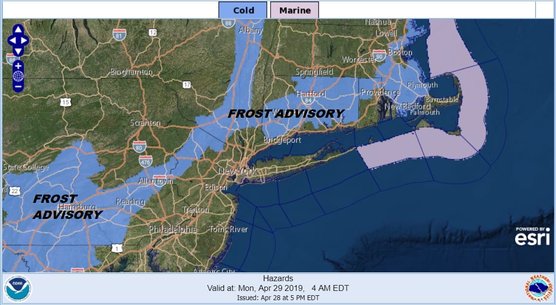
Our weak weather system is moving along to the east this evening. The rain today was minimal for the most part. It remained cloudy much of the day. Temperatures hovered in the 40s to a few low 50s. The exception was Southern New Jersey where we saw 60s this afternoon. The low is tracking just south of Route 195 in New Jersey which kept areas to the north of it cloudy and dreary. Now that it is going to move offshore we should see some clearing tonight. Cold air is with us here in the Northeast and frost advisories are posted for many areas. The growing season has become and this puts some delicate plants at risk for frost damage.
SATELLITE

REGIONAL RADAR

Regional and local radars show the last of the rain moving away to the east though it continues across New England at the moment. It will continue moving eastward and move offshore later this evening. No showers are in the forecast for our zones into Monday evening.
LOCAL RADAR NEW YORK CITY

LOCAL RADAR PHILADELPHIA


No doubt we have a rather cold night ahead. Most lows along the coast will be near the 40 degree mark but inland areas will be in the 30s and cold spots will likely drop down to the freezing mark especially as skies clear out.

Monday brings some sunshine to start the day but the developing frontal boundary to the south means clouds will increase later in the afternoon. Highs will reach the upper 50s and lower 60s. Monday night into Tuesday morning we will see some showers move through. Not a lot of rain is expected here as the first of 3 lows moves eastward. The onshore flow will keep things chilly into Tuesday morning and then we might see some brightening of skies with a bit of luck. Highs will be in the upper 50s and lower 60s.
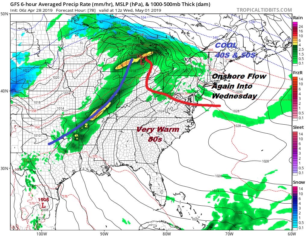
Wednesday brings another warm front toward us as low pressure heads to the Great Lakes. There may be some showers with this but the onshore flow will be there as well with temperatures struggling in the 50s to near 60 but this warm front has a shot of getting through here and that could set us up for a warm day Thursday with some sunshine and highs in the 70s. Then the cold front arrives Thursday night with the chance for some showers and thunderstorms. Assuming the front moves along we could see improving weather conditions in time for next weekend which right now looks to be dry but on the cool side both days.
MANY THANKS TO TROPICAL TIDBITS FOR THE USE OF MAPS
Please note that with regards to any tropical storms or hurricanes, should a storm be threatening, please consult your local National Weather Service office or your local government officials about what action you should be taking to protect life and property.


