DOWNLOAD MY NEW FREE JOESTRADAMUS WEATHER APP FOR ALL DEVICES
THE APP IS ABSOLUTELY FREE TO ALL BUT CONSIDERING SUBSCRIBING TO PATREON FOR A WEATHER EXPERIENCE FREE OF ADS, EXCLUSIVE VIDEOS FOR MEMBERS ONLY AND MUCH MORE…STARTS AT $2 A MONTH..MESSAGE ME AT ANY TIME
New Week Brings Same Old Onshore Flow Issues All Week
It was cold this morning for sure with many areas away from warmer urban centers dropping to near or even below the freezing mark. Frost was on the ground in many areas. At least we have some sunshine ahead of us today which should take temperatures back up to the upper 50s and lower 60s this afternoon. To the west across the Great Lakes we are seeing clouds rolling eastward and we will probably see some high clouds masking the sun later today.
SATELLITE

At least we have no precipitation issues today as the radars both regionally and locally remain quiet this morning though there may be some pick up well to the west later this afternoon but nothing comes close to us.
REGIONAL RADAR

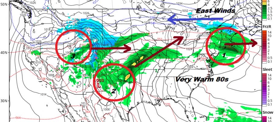
We will being the bowling alley of weather systems tonight. There are three weather systems ahead of us running along a frontal boundary to our south. Each one will cause that boundary to buckle either a bit to the north or a bit to the south. South of the boundary zone which will like on average across Maryland east to off the Delaware coast we will see warm dry conditions with temperatures reaching the 70s and 80s while to north of it it will be in the cooler 50s and just into the 60s.
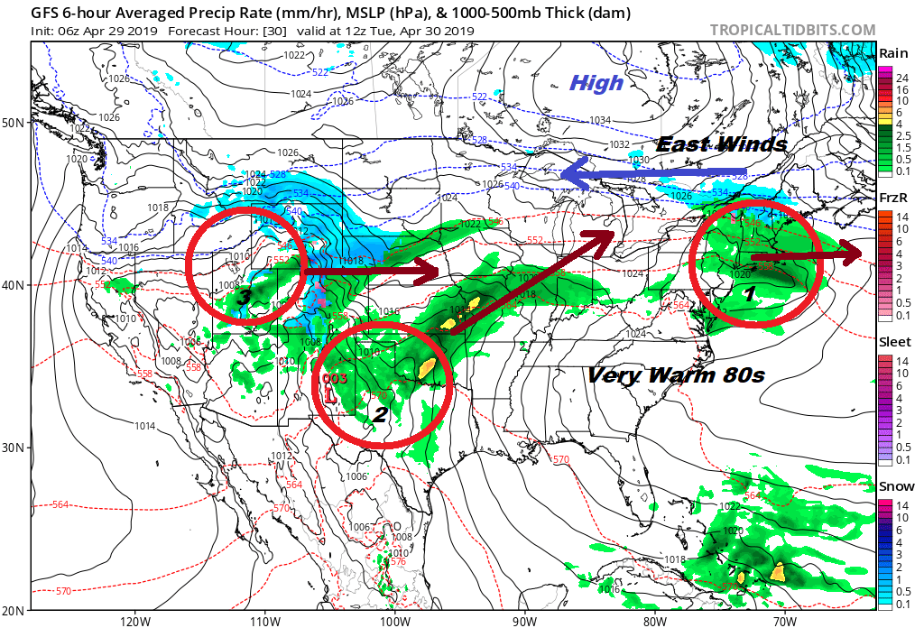
System number one moves out Tuesday morning with any showers ending before daybreak. Then we sit in leftover clouds with perhaps some brightening or even some breaks of sun possible but that will dependent on the onshore flow (east wind). It is possible that inland areas could break out into some sun during the afternoon Thursday. Most highs will be in the 60s except 50s along the coast. Then the onshore flow strengthens and system number 2 arrives on Wednesday with clouds and showers
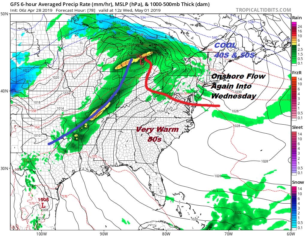
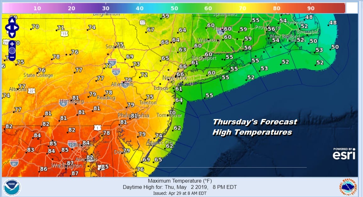
This second low takes a track toward the Great Lakes but the warm front extends southeastward toward the Delaware coast. North of there it is going to be clouds showers and temperatures just in the 50s. Not a fun day here for sure. The issue for Thursday is whether that warm front moves northward and how far north does it get. It might reach NYC where temperatures south and west of NYC reach the upper 70s and lower 80s while north and east of NYC it remains in the 60s with 50s over Southern New England and Long Island. Thursday might be a day where we go to clouds and sun in the warm sector and stay damp and overcast where the ocean winds persist.
Now comes Friday where the next cold front arrives with the chance for showers and thunderstorms. The front that comes through is going to stall out and this may create issues for this coming weekend. We will address those issues later today.
MANY THANKS TO TROPICAL TIDBITS FOR THE USE OF MAPS
Please note that with regards to any tropical storms or hurricanes, should a storm be threatening, please consult your local National Weather Service office or your local government officials about what action you should be taking to protect life and property.


