Weather Conditions Improve Above Average Temperature Weekend
Weather Conditions Improve
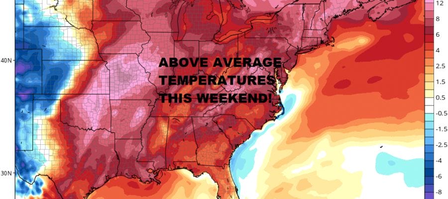
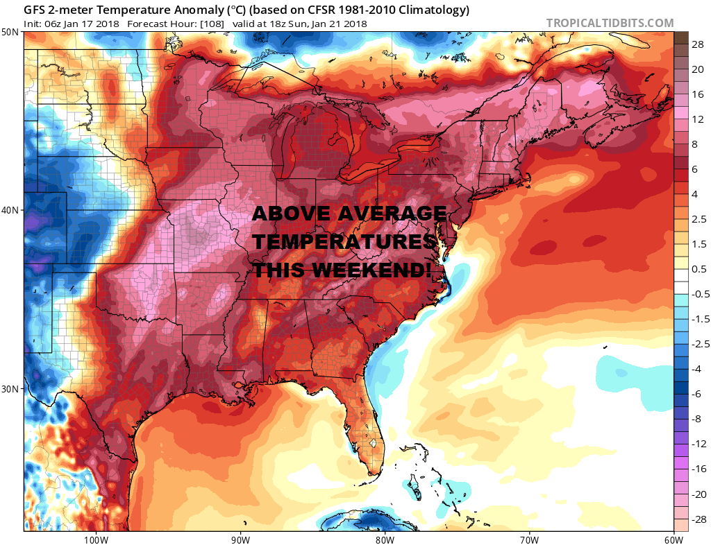
Above Average Temperature Weekend
The last of the overnight precipitation be it snow inland or a mix to rain along the immediate coast is moving out this morning. Accumulations in general finished on the low end of forecast ranges which was no surprise really as we watched this all play out yesterday. A weak system to the west and one to the east and you could only squeeze out so much from either one. Along and north of Route 84 it appears that there were some 5 to 6 inch amounts in the Hudson Valley and in Northwest New Jersey. Weather conditions should improve this afternoon as the last of the clouds to the west move offshore and skies should begin to clear out. Temperatures today will likely hold in the 30s.
US SATELLITE

REGIONAL RADAR

LOCAL RADAR NEW YORK CITY

LOCAL RADAR PHILADELPHIA


Skies will clear out area wide tonight and it will be cold as lows head down into the teens and lower 20s. This sets us up for a cold day on Thursday with sunshine and highs just into the 30s. The cold air begins to move out Friday as highs will be in the 30s to near 40. Then a real break for the weekend from the cold as we see the high pressure cell move out to the southeast and a west wind takes over. Sunshine is forecast both days and except for the sea breeze along south facing shorelines, highs will be in the 40s to near 50 both days. The next chance for rain will be with an approaching cold front later on Monday. No snow storms big or small for us to worry about for while.
 GET JOE A CIGAR IF YOU LIKE

FiOS1 News Weather Forecast For Long Island
FiOS1 News Weather Forecast For New Jersey
FiOS1 News Weather Forecast For Hudson Valley


