Weather Conditions Back to Summer Wednesday
Weather Conditions Back to Summer Wednesday
Satellite & radar loops this afternoon continues to show improvement as clouds along the coast and the rain that went with it slide away to the east. The bank of clouds in the Atlantic Ocean also clearly show up as a brick wall where Hurricane Gert will be soon moving along to the northeast. The hurricane is passing between North Carolina and Bermuda and out to sea it goes. The only impact will be on the surf at the area beaches over the next 2 days. If you are beach bound to either the Long Island south shore or the New Jersey shore there will be rip current issues along with some wave action.
SATELLITE LOOP

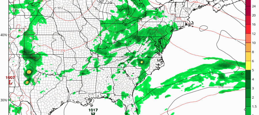
REGIONAL RADAR

LOCAL RADAR NEW YORK CITY

LOCAL RADAR PHILADELPHIA


We will see skies partially clear out overnight. There could be some patchy fog that develops in some areas. Wednesday we see partly to mostly sunny skies with temperatures in the mid 80s to near 90. Thursday looks good from Central New Jersey north and east. South and west of there clouds will be increasing and there could be some downpours by evening over Southeastern Pennsylvania and SW New Jersey but the cloud line will be sharp. North and east of Central NJ it should be sunny for most of the day before clouds move in late Thursday or Thursday evening.
WEATHER CONDITIONS GFS MODEL THURSDAY NIGHT INTO SATURDAY MORNING
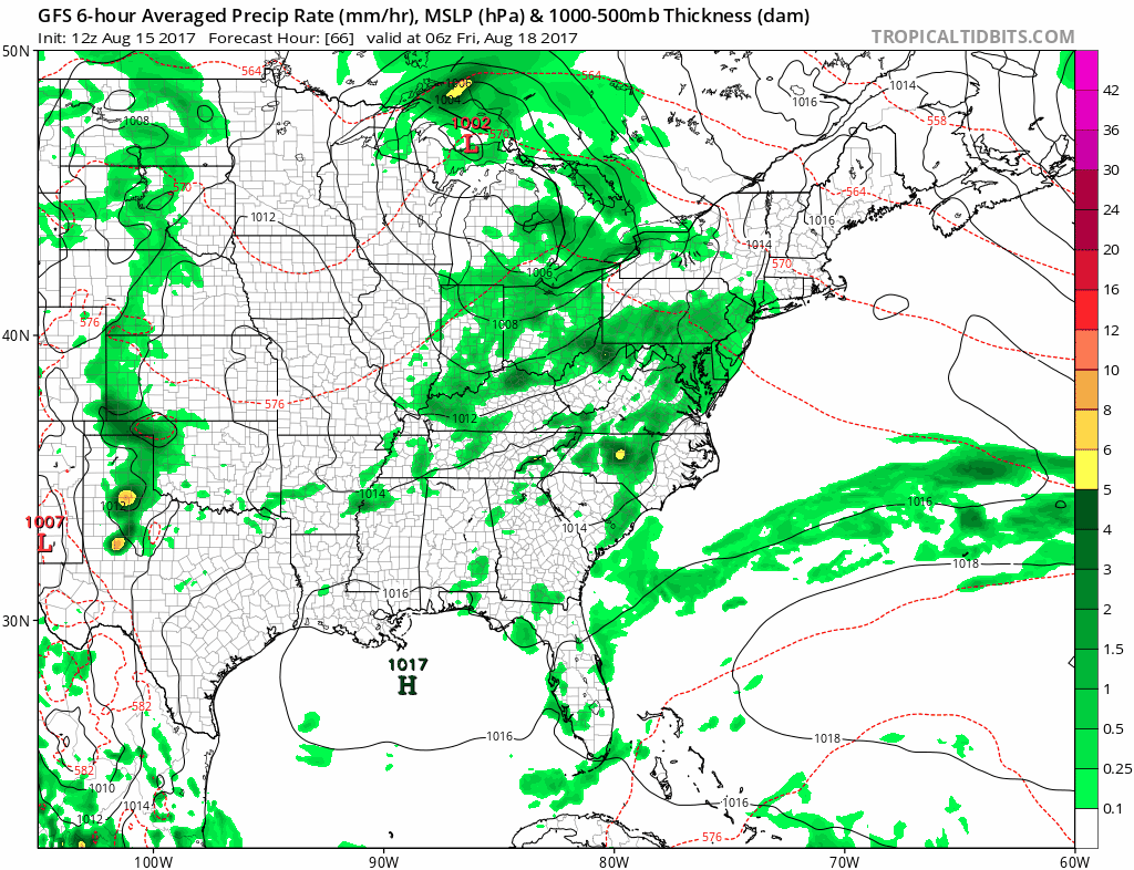
The next warm front cold front will bring some downpours late Thursday night into Friday morning. Then we are looking at a break until the cold front arrives. There could be some showers and thunderstorm again late Friday and Friday night. Weather conditions should improve over the weekend
 GET JOE A CIGAR IF YOU LIKE

FiOS1 News Weather Forecast For Long Island
FiOS1 News Weather Forecast For New Jersey
FiOS1 News Weather Forecast For Hudson Valley
NATIONAL WEATHER SERVICE SNOW FORECASTS
LATEST JOESTRADAMUS ON THE LONG RANGE


