
Wave Offshore Tuesday Thunderstorm Risk Wednesday Nice Dry Late Week
We are seeing high clouds manly along coastal areas. There is a stalled frontal boundary offshore and there will be a bit of a wave that will develop on the front and move northeastward tonight into Tuesday morning. There should be no impact inland from this other than some high clouds tonight into Tuesday morning while along the immediate coast of New Jersey and over Long Island there will likely be a heavier overcast and the chance for a couple of scattered showers late tonight into Tuesday morning. Otherwise it will just be a warm and quiet night with temperatures in the mid 60s to lower 70s by morning.
SATELLITE

REGIONAL RADAR

Not much is happening on the regional and local radars. We see some scattered showers from Chesapeake Bay south to along and off the North Carolina coast. This is from the developing weak wave. Otherwise the radars are quiet today inland with no precipitation echos showing up.
LOCAL RADAR NEW YORK CITY

LOCAL RADAR PHILADELPHIA 

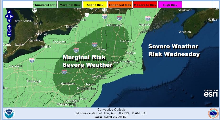
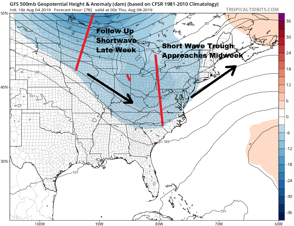
There are no important changes to the outlook. Except for some early clouds along the coast we should go to a mix of sun and clouds overall Tuesday and it will be a very warm to borderline hot day with highs reaching the upper 80s inland while it will be a little lower along the coast, low to mid 80s with a bit of a light ocean wind. Humidity will be rising which sets us up for Wednesday which will be a hot humid day with sunshine. Temperatures will reach the upper 80s to around or just over 90 with dew points in the low 70s. Combine these factors with a strong short wave trough and approaching cold front and you have the ingredients for some severe thunderstorms. The Storm Prediction Center has a marginal risk for severe weather at the moment and it is likely that this area will be expanded.
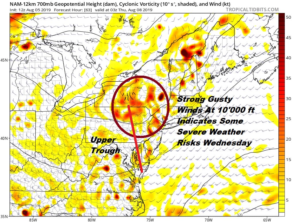
We have seen our fair share of severe weather this summer season and the NAM model at the 10’000 ft level has been a good model to use in identifying the severe weather threat. Gusty winds at this level with the approaching cold front and upper trough have been a strong indicator of potential severe thunderstorms. These winds can mix down to the surface in downdrafts and the model is showing a rather busy profile for Wednesday evening for much of the area. The Storm Prediction Center has us at a marginal risk for severe weather and if daytime heating really gets going, we can look for this risk area to be expanded for Wednesday. Threat time would be late afternoon and evening.
A second front will approach late Thursday which will be another very warm and humid day with some sunshine and the threat for some scattered showers or a thunderstorm when the front comes through. Highs again will be in the mid 80s to near 90. The second upper trough seems less potent than the first and there will be less for this front to work with as it approaches and moves through.
Once the second front moves through, nice dry air takes over for Friday and for the weekend as long as the front keeps moving and we think it will. Look for sunshine on Friday with lower humidity and highs in the low to mid 80s. The weekend is shaping up nice and sunny with reasonable temperatures and comfortable humidity. Highs for both Saturday and Sunday will be in a range from 78 to 84 with no serious weather issues.
MANY THANKS TO TROPICAL TIDBITS FOR THE USE OF MAPS
Please note that with regards to any tropical storms or hurricanes, should a storm be threatening, please consult your local National Weather Service office or your local government officials about what action you should be taking to protect life and property.


